
 Print-Friendly Version Print-Friendly Version
|
|
Snow Hike - Andrews Cove to Tray Mountain | |||||||
| The Basics: | |||||||
| Event Type: | Hike | ||||||
| Event Location: | Chattahoochee National Forest | ||||||
| Date(s) & Time: | Mon, Dec 27 2010 9:15 am >> N/A (Carpool Departure: 9:30 am *log in for location*) | ||||||
| Registration Opens: | Sat, Dec 25 2010 2:00 pm | ||||||
| Registration Cut Off: | Sun, Dec 26 2010 10:00 pm | ||||||
| Event Duration: | per itinerary | ||||||
| Difficulty Rating: | D5: Difficult | ||||||
| Trip Leader(s): | Tony C Email Trip Leader(s) Email Trip Leader(s)
You must be logged in to get the Trip Leader contact information. | ||||||
| Member Cost: | None | ||||||
| Participant Info: | |||||||
| Who's Invited: | Members Only, 21 And Older Only | ||||||
| Maximum Group Size: | 10 | ||||||
| Minimum Group Size: | 5 | ||||||
| Number Registered So Far: | 3 / 0 (To see who's signed up, log in to the Member Area) | ||||||
| Are Dogs Permitted: | No | ||||||
| Itinerary: | |||||||
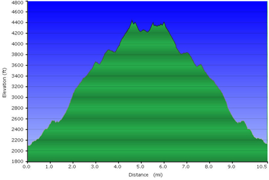
With hiking, like many things in life, the journey should be more important than the destination. However.... the main purpose of this hike is to reach the superb Tray Mtn ridge overlook and check out the view with the snowy landscape. I'm not sure how much it is snowing up there or how much will be left on Monday but we will try to find out. (And of course we will have lots of beautiful scenery along way as well).
 | |||||||
| How to Get There: | |||||||
| Carpool to Event Distance (round trip): | 150Mile(s) | ||||||
| Carpool Departure Time: | 9:30 am | ||||||
| Carpool Location: | Log in for location | ||||||
| Carpool Directions: | Log in for directions | ||||||
| Carpool Cost: | Estimated cost per vehicle for this event is $60.00 using a reimbursement rate guideline of $0.400 per mile. The total amount should be divided by the number of people in the vehicle, including the driver. This is a guideline, not a rule, for drivers but the cost should not be higher unless there are extenuating circumstances. | ||||||
| Notes: | |||||||
|
* We encourage all members to follow our Etiquette Guidelines while participating in AOC events. | |||||||
| Cost Includes: | NA | ||||||
Cancellation/Partial Attendance: Please review the AOC cancellation policy. *Note: NA | |||||||
 Calendar of Events
 Event Places