Sat, Sep 30 2017 - Standing Indian from Beech Creek (View Original Event Details)
|  |
Thanks for joining me on a beautiful hike in the Southern Nantahala's! We got lucky with the weather as it got a bit cooler finally. Starting with a nice drive along the Tallulah River, through the quaint little mountain town of Tate City, and over the border into North Carolina, we started our hike at the Beech Creek trailhead.
Immediately we went up the steep ridge, viewing the revival of the forest after the raging fire from last fall. The stronger trees showing their scars, but still thriving, and most of the dead fall merged into the forest floor. The flowers loving the sunshine reaching the ground, and all the nutrients which the fire provided. As we followed the pretty little Beech Creek winding our way up the gradual slope of the ravine, we could see the Blue Ridge above to our right, and Big Scaly ridge to our left. Both giants rising high above, dwarfing the humans winding up the narrow ravine.
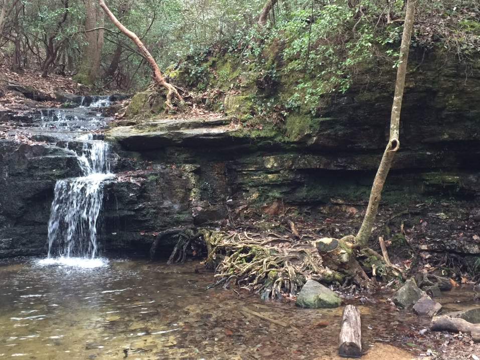
We came to a pretty little waterfall, and took a break, while some ate a snack or two and some got more water. Some of the best clear mountain water full of minerals you can find anywhere. Tastes so good, and so refreshing. The body needs that fresh mountain water, especially after spending too much time in the city.
Then we started up the steep slope, at a perpendicular angle to the slope, going straight up to Beech Gap, gaining about 800' within approximately 1/3 of a mile. Sometimes it was more like crawling. Somebody added some brightly colored flags up the slope making it easier than last time I did it. But if you loose the flags, just keep going perpendicular to the ridge until you hit the A.T.
Once we caught our breath, we followed the Blue Ridge on the A.T. gaining almost another 1000', but in a more gradual incline to Standing Indian, for a fantastic breath taking view of the surrounding mountains. We ate lunch, and took our time, just hanging out at the top for quite some time. With the long days, it was very enjoyable to take our time there.
After lunch, we went along the ridge to the west for more scenic views of the valley, seeing all the way to Lake Burton and perhaps Lake Rabun to the south, and Chatuge Lake to the west, and on up to the mountains to the north.
And for the first time, did a little exploring to the rock outcropping further to the west thanks to Mark's suggestion. He took a couple of pictures of me, and when I got back the rest of the group decided to go over there and check it out. Luckily, Laura noticed the silhouette of the Standing Indian on the route over there, through the thick Rhodo bushes. And Marina captured the face in a great picture of it.
After spending over an hour on the top, we continued down to Deep Gap, then down the extremely steep Deep Gap Branch trail. This I feel is the more challenging part of this loop. You really need to be careful going down this trail. Yet it's so beautiful as it dips down the ravine along Deep Creek Branch, all the way back down to the Tallalulah river basin.
Once off the trail, because we decided not to have a car shuttle, we walked about a mile down the Tallulah river road, which I don't mind too much, since it follows the river, and there's little traffic. However Mark R. told me they were charged by a large mean dog one time on this route, and even though I've never had a problem in the past, I'll probably just opt to do a car shuttle when it's an available option next time. Either that, or make sure to have a hiking pole or staff for protection.
Then on down the pretty road, back down to Clayton, with a nice meal and cold beverage at MamaG's! What a wonderful day, and I'm very appreciative for the people who register for these types of events. I really enjoy sharing these moments with people who love nature, and are fit enough to make it seem easy, despite the groaning whenever we got out of those cars!
Thanks for coming out, and hope to see you again!
Michael Johnson
p.s.
I will post a link to the pictures Marina and I took of our event. If you want to share yours, send me a note, and I'll add them, if you send me a link.
My stat's for this hike were 12.57 miles and about 2731' elevation gain from the bottom. I would like to compare that with what you got, since almost everyone had their own app's and gadgets recording the hike.
 Calendar of Events
 Event Places