Fri, Oct 23 2009 - SPOTS AVAILABLE Black Mtn Crest Trail Backpacking Adventure (View Original Event Details)
|  |
Our Black Mountain Crest (BMC) Adventure was indeed a great adventure. Elizabeth, Resa, Celeste, Danny, Pawan, and Andy enjoyed the trail for the first time while Matt and Rob had an excellent repeat adventure. This was a truly a great trip from start to finish!<br><Br>
With 8 hearty souls in 4 cars we left a rainy Atlanta about 6:30pm and began what would be about a 5.5 hour drive to the Mount Mitchell State Park Entrance. We finally escaped the rain up I-85 at the SC border only to find it again an hour south of Asheville. The rain and wind progressively worsened, and we knew it would be an interesting drive once we stopped for gas in Asheville. We could see the low cloud ceilings in the distance and imagined what the Blue Ridge Parkway would be like. We soon started climbing on a windy road that would connect us with the Parkway and at about 3000 feet we were enveloped in a thick fog with moderate rain. We proceeded slowly until we finally found/reached the parkway. Yay, only 22 miles to go! Only by this time our visibility was reduced to between 20 and 50 feet, the rain intensified, and the winds swirled around us at 30 to 40 mph as we did our best follow the center double yellow line (see a bit
here: http://www.youtube.com/user/atlpack90#p/u/0/NHV_WhzROyo). We did however get to see nice impromptu water falls about every 50 feet though. We finally arrived at the entrance a little before midnight. Only Rob, and the 2 new AOCers Celeste, and Resa decided to brave the elements while the rest of us attempted to sleep in the cars. The driving rain and wind peaked at about 4:00am, and fortunately we awoke to only overcast skies with gusty winds.<br><Br>
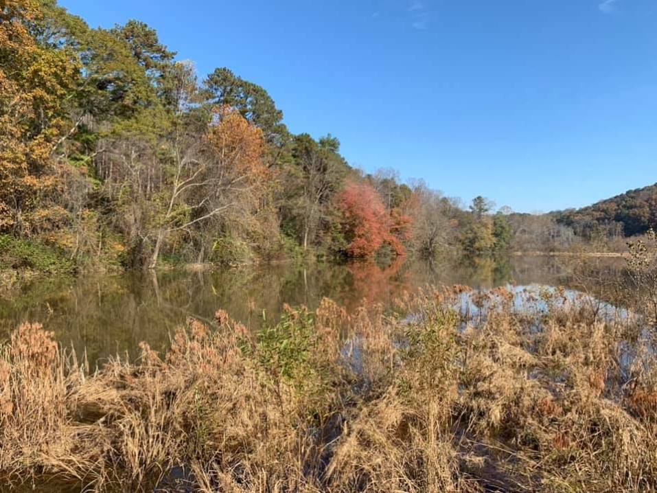
OK, now on to the backpacking trip. On Saturday morning as we drove up to Mount Mitchell we burst through the low clouds and caught our first glimpses of the surrounding mountain tops. The winds in the parking were howling between 30 and 40 mph. We left 2 cars and then drove an hour to the Bowlens Creek trailhead as the skies mostly cleared. We parked and began the 3000+ foot ascent up to the Black Mountain Crest. We ascended from peak fall color at the valley floor into the evergreen Balsam forest near the crest. As we approached the Celo Knob, the first peak on the crest, we were treated to incredible views of the mountains surrounding the colorful valley several thousand feet below. We dropped packs an ascended a steep, short trail to the peak of Celo knob to get our first of many unlimited views looking east toward Grandfather Mountain, Table Rock and beyond. After another half mile hike we found a great lunch spot on a rock pile with 360 degree views. The weather was near perfect and several of us were comfortably basking in the sun in shorts and t-shirts. We could also see low clouds starting to slowly spill over the crest of the range to our west.<br><Br>
We were awed as we continually encountered breathtaking views, rich biodiversity, and difficult but exciting trail conditions. This is a trail that will definitely keep your hiking speeds lower than you are used to due to the many steep and rocky sections. After a strenuous section up and down Winter Star we made it into camp around 4:30 at Deep Gap as the clouds finally made their way to our ridge and obscured our views. The temperatures dropped very quickly at 5700 feet and the winds picked up, so we set up camp, fetched water (about 1/4 mile down the old logging road since the primary source was dry), ate dinner, and slowly stoked a nice fire. The temperatures hovered in the upper 30's until we all hit the tents and hammocks as the winds continued to blow briskly (just as it did 2 years prior). <br><br>
By Sunday morning the skies had cleared and the winds died down to nil. The low temperature was around 27 degrees and ice formed inside some of our tents and water bottles. The temps quickly rose and after many inexplicable push-ups by Rob, Andy, and Elizabeth, we were off to conquer Potato Hill which was no small potatoes. The weather was now perfect with clear skies, no winds, and excellent visibilities as we continued south on the trail. The trail from this stretch past Balsam Cone until Mount Craig was especially entertaining and challenging. Several sections had ropes to assist hikers which I imagine would be very handy if these rock faces were covered with ice. As we approached Mt. Craig, we came across an ideal vantage point looking north at the crest we had traversed and several of us posed on an old dead tree for pictures. We stopped for a few pics near the summit of Mt. Craig and watched how the trail turn from a rugged sparsely maintained trail to a finely graveled path as we approached the Mt. Mitchell parking area. We crossed the packed parking lot feeling a bit out of place and completed our route up the short walkway to the new viewing platform on the top of Mt. Mitchell, the highest peak east of the Mississippi. <br><Br>
With 6300 vertical ascent and 12 mostly difficult miles under our belts, we felt fortunate to have completed our journey with great companions, ideal weather, and incredible scenery that few places can match. Congratulations goes to Elizabeth, Resa, Celeste, Danny, Pawan, and Andy on bagging 6 of the 40 6000 foot peaks in the southeast (Celo, Winter Star, Potato Hill, Balsam Cone, Mt. Craig, and Mt. Mitchell). Rob and Matt can vouch that this trail is just as good the second time. The Black Mountain Crest is a special place that you NEED to see at least once, and likely will want to experience again.
 Calendar of Events
 Event Places