 Print-Friendly Version Print-Friendly Version
|
|
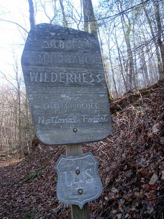
Rescheduled: Blood Mountain Via Jarrad Gap, AT and Freeman | |||||||
| The Basics: | |||||||
| Event Type: | Hike | ||||||
| Event Location: |
Suches, GA


| ||||||
| Date(s) & Time: | Sat, Mar 14 2015 7:45 am >> Sat, Mar 14 2015 6:00 pm (Carpool Departure: 7:45 am *log in for location*) | ||||||
| Registration Opens: | Mon, Feb 9 2015 8:00 pm | ||||||
| Registration Cut Off: | Fri, Mar 13 2015 6:00 pm | ||||||
| Event Duration: | 10 Hours 15 Minutes | ||||||
| Difficulty Rating: | D4: Moderate to Difficult | ||||||
| Distance: | 10.3 Miles | ||||||
| Pace: | Moderate | ||||||
| Trip Leader(s): | Bob J Kelly  Email Trip Leader(s) Email Trip Leader(s)
You must be logged in to get the Trip Leader contact information. | ||||||
| Member Cost: | None | ||||||
| Participant Info: | |||||||
| Who's Invited: | Members Only, 21 And Older Only | ||||||
| Maximum Group Size: | 12 | ||||||
| Minimum Group Size: | 4 | ||||||
| Number Registered So Far: | 5 / 0 (To see who's signed up, log in to the Member Area) | ||||||
| Are Dogs Permitted: | Yes | ||||||
| Itinerary: | |||||||
PLEASE NOTE: THIS EVENT HAS BEEN RE-SCHEDULED FOR SATURDAY, MARCH 14TH Join me on a nice altertnate route to Blood Mountain that will work your appetite up just in time for lunch at the summit! We will allow two well behaved dogs on this trip. We already have one signed up. | |||||||
| |||||||
| How to Get There: | |||||||
| Event Directions: | North on GA 400. Take a left onto SR 60/19 toward Dahlonega. At the fork of SR 60 and SR 19, go straight on SR 60 to Suches. Take a right on SR 180. The entrance to the Lake Winfield Scott Recreation Area is on the right, approximately 7-8 miles on after you turn onto SR 180. As you drive toward the lake, past the campground, the parking lot is located on the left, just before you get to the bridge. The trailhead is located across the bridge and to your right. We have a good few folks meeting us at Lake Winfield Scott. For those who are not carpooling, please be at Lake Winfield Scott ready to go at 9 AM on Saturday. | ||||||
| Carpool to Event Distance (round trip): | 130Mile(s) | ||||||
| Carpool Departure Time: | 7:45 am | ||||||
| Carpool Location: | Log in for location | ||||||
| Carpool Directions: | Log in for directions | ||||||
| Carpool Cost: | Estimated cost per vehicle for this event is $52.00 using a reimbursement rate guideline of $0.400 per mile. The total amount should be divided by the number of people in the vehicle, including the driver. This is a guideline, not a rule, for drivers but the cost should not be higher unless there are extenuating circumstances. | ||||||
| Notes: | |||||||
|
$5 day use fee per vehical at Lake Winfield * We encourage all members to follow our Etiquette Guidelines while participating in AOC events. | |||||||
Cancellation/Partial Attendance: Please review the AOC cancellation policy. | |||||||
 Calendar of Events
 Event Places