 Print-Friendly Version Print-Friendly Version
|
|
Kennesaw Park Trail Mix - Southern Meadow | |||||||
| The Basics: | |||||||
| Event Type: | Hike | ||||||
| Event Location: |
Cheatham Hill parking lot


| ||||||
| Date(s) & Time: | Sun, Mar 22 2015 9:00 am >> Sun, Mar 22 2015 12:00 pm | ||||||
| Registration Opens: | Fri, Mar 20 2015 11:59 pm | ||||||
| Registration Cut Off: | Sun, Mar 22 2015 8:00 am | ||||||
| Event Duration: | 3 Hours | ||||||
| Difficulty Rating: | D3: Moderate | ||||||
| Distance: | 7 Miles | ||||||
| Pace: | Moderate | ||||||
| Trip Leader(s): | Ron S Email Trip Leader(s) Email Trip Leader(s)
You must be logged in to get the Trip Leader contact information. | ||||||
| Member Cost: | None | ||||||
| Participant Info: | |||||||
| Who's Invited: | Members Only, 21 And Older Only | ||||||
| Maximum Group Size: | 12 | ||||||
| Minimum Group Size: | 2 | ||||||
| Number Registered So Far: | 3 / 0 (To see who's signed up, log in to the Member Area) | ||||||
| Are Dogs Permitted: | No | ||||||
| Itinerary: | |||||||
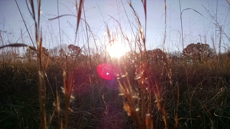
Please join me on this hike through the southern section of the Kennesaw Battlefield Park. There is a lot of variety of terrain and micro-climates and to me, one of the highlights is the large open meadow on the last mile of the hike (hence the name). We will start at the Cheatham Hill parking lot and after the customary introductions, we will hike the east and west trails clockwise, seeing the swamp, the horse trailer area, the John Ward parking lot, the grave of the unknown soldier, the unfinished bomb tunnel, and the huge Illinois Monument (near the parking lot where we started). But instead of finishing, we'll go back down the hill, through the woods, around the meadow and finally back to the cars, making just over 7 miles. It is a D3 because of the 7+ mile distance and 2.5 mph avg pace, but since there are no huge elevation changes, this will make a good first hike at this difficulty level. We will make short, frequent stops to get a good feel for this part of the park (and maybe catch your breath if necessary). This is one of my all-time favorite local hikes with lots of variety of terrain and changes throughout the seasons and I plan to do this hike periodically to see those changes. This Sunday may be drizzling but we'll see plenty of flowering trees and fresh green growth. | |||||||
| |||||||
| How to Get There: | |||||||
| Event Directions: | The trailhead is the Cheatham Hill
parking lot off of Dallas Hwy, west of
Marietta, GA. Going north on I-75 near Marietta, take exit 263 (120 South Loop to Marietta and Southern Polytechnic). Follow the 120 South Loop for about 3 miles to Whitlock Ave. The "loop" makes a hard right after you cross under the tracks (but you can't miss it). Then left (west) on Whitlock Ave and go about 3 more miles to Cheatham Hill Drive on your left. The parking lot is at the end of the road. The GPS coordinates of the trailhead are 33.936571, -84.596983 Alternatively, this street address works in my google maps on my android phone: Cheatham Hill Drive, Marietta, GA 30064 Note: Make sure you plug in "Drive", NOT "Road".
| ||||||
| Notes: | |||||||
|
There is water available at the
parking lot and at Kolb farm about half
way through the main loop. * We encourage all members to follow our Etiquette Guidelines while participating in AOC events. | |||||||
Cancellation/Partial Attendance: Please review the AOC cancellation policy. *Note: I will let you know (by e-mail) by 7:00 am on the morning of the hike if I need to cancel this in case of really bad weather or road conditions. | |||||||
 Calendar of Events
 Event Places