 Print-Friendly Version Print-Friendly Version
|
|
Smoky Mountains Insanity! Charles Bunion + Mt. Leconte | |||||||
| The Basics: | |||||||
| Event Type: | Hike | ||||||
| Event Location: |
Smoky Mountains near Bryson City, NC


| ||||||
| Date(s) & Time: | Sun, May 31 2015 9:30 am >> Sun, May 31 2015 6:30 pm (Carpool Departure: 6:00 am *log in for location*) | ||||||
| Registration Opens: | Wed, May 27 2015 8:00 pm | ||||||
| Registration Cut Off: | Sat, May 30 2015 5:00 pm | ||||||
| Event Duration: | 9 Hours | ||||||
| Difficulty Rating: | D6: Advanced (Exploratory) | ||||||
| Distance: | 20 Miles | ||||||
| Pace: | Fast | ||||||
| Trip Leader(s): | John L Email Trip Leader(s) Email Trip Leader(s)
You must be logged in to get the Trip Leader contact information. | ||||||
| Member Cost: | None | ||||||
| Participant Info: | |||||||
| Who's Invited: | Members Only, 21 And Older Only | ||||||
| Maximum Group Size: | 8 | ||||||
| Minimum Group Size: | 4 | ||||||
| Number Registered So Far: | 4 / 0 (To see who's signed up, log in to the Member Area) | ||||||
| Are Dogs Permitted: | No | ||||||
|
Note: This is an "EXPLORATORY" trip. This means that there are parts of this trip, or perhaps the whole trip, that is new to your Trip Leader(s). However, they are confident that this will not be an issue. This note is here so that you can make an informed decision. When a Trip Leader isn't personally familiar with a trip, there is an increased chance of things not going as planned and you need to be prepared. The Trip Leader may have additional details in the itinerary. | |||||||
| Itinerary: | |||||||
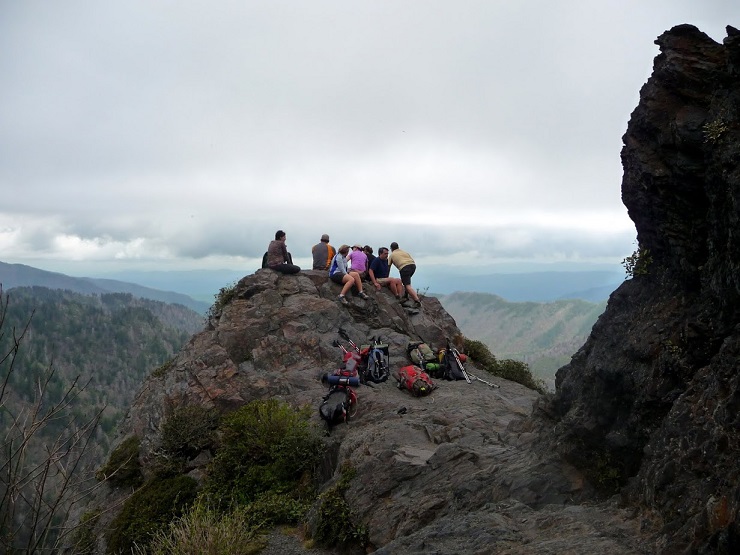
(Promo photo courtesy of Denise Millon and Geri Dominguez) This has a ton of driving and is also a shuttle hike to add some variety. We will probably get back to Atlanta between 9pm - 10pm. We leave the carpool at 6:00 am and head North for 3 hours. Drop off everyone at the Newfound Gap parking lot on HWY 441. Take all vehicles and park them at Alum Cave Trailhead. Take one back with all drivers to NewFound Gap and begin the hike, hopefully starting our hike no later than 9:30 am. Head north on the AT for about 1.7 miles, then veer right onto the Sweet Heifer Creek Trail. Hike for another 3.5 miles and we will arrive at the Kephart Shelter. We take a quick break, then proceed onto the Grassy Branch Trail. After 2.5 miles and an 1800-foot climb, we will turn left onto Dry Sluice Gap Trail. After 1.3 miles we join the AT and reach Charlies Bunion where we can rest for a bit and have lunch. After enjoying the view, we quickly turn around and head south on the AT to Icewater Spring Shelter. Shortly after we take the Boulevard Trail (taking a quick stop to "The Jumpoff" along the way) up to Mt. Leconte, a historic and cool mountain resort with a restaurant and cabins. We will rest up and look around, then head down the Alum Cave Trail back to the cars (I'd like to be finished by 6:00 pm at the latest). We will most likely stop somewhere on the way back to have a quick meal, hence this will be a full but fun day. Looking at several maps from other sites, I estimate this will be right around 20 miles with over 4000 feet of elevation gain, hence the D6 rating. If the mileage or elevation turns out to be less, I will adjust the D-Level accordingly, but I feel that these numbers are fairly accurate. Plan to be prepared for a long day of hiking. | |||||||
| |||||||
| How to Get There: | |||||||
| Event Directions: | From Indian Trail, take I-85 North to I-985 North. The GPS coordinates and location of the Newfound Gap Parking Lot is approximately: U.S. 441
| ||||||
| Carpool to Event Distance (round trip): | 333Mile(s) | ||||||
| Carpool Departure Time: | 6:00 am | ||||||
| Carpool Location: | Log in for location | ||||||
| Carpool Directions: | Log in for directions | ||||||
| Carpool Cost: | Estimated cost per vehicle for this event is $133.20 using a reimbursement rate guideline of $0.400 per mile. The total amount should be divided by the number of people in the vehicle, including the driver. This is a guideline, not a rule, for drivers but the cost should not be higher unless there are extenuating circumstances. | ||||||
| Notes: | |||||||
|
No dogs allowed for this event. * We encourage all members to follow our Etiquette Guidelines while participating in AOC events. | |||||||
Cancellation/Partial Attendance: Please review the AOC cancellation policy. | |||||||
 Calendar of Events
 Event Places