 Print-Friendly Version Print-Friendly Version
|
|
Duncan Ridge Trail Adventure | |||||||
| The Basics: | |||||||
| Event Type: | Explorer | ||||||
| Event Location: | Duncan Ridge Trail (Dahlonega to Blairsville) | ||||||
| Date(s) & Time: | Fri, Oct 24 2008 1:00 pm >> N/A (Carpool Departure: 12:00 pm *log in for location*) | ||||||
| Registration Opens: | Thu, Sep 11 2008 10:00 pm | ||||||
| Registration Cut Off: | Tue, Oct 21 2008 11:30 pm | ||||||
| Event Duration: | 3 days and 2nights | ||||||
| Difficulty Rating: | D6: Advanced | ||||||
| Trip Leader(s): | Rob Garner Kelly Harris Matt Tichenor  Email Trip Leader(s) Email Trip Leader(s)
You must be logged in to get the Trip Leader contact information. | ||||||
| Member Cost: | None | ||||||
| Participant Info: | |||||||
| Who's Invited: | Members Only, 21 And Older Only | ||||||
| Maximum Group Size: | 10 | ||||||
| Minimum Group Size: | 5 | ||||||
| Number Registered So Far: | 7 / 0 (To see who's signed up, log in to the Member Area) | ||||||
| Are Dogs Permitted: | No | ||||||
| Itinerary: | |||||||
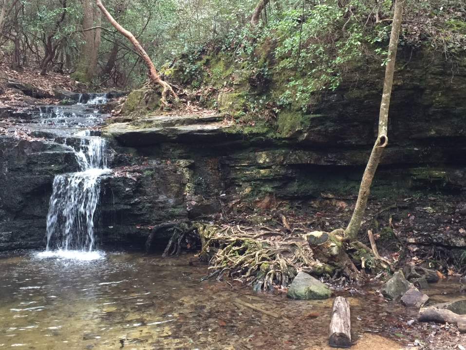
| Are you ready to backpack the complete Duncan Ridge Trail (DRT) in a weekend? The DRT is a challenging trail in North Georgia offering over 12000 feet of vertical climb in 30 miles. Total trip length will be about 31 miles including the hike to and from the endpoints. GeorgiaTrails.com offers this description: "This path is extremely strenuous. For experienced backpackers this trail offers some of the most challenging climbs in the United States. The Duncan Ridge Trail begins at Three Forks on the Appalachian Trail and shares the same footpath with the Benton MacKaye Trail until it reaches Ga. Highway 60. Shortly after the highway, near the top of Rhodes Mountain the Benton MacKaye goes west while the Duncan Ridge heads east. From Rhodes Mountain the trail descends rapidly into Rhodes Mountain Gap. The next mile is an easy up and down, but then the trail goes sharply up and down and continues the rapid ascent/descent cycle until it reaches Fish Gap. Another sharp ascent and the trail reaches the summit of Akin Mountain and continues on to Mulky Gap. 3 miles after leaving Mulky Gap the DRT begins to run next to Forest Service Road 39, also known as Duncan Ridge Road. Continuing the steep ascent/descent cycle that it began at Rhodes Mountain, the DRT climbs both Wildcat Knob and Coosa Bald. The Coosa Backcountry Trail joins the Duncan Ridge Trail briefly. A final climb up Slaughter Mountain and the trail ambles easily down to its end at the Appalachian Trail in Slaughter Gap." This trip is listed as an "Adventure" since none of us have hiked the trail, are uncertain of the water sources' exact locations/statuses, and will not have predetermined camp sites. Due to the required distances per day we will be moving at a moderate to fast pace when the terrain allows. For example Saturday we plan to hike 16 miles including a 6 - 7000 foot vertical gain. Expect Saturday to be a solid D6 day due to distance and difficulty. We will be packing light and sharing water filters, canister stoves, etc. when possible, so we can keep our pack weights under 30 pounds. We plan to wake up at sunrise on Saturday and Sunday to maximize our trail time. Please be prepared to hike in any weather since we do not forsee cancelling the hike due to rain, snow or cold temperatures. We shouldn't have to worry about thunderstorms in late October (but you never know). As with any fall outing in the mountains we'll need to wear some orange, since it is firearms hunting season for deer and bear. Please do not sign up unless you are able to backpack at a moderate to fast pace and have recent D5 or D6 backpacking experience as there are very few exit points on this trail. You must also have fairly lighweight gear and are willing to hike with the group since parts of the trail may be difficult to navigate. IMPORTANT: Due to the length of this trip, we plan to leave Atlanta at 1:00pm on Friday in order to hike 5 miles that day. We then plan to hike 16 or so miles on Saturday and the remaining 10 on Sunday. We should get back to Atlanta arounbd 6:00 pm on Sunday. This trip requires a shuttle, so we will be dropping half of the cars at Lake Winfield Scott Campgroung then drive to Three Forks (including about 15 miles on Forest Service roads). | |||||||
| |||||||
| How to Get There: | |||||||
| Carpool to Event Distance (round trip): | 200Mile(s) | ||||||
| Carpool Departure Time: | 12:00 pm | ||||||
| Carpool Location: | Log in for location | ||||||
| Carpool Directions: | Log in for directions | ||||||
| Carpool Cost: | Estimated cost per vehicle for this event is $80.00 using a reimbursement rate guideline of $0.400 per mile. The total amount should be divided by the number of people in the vehicle, including the driver. This is a guideline, not a rule, for drivers but the cost should not be higher unless there are extenuating circumstances. | ||||||
| Notes: | |||||||
|
Please bring money to pay your carpool driver for gas.
We need four people to volunteer to drive. * We encourage all members to follow our Etiquette Guidelines while participating in AOC events. | |||||||
Cancellation/Partial Attendance: Please review the AOC cancellation policy. | |||||||
 Calendar of Events
 Event Places