 Print-Friendly Version Print-Friendly Version
|
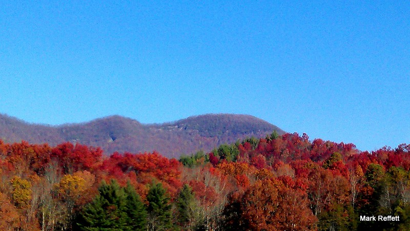
Hightower Bald - Fall Foliage On Georgia’s 3rd Highest Mountain | |||||||
| The Basics: | |||||||
| Event Type: | Hike | ||||||
| Event Location: |
Approximately 10 miles East of Hiawassee, Ga


| ||||||
| Date(s) & Time: | Sun, Oct 11 2015 8:00 am >> Sun, Oct 11 2015 6:00 pm (Carpool Departure: 8:00 am *log in for location*) | ||||||
| Registration Opens: | Thu, Oct 8 2015 6:30 pm | ||||||
| Registration Cut Off: | Sat, Oct 17 2015 4:40 pm | ||||||
| Event Duration: | 10 Hours | ||||||
| Difficulty Rating: | D5: Difficult | ||||||
| Distance: | 7 Miles | ||||||
| Pace: | Moderate | ||||||
| Trip Leader(s): | Mark Email Trip Leader(s) Email Trip Leader(s)
You must be logged in to get the Trip Leader contact information. | ||||||
| Member Cost: | None | ||||||
| Participant Info: | |||||||
| Who's Invited: | Members Only, 21 And Older Only | ||||||
| Maximum Group Size: | 10 | ||||||
| Minimum Group Size: | 3 | ||||||
| Number Registered So Far: | 5 / 0 (To see who's signed up, log in to the Member Area) | ||||||
| Are Dogs Permitted: | Yes | ||||||
| Itinerary: | |||||||
Standing 4568' above sea level within the boundaries of the Southern Nantahala Wilderness Area of the Chattahoochee National Forest, Hightower Bald is Georgia's third highest mountain. It is the highest of a series of a half dozen mountain peaks all over 4,000 feet that run west to Eagle Mountain. This ridge line lying in the Southern Nantahala Wilderness is one of the most remote areas in the state due to the rugged terrain, lack of roads, and... NO trails. Absolutely perfect for those who like a little more free- form adventure in their hiking. It should be close to early Autumn foliage on these high ridges, so hopefully there will be some nice colors.
Due to the nature of this hike, it will be cancelled if there is a significant chance of rain or bad weather. We plan to stop in Clayton for dinner afterwards, so if you do not wish to eat then you will either need to drive your own vehicle or arrange to ride with someone else who's not stopping. | |||||||
| |||||||
| How to Get There: | |||||||
| Event Directions: | If there is anyone who for some reason needs to meet at the event, I will provide directions via email. | ||||||
| Carpool to Event Distance (round trip): | 210Mile(s) | ||||||
| Carpool Departure Time: | 8:00 am | ||||||
| Carpool Location: | Log in for location | ||||||
| Carpool Directions: | Log in for directions | ||||||
| Carpool Cost: | Estimated cost per vehicle for this event is $84.00 using a reimbursement rate guideline of $0.400 per mile. The total amount should be divided by the number of people in the vehicle, including the driver. This is a guideline, not a rule, for drivers but the cost should not be higher unless there are extenuating circumstances. | ||||||
| Notes: | |||||||
|
Up to 2 well behaved dogs will be allowed on the event. Dogs should be able to be trusted off-leash as the terrain, vegetabtion, and obstacles will make it difficult, if not impossible, to deal with a leash. However, there are a few points on this hike near cliffs, where dogs will have to remain on a leash for safety. * We encourage all members to follow our Etiquette Guidelines while participating in AOC events. | |||||||
Cancellation/Partial Attendance: Please review the AOC cancellation policy. | |||||||
 Calendar of Events
 Event Places