 Print-Friendly Version Print-Friendly Version
|
|
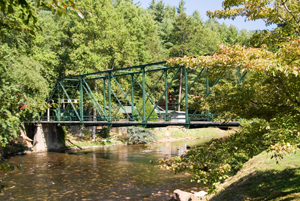
Shallowford Bridge to Weaver Creek Road - Benton MacKaye Trail | |||||||
| The Basics: | |||||||
| Event Type: | Explorer | ||||||
| Event Location: | Benton MacKaye Trail Section 6 | ||||||
| Date(s) & Time: | Sat, Sep 20 2008 8:00 am >> N/A (Carpool Departure: 8:00 am *log in for location*) | ||||||
| Registration Opens: | Fri, Sep 12 2008 11:00 am | ||||||
| Registration Cut Off: | Fri, Sep 19 2008 11:55 pm | ||||||
| Event Duration: | One Day | ||||||
| Difficulty Rating: | D4: Moderate to Difficult | ||||||
| Trip Leader(s): | Scott Sanders Email Trip Leader(s) Email Trip Leader(s)
You must be logged in to get the Trip Leader contact information. | ||||||
| Member Cost: | None | ||||||
| Participant Info: | |||||||
| Who's Invited: | Members Only, 21 And Older Only | ||||||
| Maximum Group Size: | 8 | ||||||
| Minimum Group Size: | 4 | ||||||
| Number Registered So Far: | 6 / 0 (To see who's signed up, log in to the Member Area) | ||||||
| Are Dogs Permitted: | No | ||||||
| Itinerary: | |||||||
| 9.8 total miles, with elevation changes. We'll hike 9.8 miles from Shallowford Bridge on the Toccoa river to Weaver Creek Road. If you like a long gentle climb and a long gentle descent - this one's for you! After a 1600 foot climb (to the top of Rocky Mountain) spread over 6 miles, you descend about 1500 over the next 3.8 miles. This hike offers a lot of diversity in plant life and scenery. Mountain tops, river views (Toccoa) and everything in between. | |||||||
| |||||||
| How to Get There: | |||||||
| Event Directions: | We'll carpool from Mansell Road park and ride North on Ga 400/ US 19 to Dahlonega and pick up Ga 60. Go 23.5 mile after the US 19/Ga 60 junction at Stonepile Gap (on Ga 60), turn left on Dial Road for 7.2 miles, and park at the Aska Road Parking lot. We'll drop another car(s) a few miles away on Weaver Creek Road | ||||||
| Carpool to Event Distance (round trip): | 175Mile(s) | ||||||
| Carpool Departure Time: | 8:00 am | ||||||
| Carpool Location: | Log in for location | ||||||
| Carpool Directions: | Log in for directions | ||||||
| Carpool Cost: | Estimated cost per vehicle for this event is $70.00 using a reimbursement rate guideline of $0.400 per mile. The total amount should be divided by the number of people in the vehicle, including the driver. This is a guideline, not a rule, for drivers but the cost should not be higher unless there are extenuating circumstances. | ||||||
| Notes: | |||||||
|
PACE - slow to moderate. Think 2.0+/- MPH average. I hike long miles, but I am not going to rush or leave anyone behind. There will be time for taking photos, if you don't linger too long. Think "light weight" when packing - you should be under 12 pounds on total weight. We'll be stopping at all trail intersections, gaps, and road crossings to "collect" the group as we hike and not get stretched out too much (for safety reasons) This is ALMOST a MODERATE trip. If you have questions, sign up and email me. I reserve the right to remove anyone who I feel might not be up to the challenge.
If bad weather arrives, we'll reschedule. * We encourage all members to follow our Etiquette Guidelines while participating in AOC events. | |||||||
| Cost Includes: | NA | ||||||
Cancellation/Partial Attendance: Please review the AOC cancellation policy. *Note: NA | |||||||
 Calendar of Events
 Event Places