 Print-Friendly Version Print-Friendly Version
|
Rock Gap to Albert Mountain | |||||||
| The Basics: | |||||||
| Event Type: | Hike | ||||||
| Event Location: |
Standing Indian area, near Franklin, NC


| ||||||
| Date(s) & Time: | Sat, Dec 5 2015 8:00 am >> Sat, Dec 5 2015 8:00 pm (Carpool Departure: 8:00 am *log in for location*) | ||||||
| Registration Opens: | Tue, Dec 1 2015 9:00 pm | ||||||
| Registration Cut Off: | Fri, Dec 4 2015 7:00 pm | ||||||
| Event Duration: | per itinerary | ||||||
| Difficulty Rating: | D4: Moderate to Difficult | ||||||
| Distance: | 12 Miles | ||||||
| Pace: | Moderate | ||||||
| Trip Leader(s): | Dorothea Mike S  Email Trip Leader(s) Email Trip Leader(s)
You must be logged in to get the Trip Leader contact information. | ||||||
| Member Cost: | None | ||||||
| Participant Info: | |||||||
| Who's Invited: | Members Only, 21 And Older Only | ||||||
| Maximum Group Size: | 12 | ||||||
| Minimum Group Size: | 2 | ||||||
| Number Registered So Far: | 12 / 0 (To see who's signed up, log in to the Member Area) | ||||||
| Are Dogs Permitted: | No | ||||||
| Itinerary: | |||||||
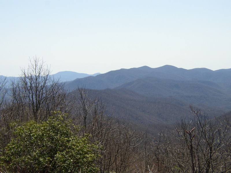
This is an in-and-out hike on the AT from Rock Gap to Albert Mountain. The hike falls between a D4 and D5 in level of difficulty: D5 for the distance, and D4 for the elevation gain; we gain 2100 ft gradually over 6 miles on largely non-rocky terrain. Hiking time is 5-6 hours, to which we add however long we spend on the tower taking in the 360-degree view and eating lunch. The trail runs along a ridge for much of the way, so we will have some nice winter views. Be sure to bring a jacket, as at that elevation and with a possible wind it could be chilly. Mike will coordinate the carpool at the Indian Trail park & ride, and Dorothea will join the group at the Clayton Ingles (which has a Starbucks). We plan to stop in Clayton for supper afterwards, which means we will get back to Atlanta by about 8:00. If you do not wish to stay for supper, you will have to carpool with others who do not wish to stay or drive on your own as far as Clayton. | |||||||
| |||||||
| How to Get There: | |||||||
| Event Directions: | From the Indian Trail park & ride, take I-85 North. After 11 miles bear left to take I-985 North. This road will change to GA 365, US 441, and US 23. Stay on it for 75 miles, then stop at the Ingles in Clayton for a pit-stop and to meet the other trip coordinator. Once back on the 441, it is 21 miles to Franklin. Make a left onto US 64 West and travel 10 miles, then turn left on to S.R. 1448 (Old US 64). Continue on S.R. 1448 to Wallace Gap and turn right, following the sign to Standing Indian Campground. After half a mile look for Parking at Rock Gap on your left. We'll be driving on paved road the entire way. Travel time: 1.5 hours to Clayton + 45 minutes to the trailhead at Rock Gap | ||||||
| Carpool to Event Distance (round trip): | 248Mile(s) | ||||||
| Carpool Departure Time: | 8:00 am | ||||||
| Carpool Location: | Log in for location | ||||||
| Carpool Directions: | Log in for directions | ||||||
| Carpool Cost: | Estimated cost per vehicle for this event is $99.20 using a reimbursement rate guideline of $0.400 per mile. The total amount should be divided by the number of people in the vehicle, including the driver. This is a guideline, not a rule, for drivers but the cost should not be higher unless there are extenuating circumstances. | ||||||
| Notes: | |||||||
|
If you have not recently completed comparable AOC hikes, we will be contacting you to determine whether this is the right hike for you * We encourage all members to follow our Etiquette Guidelines while participating in AOC events. | |||||||
Cancellation/Partial Attendance: Please review the AOC cancellation policy. | |||||||
 Calendar of Events
 Event Places