 Print-Friendly Version Print-Friendly Version
|
|
Big Frog Mountain - Benton MacKaye Trail Sections 10 and 11 | |||||||
| The Basics: | |||||||
| Event Type: | Explorer | ||||||
| Event Location: | Benton MacKaye Trail Sections 10 and 11 | ||||||
| Date(s) & Time: | Mon, Dec 29 2008 8:00 am >> N/A (Carpool Departure: 8:00 am *log in for location*) | ||||||
| Registration Opens: | Wed, Dec 24 2008 9:00 am | ||||||
| Registration Cut Off: | Sun, Dec 28 2008 9:00 pm | ||||||
| Event Duration: | One Day | ||||||
| Difficulty Rating: | D5: Difficult | ||||||
| Trip Leader(s): | Scott Sanders Kevin Crowe  Email Trip Leader(s) Email Trip Leader(s)
You must be logged in to get the Trip Leader contact information. | ||||||
| Member Cost: | None | ||||||
| Participant Info: | |||||||
| Who's Invited: | Members Only, 21 And Older Only | ||||||
| Maximum Group Size: | 8 | ||||||
| Minimum Group Size: | 4 | ||||||
| Number Registered So Far: | 8 / 0 (To see who's signed up, log in to the Member Area) | ||||||
| Are Dogs Permitted: | No | ||||||
| Itinerary: | |||||||
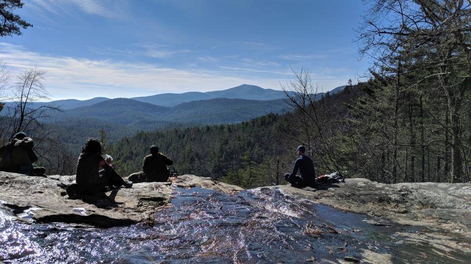
| 16.4 total miles, with several big elevation changes.
We'll hike 16.4 miles from Watson Gap to Chestnut Ridge via Big Frog Mountain. If you like long hikes at a 3.0 mph+ average pace - this one's for you! This hike offers a lot of high elevation peak to gap hiking. Scenery should be great with the leaves down. There are very few outs on this hike if you get hurt. Be prepared and be safe. Much of the hike is in Cohutta Wilderness and Big Frog Wilderness area. If this trail had three ratings for distance, elevation, and pace, It would look like a D5-D4-D4, respectively. | |||||||
| |||||||
| How to Get There: | |||||||
| Event Directions: | We'll carpool from Chastain, and go North on Ga 5 towards Watson Gap near the Cohutta Wilderness.
| ||||||
| Carpool to Event Distance (round trip): | 180Mile(s) | ||||||
| Carpool Departure Time: | 8:00 am | ||||||
| Carpool Location: | Log in for location | ||||||
| Carpool Directions: | Log in for directions | ||||||
| Carpool Cost: | Estimated cost per vehicle for this event is $72.00 using a reimbursement rate guideline of $0.400 per mile. The total amount should be divided by the number of people in the vehicle, including the driver. This is a guideline, not a rule, for drivers but the cost should not be higher unless there are extenuating circumstances. | ||||||
| Notes: | |||||||
|
PACE - moderate to fast. Think 3.0+/- MPH average. I hike long miles, but I am not going to leave anyone behind. Think "light weight" when packing - you should be under 12 pounds on total weight. We'll be stopping at all trail intersections, gaps, and road crossings to "collect" the group as we hike and not get stretched out too much (for safety reasons) This is a STRENUOUS trip. If you have questions, sign up and email me. We reserve the right to remove anyone who we feel might not be up to the challenge.
If bad weather arrives, we'll reschedule. * We encourage all members to follow our Etiquette Guidelines while participating in AOC events. | |||||||
| Cost Includes: | NA | ||||||
Cancellation/Partial Attendance: Please review the AOC cancellation policy. *Note: NA | |||||||
 Calendar of Events
 Event Places