 Print-Friendly Version Print-Friendly Version
|
Jack’s Knob Trail - Brasstown Bald - Chattahoochee Gap | |||||||
| The Basics: | |||||||
| Event Type: | Hike | ||||||
| Event Location: |
Blairsville, GA


| ||||||
| Date(s) & Time: | Sat, Mar 26 2016 8:30 am >> Sat, Mar 26 2016 8:30 pm (Carpool Departure: 8:30 am *log in for location*) | ||||||
| Registration Opens: | Mon, Mar 21 2016 8:00 pm | ||||||
| Registration Cut Off: | Fri, Mar 25 2016 6:00 pm | ||||||
| Event Duration: | per itinerary | ||||||
| Difficulty Rating: | D5: Difficult | ||||||
| Distance: | 10 Miles | ||||||
| Pace: | Moderate | ||||||
| Trip Leader(s): | Dorothea Mike S  Email Trip Leader(s) Email Trip Leader(s)
You must be logged in to get the Trip Leader contact information. | ||||||
| Member Cost: | None | ||||||
| Participant Info: | |||||||
| Who's Invited: | Members Only, 21 And Older Only | ||||||
| Maximum Group Size: | 12 | ||||||
| Minimum Group Size: | 2 | ||||||
| Number Registered So Far: | 7 / 0 (To see who's signed up, log in to the Member Area) | ||||||
| Are Dogs Permitted: | No | ||||||
| Itinerary: | |||||||
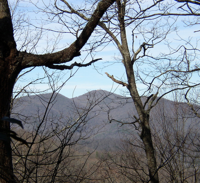
This hike starts with a steep one-hour climb through the woods, then another half-hour hike across the parking lot and up to the summit. But the climb is richly rewarded with a 360 degree view from the highest peak in GA. If the weather is good, we'll stay about an hour to look around and to eat lunch. Then it is back to the cars and across Hwy 180 to hike the second part of Jack's Knob Trail. At the cars you can pick up another bottle of water, if you wish. Now we hike up and down and up and down again to reach Chattahoochie Gap. A short side trail takes us to the headwaters of the "mighty" Chattahoochie River, which flows to Atlanta and eventually to the Gulf of Mexico. Then up and down and up and down again to return to the cars. Technical description: We start at Jack's Gap on Hwy 180 and hike to Brasstown Bald parking lot, gaining 1500 ft of elevation in 2.2 miles. From there we take the Summit Trail to the top, which adds another 500 ft of elevation gain in .6 mile. The return to Jack's Gap is mainly downhill but does involve another 200 ft in elevation gain, leading to a total of 2200 ft of elevation gain over 5.6 miles. Starting again at Jack's Gap and going the opposite direction, we cross Hwy 180 and hike to Chattahoochee Gap. To the gap and back entails a total of 1600 ft elevation gain (1000 ft out and 600 ft back) over 4.6 miles. Hiking the entire trail both ways involves 10.2 miles and 3800 ft elevation gain. Since this is a social hike, we will follow the hike with a dinner stop at Shenanigan's in Dahlonega. Anyone preferring not to stay for dinner should, when registering for the hike, indicate this preference in the notes field, and we will endeavor to match up similarly-inclined hikers for the carpool. In line with AOC practice, we will take as few cars as possible to the trailhead. Mike will be coordinating the carpool at the Mansell park-and-ride. The group will make a pit stop at the Cleveland Ingles, where Dorothea will join the group. | |||||||
| |||||||
| How to Get There: | |||||||
| Event Directions: | From the park-and-ride drive north on GA 400. When GA 400 ends at the Chevron Station, continue on GA 115. Drive 4.8 miles to where GA 115 meets GA 52. Turn right. Continue on GA 115 until you reach the traffic circle around the old courthouse in Cleveland. Take US 129 north. At the next traffic light (intersection with GA 75), you will see Ingles to your right. Turn in and make a pit stop. Resuming the drive, take GA 75 in the direction of Helen. Turn left onto Asbestos Road and follow it to where it makes a T-junction with Alt GA 75. Turn right onto Alt GA 75 and continue across the bridge at the T-junction with GA 75. Turn left onto GA 75 and stay on it to the top of the mountain (Unicoi Gap) and down the other side to where the road levels off. Turn left on to GA 60 and follow it to the parking area at Jack's Gap (signed Brasstown Bald). Travel time: 1 hour to Cleveland plus 45 minutes to Jack’s Gap. | ||||||
| Carpool to Event Distance (round trip): | 175Mile(s) | ||||||
| Carpool Departure Time: | 8:30 am | ||||||
| Carpool Location: | Log in for location | ||||||
| Carpool Directions: | Log in for directions | ||||||
| Carpool Cost: | Estimated cost per vehicle for this event is $70.00 using a reimbursement rate guideline of $0.400 per mile. The total amount should be divided by the number of people in the vehicle, including the driver. This is a guideline, not a rule, for drivers but the cost should not be higher unless there are extenuating circumstances. | ||||||
| Notes: | |||||||
|
We will be contacting anyone who has not done at least a D4 hike with the AOC to determine whether this is an appropriate hike for you. * We encourage all members to follow our Etiquette Guidelines while participating in AOC events. | |||||||
Cancellation/Partial Attendance: Please review the AOC cancellation policy. | |||||||
 Calendar of Events
 Event Places