 Print-Friendly Version Print-Friendly Version
|
|
East Palisades Edges - Easter Morning | |||||||
| The Basics: | |||||||
| Event Type: | Hike | ||||||
| Event Location: |
Whitewater Creek Entrance


| ||||||
| Date(s) & Time: | Sun, Mar 27 2016 10:00 am >> Sun, Mar 27 2016 1:00 pm | ||||||
| Registration Opens: | Mon, Mar 21 2016 5:30 pm | ||||||
| Registration Cut Off: | Sun, Mar 27 2016 9:00 am | ||||||
| Event Duration: | 3 Hours | ||||||
| Difficulty Rating: | D2: Easy to Moderate | ||||||
| Distance: | 6 Miles | ||||||
| Pace: | Moderate | ||||||
| Trip Leader(s): | Ron S Email Trip Leader(s) Email Trip Leader(s)
You must be logged in to get the Trip Leader contact information. | ||||||
| Member Cost: | None | ||||||
| Participant Info: | |||||||
| Who's Invited: | Members Only, 21 And Older Only | ||||||
| Maximum Group Size: | 12 | ||||||
| Minimum Group Size: | 2 | ||||||
| Number Registered So Far: | 7 / 0 (To see who's signed up, log in to the Member Area) | ||||||
| Are Dogs Permitted: | Yes | ||||||
| Itinerary: | |||||||
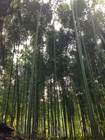
This is a D2 hike on the tough side. We are going to explore this beautiful park in a counter-clockwise direction and see all the edges and the main attractions within it at average pace of well under 3 mph. There will be three fairly steep climbs but the total elevation gain should be less than 1000 ft. We will start at the lower (whitewater creek) parking lot and warm up with a short out and back downstream crossing the small suspension bridge. Then we will take the valley trail below the rock wall. Being well warmed up by then, we start our first real climb, zig-zaging a bit as we make our way up to Indian Trail Road and Riverview Road and back down to the bamboo grove by the river. Next will be another climb to the overlook for a brief rest while listening to the Devil's Race Course Shoals below the cliff. Then we will descend to the cave for a good group photo. The last mini out and back will be marker "EP 30" over a little hill before enjoying a peaceful walk on the wide, flat trail along the river back to the cars.
| |||||||
| |||||||
| How to Get There: | |||||||
| Event Directions: | Please note the physical address and the directions mentioned below are approximate, the best way to get to the parking lot is by using the GPS co-ordinates. GPS co-ordinates: 33.877793, -84.442004 Approximate Physical Address - 4059 Whitewater Creek Rd NW, Atlanta, GA 30327 From I -285 East From I-285 West From I-75 North From U.S. 41 (Cobb Highway South) From U.S. 41 (Cobb Highway North) | ||||||
| Notes: | |||||||
|
Bring 3$ cash for parking unless you have an annual pass for the CRNRA (which you can purchase here: http://www.nps.gov/chat/planyourvisit/fees.htm ) Trail Map (PDF) - http://www.nps.gov/chat/planyourvisit/upload/TrailMapPalisadesEast.pdf * We encourage all members to follow our Etiquette Guidelines while participating in AOC events. | |||||||
Cancellation/Partial Attendance: Please review the AOC cancellation policy. | |||||||
 Calendar of Events
 Event Places