 Print-Friendly Version Print-Friendly Version
|
|
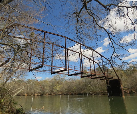
Jones Bridge Hike | |||||||
| The Basics: | |||||||
| Event Type: | Hike | ||||||
| Event Location: |
Johns Creek, GA


| ||||||
| Date(s) & Time: | Sat, Apr 2 2016 10:00 am >> Sat, Apr 2 2016 12:00 pm | ||||||
| Registration Opens: | Wed, Mar 30 2016 9:00 am | ||||||
| Registration Cut Off: | Sat, Apr 2 2016 8:30 am | ||||||
| Event Duration: | 2 Hours | ||||||
| Difficulty Rating: | D2: Easy to Moderate | ||||||
| Distance: | 5.5 Miles | ||||||
| Pace: | Fast | ||||||
| Trip Leader(s): | Tatiana Email Trip Leader(s) Email Trip Leader(s)
You must be logged in to get the Trip Leader contact information. | ||||||
| Member Cost: | None | ||||||
| Participant Info: | |||||||
| Who's Invited: | Members Only, 21 And Older Only | ||||||
| Maximum Group Size: | 8 | ||||||
| Minimum Group Size: | 3 | ||||||
| Number Registered So Far: | 9 / 0 (To see who's signed up, log in to the Member Area) | ||||||
| Are Dogs Permitted: | No | ||||||
| Itinerary: | |||||||
We will move at a moderately fast pace over 3 ml/hr to cover over at least 5.5 miles with stops in few intersections. We will start our hike promptly at 10 am. with the "Grand Finale" loop, and come back to the parking lot 10-12 minuts later. If you are running late, this is your chance to meet the group. We walk along the river towards the pond, and come back through the woods. ***Don't leave any valuables in your vehicles for there have been cases of vandalism.
| |||||||
| |||||||
| How to Get There: | |||||||
| Event Directions: | For your GPS, the address to input is From GA 400, take exit 7a, and head East 4.1 miles through the intersection of Holcomb Bridge and Nesbitt Ferry Road to the junction of Barnwell Road. Turn left on Barnwell Rd, and travel approx 2 miles to Jones Bridge Branch which will be on the right. Turn in and go a little over 1/2 mile to large parking lot at end of road. Directions: http://www.nps.gov/chat/planyourvisit/jonesbridge.htm Trail Map: http://www.nps.gov/chat/planyourvisit/loader.cfm?csModule=security/getfile&PageID=133874 | ||||||
| Notes: | |||||||
|
* We encourage all members to follow our Etiquette Guidelines while participating in AOC events. | |||||||
Cancellation/Partial Attendance: Please review the AOC cancellation policy. | |||||||
 Calendar of Events
 Event Places