
 Print-Friendly Version Print-Friendly Version
|
|
Mason Mill Park: Exciting new PATH Trails + a few Old Favorites! | |||||||
| The Basics: | |||||||
| Event Type: | Hike | ||||||
| Event Location: |
NE Atlanta near Clairmont Rd & I-85


| ||||||
| Date(s) & Time: | Sat, Jan 14 2017 2:30 pm >> Sat, Jan 14 2017 4:30 pm | ||||||
| Registration Opens: | Thu, Jan 12 2017 12:00 pm | ||||||
| Registration Cut Off: | Sat, Jan 14 2017 12:00 pm | ||||||
| Event Duration: | 2 Hours | ||||||
| Difficulty Rating: | D2: Easy to Moderate | ||||||
| Distance: | 5 Miles | ||||||
| Pace: | Moderate | ||||||
| Trip Leader(s): | Charlie Cottingham Email Trip Leader(s) Email Trip Leader(s)
You must be logged in to get the Trip Leader contact information. | ||||||
| Member Cost: | None | ||||||
| Participant Info: | |||||||
| Who's Invited: | Members Only, 21 And Older Only | ||||||
| Maximum Group Size: | 15 | ||||||
| Minimum Group Size: | 2 | ||||||
| Number Registered So Far: | 18 / 0 (To see who's signed up, log in to the Member Area) | ||||||
| Are Dogs Permitted: | Yes | ||||||
| Itinerary: | |||||||
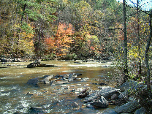
EVENT PLAN: The unusually warm and dry springlike weather is expected to continue at least through the weekend. Hope you can join us for this adventurous 2-hour hike via the network of shady creekside trails that connect Mason Mill Park, Medlock Park and Ira Melton Park here in NE Atlanta near Emory. We'll gather a few minutes before 2:30 PM just inside the Mason Mill Park entrance, in the free parking lot (by the stone restroom building and kids' playground - see detailed Directions below). ABOUT the PARKS, TRAILS and HIKING OPTIONS: The three pretty DeKalb County parks mentioned above are located just east of Clairmont Road near Emory University and the VA Hospital. They conveniently connect with one another via a network of hiking/biking paths and boardwalks. The currently 1-mile-long South Peachtree Creek PATH Trail is the main artery through this shady corridor, and like the better known Silver Comet Trail was designed and built to the high standards of Atlanta's "PATH Foundation." One nice section of this PATH Trail is its half-mile-long raised deck through the forest canopy above Peachtree Creek. Another nearby section traverses the railroad track via a 3-story-high wooden walkway and deck. Hikers here are treated to aerial views of the picturesque restored ruins of the historic early-20th-Century Decatur Waterworks. The highest portion of this deck has proven to be a good dark spot for urban "skygazing" - i.e, viewing the stars & planets, sunsets, moonrises, eclipses, meteor showers, comets, etc. Another nice new feature of the Waterworks area is a new footbridge and large stepping stones which provide convenient access the white-blazed Ira Melton trail network. FOR a COLOR MAP of the SOUTH PEACHTREE CREEK "PATH" TRAIL and how it interconnects Mason Mill & Medlock Park and other DeKalb County-owned green space, click this link: http://pathfoundation.org/wp-content/uploads/2011/11/south-peachtree-creek-trail.pdf | |||||||
| |||||||
| How to Get There: | |||||||
| Event Directions: | FROM the I-85 CLAIRMONT ROAD EXIT in NE METRO ATLANTA to our MASON MILL PARK Meetup Spot: (For a zoomable color MAP and satellite view of this spot and its vicinity click on the square blue & green "Event Location" near the top of this article.) 1. From the I-85 "Clairmont Road" Exit (Exit #91) in NE Atlanta take Clairmont Rd southward (toward Decatur) about 2.3 miles to the traffic light at McConnell Drive. (This is the next light south of the big Clairmont/ North Druid Hills intersection. If you reach the huge VA Hospital you've gone a couple of blocks too far!) LAT/LON COORDINATES of the Mason Mill Park spot where we'll meet: (You GPS or Google.com/maps users may wish to augment my above verbal directions by entering these map coordinates as your destination address.) | ||||||
| Notes: | |||||||
|
* We encourage all members to follow our Etiquette Guidelines while participating in AOC events. | |||||||
| Cost Includes: | Free Event with Free Parking! | ||||||
Cancellation/Partial Attendance: Please review the AOC cancellation policy. | |||||||
 Calendar of Events
 Event Places