 Print-Friendly Version Print-Friendly Version
|
|
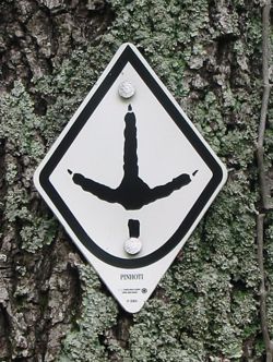
Pinhoti Trail - Snake Creek Gap to Pilchers Pond | |||||||
| The Basics: | |||||||
| Event Type: | Hike | ||||||
| Event Location: | Near Resaca GA in Walker County | ||||||
| Date(s) & Time: | Sun, Aug 8 2010 9:30 am >> N/A (Carpool Departure: 8:00 am *log in for location*) | ||||||
| Registration Opens: | Sun, Aug 1 2010 10:00 pm | ||||||
| Registration Cut Off: | Sat, Aug 7 2010 11:55 pm | ||||||
| Event Duration: | 6 hours, hiking and drive time | ||||||
| Difficulty Rating: | D3: Moderate | ||||||
| Trip Leader(s): | Phil 'Foz' Parkerson Email Trip Leader(s) Email Trip Leader(s)
You must be logged in to get the Trip Leader contact information. | ||||||
| Member Cost: | None | ||||||
| Participant Info: | |||||||
| Who's Invited: | Members Only, 21 And Older Only | ||||||
| Maximum Group Size: | 14 | ||||||
| Minimum Group Size: | 4 | ||||||
| Number Registered So Far: | 13 / 0 (To see who's signed up, log in to the Member Area) | ||||||
| Are Dogs Permitted: | Yes | ||||||
| Itinerary: | |||||||
| NOTE: Sign-up preference will be given to those doing the Kili trip in Sep since they are in training. Thanks!! This is a ten-mile, medium difficulty, in-and-out hike. It is just a little over an hour's drive up 75 from the park and ride. The Pinhoti Trail is a long trail that connects the base of the Appalachians in Alabama with the Benton McKaye Trail in the Cohuttas in Georgia, or at least it will if it is ever all connected up. There are long sections of it complete in Georgia. We will be hiking section 11 of that. We start at Snake Creek Gap and ascend to the ridgeline of Horn Mountain. We walk along the ridgeline for a couple of miles. We will have some good views here. The we gradually descend down the other side of the ridge toward our destination, Pilchers Pond. Pilchers Pond was built in 1991. Once teeming with aquatic life, Georgia's drought took its toll. ith the bass, catfish and brim long gone, the sole recreational opportunities remaining at the site consist of a single picnic table and a trash can lashed to a tree. It is these facilities of which we will avail ourselves at our lunch stop. After lunch, we will return the way we came. A lot of this hike is level ground, and the two ascents we will make are gradual but it is an excellent trail to build endurance. | |||||||
| |||||||
| How to Get There: | |||||||
| Event Directions: | Get on I75-North. Go 49 miles to exit 320. Make pit stop at Flying J truck stop on the right. Go left on GA 136 out of truck stop. Go about eight miles to Pinhoti parking lot on the right. | ||||||
| Carpool to Event Distance (round trip): | 116Mile(s) | ||||||
| Carpool Departure Time: | 8:00 am | ||||||
| Carpool Location: | Log in for location | ||||||
| Carpool Directions: | Log in for directions | ||||||
| Carpool Cost: | Estimated cost per vehicle for this event is $46.40 using a reimbursement rate guideline of $0.400 per mile. The total amount should be divided by the number of people in the vehicle, including the driver. This is a guideline, not a rule, for drivers but the cost should not be higher unless there are extenuating circumstances. | ||||||
| Notes: | |||||||
|
* We encourage all members to follow our Etiquette Guidelines while participating in AOC events. | |||||||
| Cost Includes: | The cost is your sweat! | ||||||
Cancellation/Partial Attendance: Please review the AOC cancellation policy. | |||||||
 Calendar of Events
 Event Places