

 Print-Friendly Version Print-Friendly Version
|
Chatt NRA North to South: Part 2 - Orrs Ferry & Settles Bridge | |||||||
| The Basics: | |||||||
| Event Type: | Hike | ||||||
| Event Location: | Suwanee, GA | ||||||
| Date(s) & Time: | Sun, Apr 12 2009 12:30 pm >> N/A (Carpool Departure: 12:00 pm *log in for location*) | ||||||
| Registration Opens: | Tue, Apr 7 2009 8:00 pm | ||||||
| Registration Cut Off: | Sun, Apr 12 2009 10:00 am | ||||||
| Event Duration: | approx 3 1/2 to 4 hrs | ||||||
| Difficulty Rating: | D3: Moderate | ||||||
| Trip Leader(s): | Tony C Denise Van Huss  Email Trip Leader(s) Email Trip Leader(s)
You must be logged in to get the Trip Leader contact information. | ||||||
| Member Cost: | None | ||||||
| Participant Info: | |||||||
| Who's Invited: | Members Only, 21 And Older Only | ||||||
| Maximum Group Size: | 12 | ||||||
| Minimum Group Size: | 4 | ||||||
| Number Registered So Far: | 12 / 0 (To see who's signed up, log in to the Member Area) | ||||||
| Are Dogs Permitted: | No | ||||||
| Itinerary: | |||||||
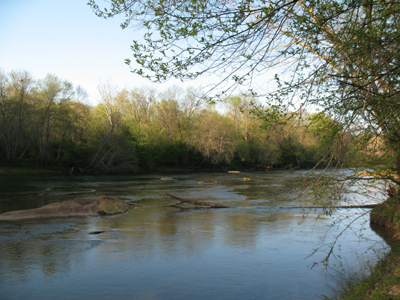
This series of hikes is designed to celebrate the beautiful collection of parks that we have in "our own backyard”, the Chattahoochee National Recreation Area. Administered by the National Park Service, the Chatt NRA offers miles of scenic trails, picturesque river views, and sightings of aquatic wildlife. While the AOC frequently offers hikes at many of these parks, I thought it would be fun to hike all the branches, starting from the most northern (Bowmans Island) to the most southern (East and West Palisades). For details on the other hikes in the series, visit the AOC forums... Part 2: Orrs Ferry & Settles BridgeJoin us for a hike at two of the lesser known units of the Chattahoochee Recreation Area. While there are no official developed trails here, there are many well-defined fisherman "use" trails that we will mainly be following. There is a little off-trail hiking...but on this terrain it would hardly be called proper bushwhacking. There are a number of areas where a side creek runs into the Chattahoochee, so we will need to hike/climb down these short steep creek banks and up the other side to continue on. These sections of the hike are mainly why it is rated D3 and not D2. This is not especially difficult, but you do need to have reasonably strong legs. You may want to wear some clothes and shoes that you don't mind getting a little dirty, just in case. But those creek areas add a bit of adventure to this hike and are rather fun, if slightly challenging. Total hiking time should be about 3.5 to 4 hrs...total distance about 7 miles. We will be moving at a pretty good pace on the flat areas which is 95% of the hike, but again this is a light D3 with little elevation gain. This area of the river is very pretty and there should be a variety of wildlife to view, etc. | |||||||
| |||||||
| How to Get There: | |||||||
| Event Directions: | Traveling north on I-85, take exit 111 and turn left (NW) onto Lawrenceville Suwanee Road. Proceed 6.1 miles (at some point the name of the road will change to Suwanee Dam Road) Turn left on Johnson Road and proceed 1.1 miles. Turn right onto Settles Bridge Road and straight onto the road that takes you to the parking/trailhead (you will see the sign). While this last mile is on a gravel road, it is well graded and fine for all vehicles. (Note: there is also a "Settles Bridge Road" on your left not long after you cross Ptree Industrial. This is not where you want to turn, so don't get confused there). | ||||||
| Carpool to Event Distance (round trip): | 38Mile(s) | ||||||
| Carpool Departure Time: | 12:00 pm | ||||||
| Carpool Location: | Log in for location | ||||||
| Carpool Directions: | Log in for directions | ||||||
| Carpool Cost: | Estimated cost per vehicle for this event is $15.20 using a reimbursement rate guideline of $0.400 per mile. The total amount should be divided by the number of people in the vehicle, including the driver. This is a guideline, not a rule, for drivers but the cost should not be higher unless there are extenuating circumstances. | ||||||
| Notes: | |||||||
|
There is no parking fee at this unit of the Chatt NRA. And if rain is forecast, the hike will be rescheduled for a later date. * We encourage all members to follow our Etiquette Guidelines while participating in AOC events. | |||||||
Cancellation/Partial Attendance: Please review the AOC cancellation policy. | |||||||