 Print-Friendly Version Print-Friendly Version
|
|
Smoky Mountains: Kephart Prong to Charles Bunion & Mount Le Conte | |||||||
| The Basics: | |||||||
| Event Type: | Hike | ||||||
| Event Location: |
Smoky Mountains near Bryson City, NC


| ||||||
| Date(s) & Time: | Sat, May 12 2018 6:00 am >> Sat, May 12 2018 9:00 pm (Carpool Departure: 6:00 am *log in for location*) | ||||||
| Registration Opens: | Fri, Apr 20 2018 6:00 pm | ||||||
| Registration Cut Off: | Tue, May 8 2018 6:11 pm | ||||||
| Event Duration: | 15 Hours | ||||||
| Difficulty Rating: | D6: Advanced | ||||||
| Distance: | 26 Miles | ||||||
| Pace: | Fast | ||||||
| Trip Leader(s): | Stefan Email Trip Leader(s) Email Trip Leader(s)
You must be logged in to get the Trip Leader contact information. | ||||||
| Member Cost: | None | ||||||
| Participant Info: | |||||||
| Who's Invited: | Members Only, 21 And Older Only | ||||||
| Maximum Group Size: | 8 | ||||||
| Minimum Group Size: | 4 | ||||||
| Number Registered So Far: | 6 / 0 (To see who's signed up, log in to the Member Area) | ||||||
| Are Dogs Permitted: | No | ||||||
| Itinerary: | |||||||
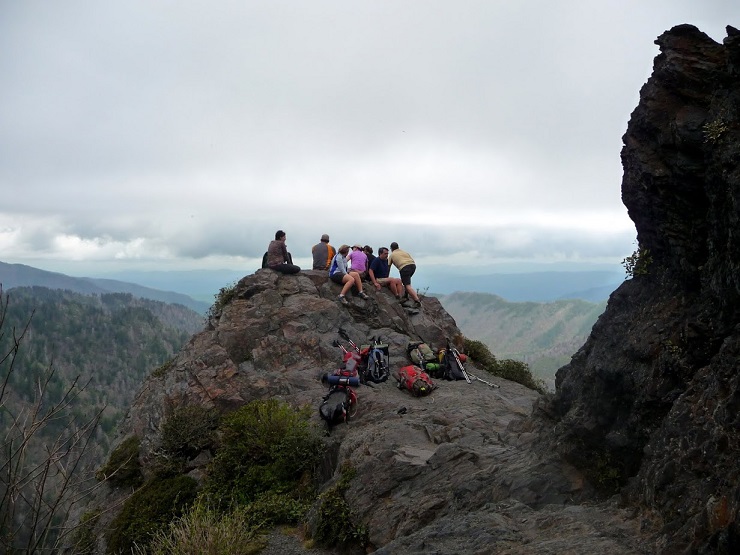
Want to escape the summer heat in Atlanta? We had so much fun on this one last year, we are going back to the Smoky Mountains and enjoy some cooler temperatures and spectacular views as we day-hike from Kephart Prong Trailhead to Charles Bunion (about 6 miles), then hop on the AT to the Boulevard Trail which takes us to Mount Le Conte (7 miles). After a short break, we return to the AT via the Boulvard Trail, head south on the AT til we hit the Sweat Heifer trail which takes us back down to the trailhead (11 miles)... Oh! Did I mention that in the process, we gain over 6000 ft of elevation? Should be great fun hike but prior D6 experience is required. The trip leader reserves the right to remove folks from the sign-up list. Also keep in mind that this hike requires a long drive (hence the early carpool departure). Even by moving at an average speed of 3 miles per hour, the hike will likely wrap up late in the afternoon and result in a late return. Acknowledgement: thanks to John LaBelle for copy/pasting his past trip and suggesting routes.
| |||||||
| |||||||
| How to Get There: | |||||||
| Event Directions: | From Indian Trail, take I-85 North to I-985 North. I-985 North eventually becomes Lanier Pkwy, which becomes US-23, which becomes to US-441.
| ||||||
| Carpool to Event Distance (round trip): | 333Mile(s) | ||||||
| Carpool Departure Time: | 6:00 am | ||||||
| Carpool Location: | Log in for location | ||||||
| Carpool Directions: | Log in for directions | ||||||
| Carpool Cost: | Estimated cost per vehicle for this event is $133.20 using a reimbursement rate guideline of $0.400 per mile. The total amount should be divided by the number of people in the vehicle, including the driver. This is a guideline, not a rule, for drivers but the cost should not be higher unless there are extenuating circumstances. | ||||||
| Notes: | |||||||
|
No dogs allowed for this event. * We encourage all members to follow our Etiquette Guidelines while participating in AOC events. | |||||||
Cancellation/Partial Attendance: Please review the AOC cancellation policy. | |||||||
 Calendar of Events
 Event Places