 Print-Friendly Version Print-Friendly Version
|
|
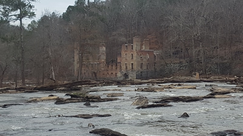
Sweetwater Creek Trails & Mill Ruins | ||||||||||||||
| The Basics: | ||||||||||||||
| Event Type: | Hike | |||||||||||||
| Event Location: |
Sweetwater Creek State Park


| |||||||||||||
| Date(s) & Time: | Tue, Jul 24 2018 10:00 am >> Tue, Jul 24 2018 12:15 pm | |||||||||||||
| Registration Opens: | Thu, Jul 19 2018 3:00 pm | |||||||||||||
| Registration Cut Off: | Tue, Jul 24 2018 8:00 am | |||||||||||||
| Event Duration: | 2 Hours 15 Minutes | |||||||||||||
| Difficulty Rating: | D2: Easy to Moderate | |||||||||||||
| Distance: | 5.5 Miles | |||||||||||||
| Pace: | Moderate | |||||||||||||
| Trip Leader(s): | Holt Ward Email Trip Leader(s) Email Trip Leader(s)
You must be logged in to get the Trip Leader contact information. | |||||||||||||
| Member Cost: | None | |||||||||||||
| Participant Info: | ||||||||||||||
| Who's Invited: | Members Only, 21 And Older Only | |||||||||||||
| Maximum Group Size: | 14 | |||||||||||||
| Minimum Group Size: | 2 | |||||||||||||
| Number Registered So Far: | 13 / 0 (To see who's signed up, log in to the Member Area) | |||||||||||||
| Are Dogs Permitted: | Yes | |||||||||||||
| Itinerary: | ||||||||||||||
| ||||||||||||||
| ||||||||||||||
| How to Get There: | ||||||||||||||
| Event Directions: | Coordinates for Parking Lot are 33.753299, -84.628643 | |||||||||||||
| Notes: | ||||||||||||||
|
* We encourage all members to follow our Etiquette Guidelines while participating in AOC events. | ||||||||||||||
Cancellation/Partial Attendance: Please review the AOC cancellation policy. | ||||||||||||||
 Calendar of Events
 Event Places