 Print-Friendly Version Print-Friendly Version
|
|
All Trails Lead to Blood Mountain | |||||||
| The Basics: | |||||||
| Event Type: | Hike | ||||||
| Event Location: |
Suches, GA


| ||||||
| Date(s) & Time: | Sat, Aug 18 2018 7:00 am >> Sat, Aug 18 2018 4:30 pm (Carpool Departure: 7:00 am *log in for location*) | ||||||
| Registration Opens: | Mon, Jul 30 2018 8:00 pm | ||||||
| Registration Cut Off: | Fri, Aug 17 2018 10:00 am | ||||||
| Event Duration: | 9 Hours 30 Minutes | ||||||
| Difficulty Rating: | D5: Difficult | ||||||
| Distance: | 12.3 Miles | ||||||
| Pace: | Moderate | ||||||
| Trip Leader(s): | Chuck R Email Trip Leader(s) Email Trip Leader(s)
You must be logged in to get the Trip Leader contact information. | ||||||
| Member Cost: | None | ||||||
| Participant Info: | |||||||
| Who's Invited: | Members Only, 21 And Older Only | ||||||
| Maximum Group Size: | 12 | ||||||
| Minimum Group Size: | 2 | ||||||
| Number Registered So Far: | 5 / 0 (To see who's signed up, log in to the Member Area) | ||||||
| Are Dogs Permitted: | No | ||||||
| Itinerary: | |||||||
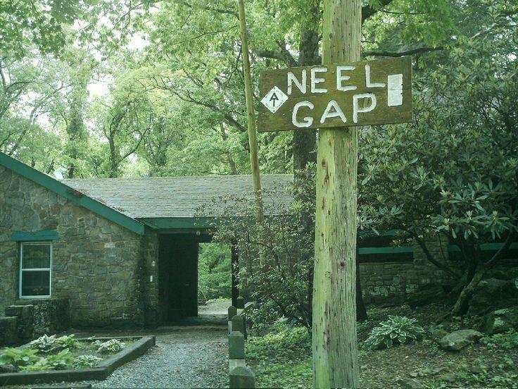
Come take a hike with us through a multitude of trails that will make good use of a compass! Our journey starts at Lake Winfield Scott, we will proceed to Slaughter Creek Trail until we reach the Jarrard Gap Trail (.75 mile). We wll intersect with the Appalachian Trail at 1.25 miles and take us to Bird Gap (1.5 mile), which will junction with the Freeman Trail. We then connect with the Appalachian Trail again at 1.9 miles and proceed towards Neels Gap for 1.0 mile. This will take us to the Mountain crossing store for lunch. For those that need a restroom break, there are outside bathrooms. After lunch we will backtrack from Neels gap to the summit of Blood Mountain (2.4 mile) and enjoy some spectacular views. We will then hop back on the A/T and head for Slaughter Creek Trail for 3.5 miles with a gentle descend returning to our cars. This is a long difficult D5 hike . If you have not recently completed a few D5 or D6 Hikes with the AOC, the Trip leader will likely contact you to determine your abilities for this hike.For the safety of the group, the trip later reserves the right to remove anyone they feel cannot complete this hike. Please no audible music or tree climbing! | |||||||
| |||||||
| How to Get There: | |||||||
| Event Directions: | North on GA 400. Take a left onto SR 60/19 toward Dahlonega. At the fork of SR 60 and SR 19, go straight on SR 60 to Suches. Take a right on SR 180. The entrance to the Lake Winfield Scott Recreation Area is on the right, approximately 7-8 miles on after you turn onto SR 180. As you drive toward the lake, past the first campground, the parking lot is located on the left, just before you get to the bridge. The trailhead is located across the bridge and to your right. | ||||||
| Carpool to Event Distance (round trip): | 130Mile(s) | ||||||
| Carpool Departure Time: | 7:00 am | ||||||
| Carpool Location: | Log in for location | ||||||
| Carpool Directions: | Log in for directions | ||||||
| Carpool Cost: | Estimated cost per vehicle for this event is $52.00 using a reimbursement rate guideline of $0.400 per mile. The total amount should be divided by the number of people in the vehicle, including the driver. This is a guideline, not a rule, for drivers but the cost should not be higher unless there are extenuating circumstances. | ||||||
| Notes: | |||||||
|
$5 day use fee per vehical at Lake Winfield Will hike in rain if weather permits. Let nature be the sounds. * We encourage all members to follow our Etiquette Guidelines while participating in AOC events. | |||||||
Cancellation/Partial Attendance: Please review the AOC cancellation policy. | |||||||
 Calendar of Events
 Event Places