 Print-Friendly Version Print-Friendly Version
|
|
Part I of a Series: Beginner’s Backpacking – James Edmonds Backcountry Trail | |||||||
| The Basics: | |||||||
| Event Type: | Backpacking | ||||||
| Event Location: | Black Rock Mountain State Park | ||||||
| Date(s) & Time: | Sat, May 1 2004 9:00 am >> N/A | ||||||
| Registration Opens: | Mon, Jan 1 2007 12:00 am | ||||||
| Registration Cut Off: | Fri, Apr 23 2004 11:59 pm | ||||||
| Event Duration: | per itinerary | ||||||
| Difficulty Rating: | D1: Easy | ||||||
| Trip Leader(s): | Michael Aubertine Email Trip Leader(s) Email Trip Leader(s)
You must be logged in to get the Trip Leader contact information. | ||||||
| Member Cost: | None | ||||||
| Participant Info: | |||||||
| Who's Invited: | Members Only, 21 And Older Only | ||||||
| Maximum Group Size: | 10 | ||||||
| Minimum Group Size: | 5 | ||||||
| Number Registered So Far: | 8 / 0 (To see who's signed up, log in to the Member Area) | ||||||
| Are Dogs Permitted: | No | ||||||
| Itinerary: | |||||||
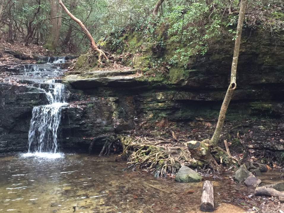
| Easy Strenuous ***NOTE: There will be a mandatory packing meeting on Thursday, April 29, 2004 to ensure that everyone has the proper gear and to divvy up the community gear*** The highest park in the state, Black Rock combines extensive hiking trails, mountains, plentiful flora and fauna and impressive views to make it one of the best state parks for the outdoors minded not only in the state but in the nation. The trail begins with an easy descent along Black Rock Mountain. At 0.7 miles, the trail reaches the beginning and end of the loop, marked by a double blaze. The sign advises you to take the counterclockwise route to the right. The trail follows an old road uphill until mile 1.1, where it takes a sharp left off of the road. The trail then descends to a paved road at mile 1.4. The trail is identified by orange paint on the road as well as a sign on the other side. After crossing the pavement, the trail descends further to Taylor Creek at mile 2.1. From here the trail begins ascending to a gravel road near Taylor Gap at mile 2.4. The trail then continues uphill for another 0.5 mile to the top of Scruggs Knob. The trail then descends down the other side of the knob to mile 3.2 where it turns left onto an old road. This is Scruggs Gap. The trail follows this road for 0.2 miles and then comes to a sign, marking the trails turn downhill to another road. Be careful not to miss this turn. The trail then turns right and continues downward on Lookoff Mountain. At mile 5.2 the trail crosses the old road again. At mile 5.4 it crosses Taylor Creek again. At Taylor Creek, the trail then goes uphill to the end of the loop at mile 6.5. This section is steep. Its not a bad idea to fill up your water at Taylor Creek. | |||||||
| |||||||
| How to Get There: | |||||||
| Event Directions: | Mountain City, GA Meet at the park office at 12 From Atlanta, take I-985 to Toccoa, then continue north on US 23 to Mountain City. From Mountain City, take Black Rock Mountain Road west off US 23 for 3 miles to dead end at the state park. | ||||||
| Notes: | |||||||
|
Are Dogs Permitted? No Will this event occur rain or shine? Yes * We encourage all members to follow our Etiquette Guidelines while participating in AOC events. | |||||||
| Cost Includes: | $15 per person covers your dinner Saturday and breakfast Sunday Payment required within 10 days of sign up. Refunds minus Paypal fees allowed before 4/23/04. No refunds after 4/23/04. Bring cash for: $3 per person for the camping fee $3 per car for parking fee | ||||||
Cancellation/Partial Attendance: Please review the AOC cancellation policy. | |||||||
 Calendar of Events
 Event Places