 Print-Friendly Version Print-Friendly Version
|
|
Chestatee WMA: Crow Mountain Creek and Dicks Creek Gap Trails with Two Waterfalls | |||||||
| The Basics: | |||||||
| Event Type: | Hike | ||||||
| Event Location: |
Crow Mountain Creek Trailhead in Chestatee WMA (north of Dahlonega)


| ||||||
| Date(s) & Time: | Sun, Oct 7 2018 8:30 am >> Sun, Oct 7 2018 3:30 pm (Carpool Departure: 7:00 am *log in for location*) | ||||||
| Registration Opens: | Wed, Oct 3 2018 7:00 pm | ||||||
| Registration Cut Off: | Sat, Oct 6 2018 9:00 pm | ||||||
| Event Duration: | 7 Hours | ||||||
| Difficulty Rating: | D4: Moderate to Difficult | ||||||
| Distance: | 9.5 Miles | ||||||
| Pace: | Moderate | ||||||
| Trip Leader(s): | Russ Email Trip Leader(s) Email Trip Leader(s)
You must be logged in to get the Trip Leader contact information. | ||||||
| Member Cost: | None | ||||||
| Participant Info: | |||||||
| Who's Invited: | Members Only, 21 And Older Only | ||||||
| Maximum Group Size: | 12 | ||||||
| Minimum Group Size: | 4 | ||||||
| Number Registered So Far: | 10 / 0 (To see who's signed up, log in to the Member Area) | ||||||
| Are Dogs Permitted: | Yes | ||||||
| Itinerary: | |||||||
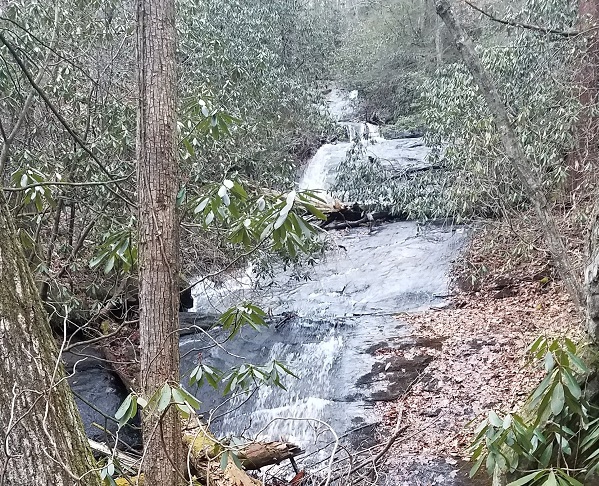
We will start the hike 8:30 at the Crow Mountain Creek trailhead and hike up to Crow Mountain Falls. From there we continue on and the trail becomes a closed forest service road and we will cross Crow Mountain creek (which may or may not be a wet foot ford). We will pass by a couple of wildlife clearings and on the way and visit the old homestead ruins at Chestnut Flats. From here we have a wet foot ford of Blood Mountain Creek and we will follow the road to the Dicks Creek Gap Trailhead. We will follow the Dicks Creek Gap trail up to the Appalachian trail at Jarrard Gap (the highest point in the hike and the half-way point). From here we turn around and follow Dicks Creek Gap trail back to the trailhead. The plan is to then follow the forest service road back to the cars (this portion will be open to cars, but is lightly travelled). On the way we will be hiking by Dicks Creek. Along the way we will take a quick side trail to see the cascades of lower Blood Mountain Creek Falls (just above where Blood Mountain Creek runs into Dick Creek). Just a few feet before we return to the cars we will have our last wet foot crossing (of Crow Mountain Creek). Here is a link to the route we took: | |||||||
| |||||||
| How to Get There: | |||||||
| Event Directions: | Note that the last mile of the drive is on dirt road. Trailhead GPS coordinate is 34.6869, -83.9436 Directions from Dahlonega, GA: Follow US Route 19/9 North of Dahlonega. At the intersection with GA Route 60, bear right to continue on US Route 19/9 for another 4.8 miles. Then, turn left onto Dicks Creek Road and follow it for 3.6 miles, passing the roadside Waters Creek Falls at Mile 2.8, after which the road turns unpaved but still well- maintained. The trailhead parking area is on the left just before an unbridged but shallow crossing of Crow Mountain Creek. Bing map directions using this link --> here | ||||||
| Carpool to Event Distance (round trip): | 110Mile(s) | ||||||
| Carpool Departure Time: | 7:00 am | ||||||
| Carpool Location: | Log in for location | ||||||
| Carpool Directions: | Log in for directions | ||||||
| Carpool Cost: | Estimated cost per vehicle for this event is $44.00 using a reimbursement rate guideline of $0.400 per mile. The total amount should be divided by the number of people in the vehicle, including the driver. This is a guideline, not a rule, for drivers but the cost should not be higher unless there are extenuating circumstances. | ||||||
| Notes: | |||||||
|
* We encourage all members to follow our Etiquette Guidelines while participating in AOC events. | |||||||
Cancellation/Partial Attendance: Please review the AOC cancellation policy. | |||||||
 Calendar of Events
 Event Places