 Print-Friendly Version Print-Friendly Version
|
|
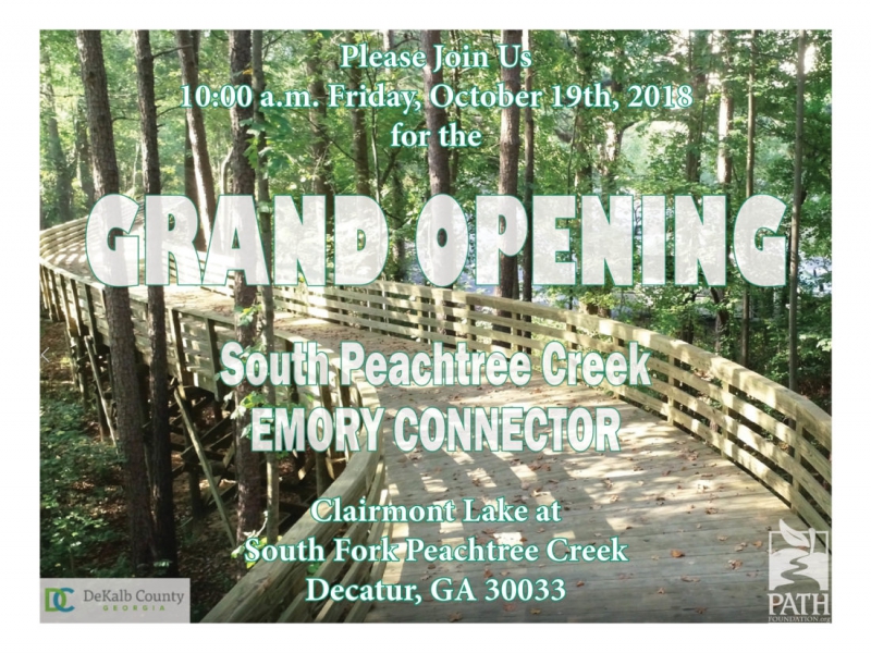
Mason Mill Park to Emory Hike celebrating Grand Opening of new PATH Connector Trail & Boardwalk | |||||||
| The Basics: | |||||||
| Event Type: | Hike | ||||||
| Event Location: |
NE Atlanta near Clairmont Rd & I-85


| ||||||
| Date(s) & Time: | Fri, Oct 19 2018 9:30 am >> Fri, Oct 19 2018 12:00 pm | ||||||
| Registration Opens: | Sun, Oct 14 2018 12:00 pm | ||||||
| Registration Cut Off: | Fri, Oct 19 2018 8:00 am | ||||||
| Event Duration: | 2 Hours 30 Minutes | ||||||
| Difficulty Rating: | D2: Easy to Moderate | ||||||
| Distance: | 5 Miles | ||||||
| Pace: | Moderate | ||||||
| Trip Leader(s): | Charlie Cottingham Lyndsay  Email Trip Leader(s) Email Trip Leader(s)
You must be logged in to get the Trip Leader contact information. | ||||||
| Member Cost: | None | ||||||
| Participant Info: | |||||||
| Who's Invited: | Members Only, 21 And Older Only | ||||||
| Maximum Group Size: | 16 | ||||||
| Minimum Group Size: | 2 | ||||||
| Number Registered So Far: | 6 / 0 (To see who's signed up, log in to the Member Area) | ||||||
| Are Dogs Permitted: | Yes | ||||||
| Itinerary: | |||||||
EVENT PLAN: Nice crisp fall hiking weather is expected this Friday morning, with mostly sunny skies and warming quickly from the high 50s into the 60s. Hope you can join us for this adventurous and scenic, but relatively easy hike that will include a much awaited celebration: the Grand Opening of the PATH Foundation's new high boardwalk connector and its paved trail extensions that will allow hikers and cyclists to traverse safely and easily between Mason Mill Park and Emory University's Lullwater Park. A couple of our recent AOC Mason Mill hikes have already "unofficially" included the gorgeous new boardwalk as it neared completion, and we're delighted that it now will be formally opened to the general public. MORE ABOUT the PARKS, TRAILS and HIKING OPTIONS: The network of shady trails at Emory University have always been just a stone's throw away from the numerous gorgeous trails on the other side of Clairmont Road at Mason Mill Park, Medlock Park and Ira Melton Park. Now with the opening of the PATH connector they all safely and conveniently interconnect. South Peachtree Creek and Burnt Fork Creek are the main "natural aquatic arteries" through this multi-park corridor. Branching from the PATH trails that generally parallel the creeks are several additional miles of ruggedly scenic narrow trails, many which likewise are along or near the creeks and their sinuous tributaries. An impressive section of the main Mason Mill PATH Trail traverses the railroad track via a 3-story-wooden deck and walkway. Here visitors are treated to aerial views of the restored ruins of the historic early-20th-Century Decatur Waterworks. The highest portion of the deck has proven to be a good dark spot for urban "skygazing" - i.e, viewing the stars & planets, sunsets, moonrises, eclipses, meteor showers, etc. Also in the Waterworks area is a set of large flat stepping stones across the creek, which at normal water levels allow hikers to access Ira Melton Park's white-blazed loop trail. In 2017 a ~1-mile-long high PATH boardwalk extension was opened between Mason Mill Park's "DeKalb Tennis Center" and North Druid Hills Road which proved to be an "instant AOC favorite," as no doubt will be the new Emory Connector boardwalk. FOR a COLOR MAP of the SOUTH PEACHTREE CREEK "PATH" TRAIL and how it interconnects Mason Mill & Medlock Park and other DeKalb County green space, click this link: https://pathfoundation.org/trails/south-peachtree-creek-trail/ CLICK THESE LINKS for recent "EMORY CONNECTOR" PHOTOS and articles about how the new PATH-style trails are making the Emory area much more accessible and safe for pedestrians and cyclists: http://news.emory.edu/stories/2017/08/er_path_extension/campus.html | |||||||
| |||||||
| How to Get There: | |||||||
| Event Directions: | FROM the I-85 CLAIRMONT ROAD EXIT in NE METRO ATLANTA to our MASON MILL PARK Meetup Spot: (For a zoomable color MAP and satellite view of this spot and its vicinity click the square blue & green "Event Location" icon near the top of this article.) 1. From the I-85 "Clairmont Road" Exit (Exit #91) in NE Atlanta take Clairmont Rd southward (toward Decatur) about 2.3 miles to the traffic light at McConnell Drive. (This is the next light south of the big Clairmont/ North Druid Hills intersection. If you reach the huge VA Hospital you've gone a couple of blocks too far!) GPS & Maps.Google.com USERS: Feel free to augment my above verbal directions by entering as your Destination Address these concise Lat/Lon coordinates for our meetup spot, being sure to include the comma & minus sign: 33.8080, -84.3066 | ||||||
| Notes: | |||||||
|
* We encourage all members to follow our Etiquette Guidelines while participating in AOC events. | |||||||
| Cost Includes: | Free Event with Free Parking! | ||||||
Cancellation/Partial Attendance: Please review the AOC cancellation policy. | |||||||
 Calendar of Events
 Event Places