 Print-Friendly Version Print-Friendly Version
|
Panthertown Valley | |||||||
| The Basics: | |||||||
| Event Type: | Backpacking | ||||||
| Event Location: | Panthertown Valley | ||||||
| Date(s) & Time: | Sat, Jul 18 2009 10:30 am >> N/A (Carpool Departure: 8:00 am *log in for location*) | ||||||
| Registration Opens: | Mon, Jun 29 2009 8:00 am | ||||||
| Registration Cut Off: | Mon, Jul 13 2009 8:00 am | ||||||
| Event Duration: | 2 days | ||||||
| Difficulty Rating: | D4: Moderate to Difficult | ||||||
| Trip Leader(s): | Ann Ralph Howard Lynn  Email Trip Leader(s) Email Trip Leader(s)
You must be logged in to get the Trip Leader contact information. | ||||||
| Member Cost: | None | ||||||
| Participant Info: | |||||||
| Who's Invited: | Members Only, 21 And Older Only | ||||||
| Maximum Group Size: | 8 | ||||||
| Minimum Group Size: | 3 | ||||||
| Number Registered So Far: | 8 / 0 (To see who's signed up, log in to the Member Area) | ||||||
| Are Dogs Permitted: | No | ||||||
| Itinerary: | |||||||
|
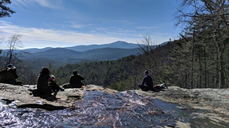
I've borrowed this description from Bruce Aldridge..Panthertown Valley, a/k/a Yosemite of the East, is a beautiful area with plenty of waterfalls. In addition, there are hundreds of species of trees, shrubs, vines, wildflowers, mosses, lichens and the largest mushrooms I’ve ever seen. Panthers no longer roam the valley, but you may see deer, fox, raccoon, skunk, barred owl, grouse and snakes. The streams are full of brook trout. And the views from the top of the cliffs are absolutely spectacular! Be prepared to backpack about 1.5 miles to our campsite near Tuckasegee river just past the Sandbar Pool, which is a very nice flat campsite. | |||||||
| |||||||
| How to Get There: | |||||||
| Event Directions: | North on I-85 to exit 1 in SC, then north on Hwy 11 about 20 miles to Walhalla. Then north on Hwy 28 to Hwy 17 north to Cashiers. At the stoplight in Cashiers, take US 64 east for 2 miles to Cedar Creek Road (SR 1120) and take a left. Proceed on Cedar Creek Road for 2.3 miles to Breedlove Road (SR 1121) and turn right. Proceed onto Breedlove Road for 3.5 miles to the Forest Service gate and the Salt Rock Gap trailhead. | ||||||
| Carpool to Event Distance (round trip): | 240Mile(s) | ||||||
| Carpool Departure Time: | 8:00 am | ||||||
| Carpool Location: | Log in for location | ||||||
| Carpool Directions: | Log in for directions | ||||||
| Carpool Cost: | Estimated cost per vehicle for this event is $96.00 using a reimbursement rate guideline of $0.400 per mile. The total amount should be divided by the number of people in the vehicle, including the driver. This is a guideline, not a rule, for drivers but the cost should not be higher unless there are extenuating circumstances. | ||||||
| Notes: | |||||||
|
* We encourage all members to follow our Etiquette Guidelines while participating in AOC events. | |||||||
Cancellation/Partial Attendance: Please review the AOC cancellation policy. | |||||||
 Calendar of Events
 Event Places