 Print-Friendly Version Print-Friendly Version
|
|
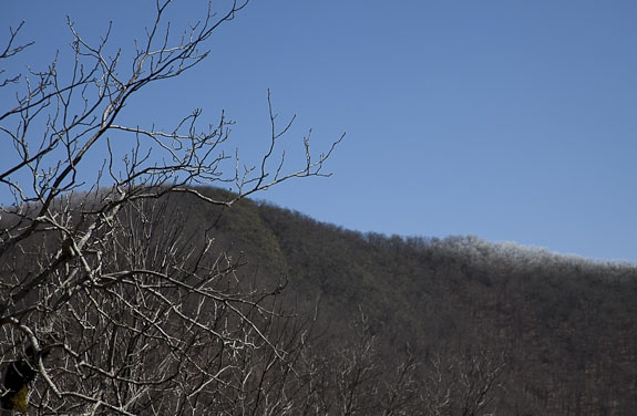
Tray Mountain from Andrews Cove | |||||||
| The Basics: | |||||||
| Event Type: | Hike | ||||||
| Event Location: | Near Helen, GA | ||||||
| Date(s) & Time: | Sun, Jan 27 2019 8:30 am >> Sun, Jan 27 2019 5:30 pm (Carpool Departure: 8:30 am *log in for location*) | ||||||
| Registration Opens: | Wed, Jan 23 2019 9:00 pm | ||||||
| Registration Cut Off: | Sat, Jan 26 2019 8:00 pm | ||||||
| Event Duration: | 9 Hours | ||||||
| Difficulty Rating: | D4: Moderate to Difficult | ||||||
| Distance: | 11 Miles | ||||||
| Pace: | Moderate | ||||||
| Trip Leader(s): | Kristi Email Trip Leader(s) Email Trip Leader(s)
You must be logged in to get the Trip Leader contact information. | ||||||
| Member Cost: | None | ||||||
| Participant Info: | |||||||
| Who's Invited: | Members Only, 21 And Older Only | ||||||
| Maximum Group Size: | 8 | ||||||
| Minimum Group Size: | 3 | ||||||
| Number Registered So Far: | 8 / 0 (To see who's signed up, log in to the Member Area) | ||||||
| Are Dogs Permitted: | No | ||||||
| Itinerary: | |||||||
Description: An in-and-out hike of about 10 miles or more. From Andrew’s Cove campground, we hike uphill along a stream for about 1 hour to Indian Grave Gap and from there continue uphill on the A.T. for another 1.5 hours to the "secret" overlook about 3/4 m beyond the summit of Tray Mountain. If we hike to the shelter, we missed the turn off trail. We will hike about 5 miles one way and gain 2400 ft of elevation. Parking: In recent years, we have been able to park in an area next to the campgroud. If there is a closed gate, we will park outside the campground on the side of the road (hopefully keep the total number of cars to two). If you’re coming from Helen, just before the hairpin turn, Andrews Cove is on the right. The campground contact phone number is un-manned due to partial govt shutdown, so I've not been able to verify if the gate is open.
This hike is borderline D5 in difficulty. Not a fitness hike. Enjoying the journey and the forest is my goal, not our end destination. Expect lovely winter mountain views. We'll hike at a moderate pace, and stop to take photos when inspired and regather at junctions, e.g., Indian Grave Gap, base of Tray Mtn, top of Tray Mtn. I have borrowed some of this description from Dorothea L. - thank you very much! *Hiking and end times are approximate. | |||||||
| |||||||
| How to Get There: | |||||||
| Event Directions: |
| ||||||
| Carpool to Event Distance (round trip): | 150Mile(s) | ||||||
| Carpool Departure Time: | 8:30 am | ||||||
| Carpool Location: | Log in for location | ||||||
| Carpool Directions: | Log in for directions | ||||||
| Carpool Cost: | Estimated cost per vehicle for this event is $60.00 using a reimbursement rate guideline of $0.400 per mile. The total amount should be divided by the number of people in the vehicle, including the driver. This is a guideline, not a rule, for drivers but the cost should not be higher unless there are extenuating circumstances. | ||||||
| Notes: | |||||||
|
* We encourage all members to follow our Etiquette Guidelines while participating in AOC events. | |||||||
Cancellation/Partial Attendance: Please review the AOC cancellation policy. | |||||||
 Calendar of Events
 Event Places