 Print-Friendly Version Print-Friendly Version
|
|
Big Scaly Mountain Waterfall Loop | |||||||
| The Basics: | |||||||
| Event Type: | Hike | ||||||
| Event Location: |
Big Scaly Mountain, NC


| ||||||
| Date(s) & Time: | Sat, Apr 20 2019 6:30 am >> Sat, Apr 20 2019 5:30 pm (Carpool Departure: 6:30 am *log in for location*) | ||||||
| Registration Opens: | Thu, Mar 14 2019 8:00 pm | ||||||
| Registration Cut Off: | Thu, Apr 18 2019 10:00 am | ||||||
| Event Duration: | 11 Hours | ||||||
| Difficulty Rating: | D5: Difficult | ||||||
| Distance: | 11 Miles | ||||||
| Pace: | Moderate | ||||||
| Trip Leader(s): | Chuck R Email Trip Leader(s) Email Trip Leader(s)
You must be logged in to get the Trip Leader contact information. | ||||||
| Member Cost: | None | ||||||
| Participant Info: | |||||||
| Who's Invited: | Members Only, 21 And Older Only | ||||||
| Maximum Group Size: | 8 | ||||||
| Minimum Group Size: | 2 | ||||||
| Number Registered So Far: | 4 / 0 (To see who's signed up, log in to the Member Area) | ||||||
| Are Dogs Permitted: | No | ||||||
| Itinerary: | |||||||
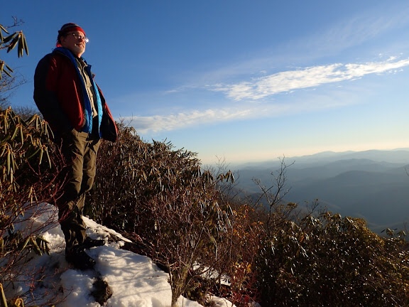
Big Scaly is the mountain just below Standing Indian. This hike is a counterclockwise loop of about 11 miles and has about 2800 feet of Mountain travel. We will start with the climb of Scaly Ridge and then down to Beech Creek for the first of stream crossings. We will follow the rushing stream up Beech Creek to the switchbacks under the cliffs of Big Scaly. Then we will take a quarter mile side trail to view the 200' High Falls and have our lunch break. Returning to the main trail and continuing up, we will eventually reach the high flat valley between Big Scaly Mountain and Standing Indian that leads to Case Knife Gap. At the Gap we will take a left uphill for a one mile round trip to the summit of Big Scaly Mountain at 5,060' and an overlook that affords a great view to the west. Then we will backtrack down to Case Knife Gap and left to continue down the Trail and back to the cars. We will hike together as one group, so you must be physically fit in order to keep up! You will probably get your feet wet in the first half of the hike.It will be promised as a moderate pace throughout the hike. You must have absolutely some recent high D4s & above levels for this event. I will most definitely use my discretion in judging your abilities to hike this event. The leader does reserve the right to remove anyone if warranted | |||||||
| |||||||
| How to Get There: | |||||||
| Event Directions: | Take I-85 N to I-985 N which turns into US 23/441 to Clayton
GA. Then go West on US 76 about eight miles.
Turn right on Persimmon Rd, near the volunteer fire department and sign
for Tallulah River Campgrounds. Continue about 4.2 miles to left at Tallulah
River Rd. This road will turn to gravel after a mile or so and leads thru
gorge to Tate City. Follow to NC state line. Trailhead parking will come up
soon on the left. | ||||||
| Carpool to Event Distance (round trip): | 220Mile(s) | ||||||
| Carpool Departure Time: | 6:30 am | ||||||
| Carpool Location: | Log in for location | ||||||
| Carpool Directions: | Log in for directions | ||||||
| Carpool Cost: | Estimated cost per vehicle for this event is $88.00 using a reimbursement rate guideline of $0.400 per mile. The total amount should be divided by the number of people in the vehicle, including the driver. This is a guideline, not a rule, for drivers but the cost should not be higher unless there are extenuating circumstances. | ||||||
| Notes: | |||||||
|
Will hike in rain if conditions are favorable! * We encourage all members to follow our Etiquette Guidelines while participating in AOC events. | |||||||
Cancellation/Partial Attendance: Please review the AOC cancellation policy. | |||||||
 Calendar of Events
 Event Places