 Print-Friendly Version Print-Friendly Version
|
|
Cumberland Trail (2 of 3) North Chickamauga Creek | |||||||
| The Basics: | |||||||
| Event Type: | Hike | ||||||
| Event Location: |
Chattanooga, TN


| ||||||
| Date(s) & Time: | Sun, Mar 24 2019 7:00 am >> Sun, Mar 24 2019 5:00 pm (Carpool Departure: 7:00 am *log in for location*) | ||||||
| Registration Opens: | Mon, Mar 18 2019 7:30 pm | ||||||
| Registration Cut Off: | Sat, Mar 23 2019 8:30 pm | ||||||
| Event Duration: | 10 Hours | ||||||
| Difficulty Rating: | D5: Difficult (Exploratory) | ||||||
| Distance: | 11 Miles | ||||||
| Pace: | Moderate | ||||||
| Trip Leader(s): | RonnyJ (Call me Ron) Email Trip Leader(s) Email Trip Leader(s)
You must be logged in to get the Trip Leader contact information. | ||||||
| Member Cost: | None | ||||||
| Participant Info: | |||||||
| Who's Invited: | Members Only, 21 And Older Only | ||||||
| Maximum Group Size: | 12 | ||||||
| Minimum Group Size: | 3 | ||||||
| Number Registered So Far: | 11 / 0 (To see who's signed up, log in to the Member Area) | ||||||
| Are Dogs Permitted: | Yes | ||||||
|
Note: This is an "EXPLORATORY" trip. This means that there are parts of this trip, or perhaps the whole trip, that is new to your Trip Leader(s). However, they are confident that this will not be an issue. This note is here so that you can make an informed decision. When a Trip Leader isn't personally familiar with a trip, there is an increased chance of things not going as planned and you need to be prepared. The Trip Leader may have additional details in the itinerary. | |||||||
| Itinerary: | |||||||
CT 2 of 3 North Chickamauga CreekJoin me as I explore the southern Cumberland Trail in a 3 hike series. The Cumberland Trail is an ambitious hiking trail project currently under development. When completed, the CT will extend more than 300 miles from the Cumberland Gap in Kentucky to Signal Point, just outside of Chattanooga. Currently over 200 miles are open with the trail slated for completion in late 2019. Additionally, the CT is part of the Great Eastern Trail, which is under development and will extend from Alabama to New York when completed. Signal Point to North Suck Creek (Done, AWESOME!) North Chickamauga Creek (3/24/19) Possum Creek (sometime soon)
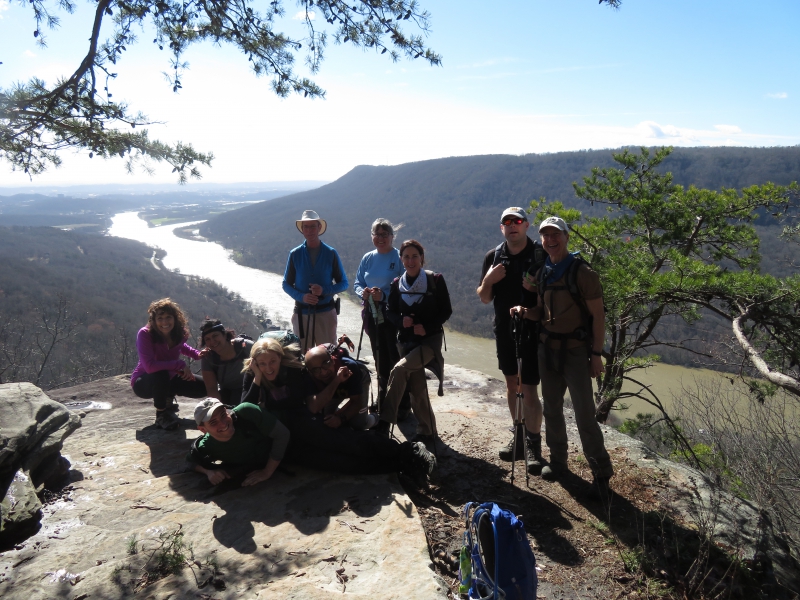
Section 2: North Chickamauga Creek This section is filled with difficult terrain, waterfalls, gorges, rapids, creek crossings and awesome vistas. If you are looking for a hike on an iconic trail with tons of cool stuff to see, this is your hike! We will be stopping at all points of interest for picture taking and high hilarity. This is an out and back hike. If you joined me on Section 1 and want another piece of the trail, or you wish you joined us, sign up for some serious FUN! We will be starting at Montlake Trailhead and head north. We will head to the Boston Branch Overlook followed by a steep descent to the Stenenson Branch Falls. After the falls we will hike along the bottom of the Cooper Creek Gorge where we can see waterfalls, plunge pools and steep cliffs. We ascend out of the gorge and shortly reach the Panther Branch Overlook. Here we will stop for lunch and enjoy the best views of the day. We will retrace our steps to complete our out and back adventure. We will be fording one creek with water levels expected to be knee deep, you should bring water shoes for the crossing or be prepared to hike with wet feet. This is a 11 mile hike with 2600 feet of ascent. Some of the terrain is steep and difficult, the hardest ascent of the hike occurs at the 8 mile point. You must have recent D4/D5 experience, be comfortable with a pace on the fast side of moderate and be prepared for difficult terrain to participate in this event. There are no bathrooms at the trail head. | |||||||
| |||||||
| How to Get There: | |||||||
| Event Directions: | The trailhead is located at 354 Montlake Rd, Soddy- Daisy, TN 37379. Please enter this address into your GPS for turn by turn directions. We will stop in the town of Soddy-Daisy for a bio-break. | ||||||
| Carpool to Event Distance (round trip): | 200Mile(s) | ||||||
| Carpool Departure Time: | 7:00 am | ||||||
| Carpool Location: | Log in for location | ||||||
| Carpool Directions: | Log in for directions | ||||||
| Carpool Cost: | Estimated cost per vehicle for this event is $80.00 using a reimbursement rate guideline of $0.400 per mile. The total amount should be divided by the number of people in the vehicle, including the driver. This is a guideline, not a rule, for drivers but the cost should not be higher unless there are extenuating circumstances. | ||||||
| Notes: | |||||||
|
* We encourage all members to follow our Etiquette Guidelines while participating in AOC events. | |||||||
Cancellation/Partial Attendance: Please review the AOC cancellation policy. | |||||||
 Calendar of Events
 Event Places