 Print-Friendly Version Print-Friendly Version
|
|
Etowah River Water Trail - Hardin Bridge | |||||||
| The Basics: | |||||||
| Event Type: | Water | ||||||
| Event Location: |
Euharlee


| ||||||
| Date(s) & Time: | Sun, May 19 2019 8:30 am >> Sun, May 19 2019 3:00 pm | ||||||
| Registration Opens: | Sun, May 12 2019 1:00 pm | ||||||
| Registration Cut Off: | Sat, May 18 2019 8:00 pm | ||||||
| Event Duration: | 6 Hours 30 Minutes | ||||||
| Difficulty Rating: | D3: Moderate (Exploratory) | ||||||
| Distance: | 10 Miles | ||||||
| Pace: | Moderate | ||||||
| Trip Leader(s): | Jerry K Email Trip Leader(s) Email Trip Leader(s)
You must be logged in to get the Trip Leader contact information. | ||||||
| Member Cost: | None | ||||||
| Participant Info: | |||||||
| Who's Invited: | Members Only, 21 And Older Only | ||||||
| Maximum Group Size: | 12 | ||||||
| Minimum Group Size: | 3 | ||||||
| Number Registered So Far: | 13 / 0 (To see who's signed up, log in to the Member Area) | ||||||
| Are Dogs Permitted: | Yes | ||||||
|
Note: This is an "EXPLORATORY" trip. This means that there are parts of this trip, or perhaps the whole trip, that is new to your Trip Leader(s). However, they are confident that this will not be an issue. This note is here so that you can make an informed decision. When a Trip Leader isn't personally familiar with a trip, there is an increased chance of things not going as planned and you need to be prepared. The Trip Leader may have additional details in the itinerary. | |||||||
| Itinerary: | |||||||
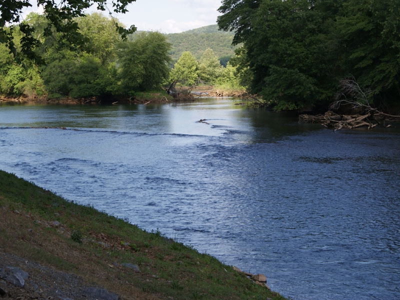
Join us as we paddle the Etowah River from the lower side of Allatoona at Hardin Bridge. We'll be paddling the Hardin Bridge section. The Etowah Water Trail site describes this section as: This ten-mile section may be the most scenic and popular paddle on the Etowah River in Bartow County. The paddle path crosses no less than six Native American fish weirs and winds beneath riverside bluffs. The highlight is a quarter-mile rock garden followed by a series of islands and shoals. With many places to stop and play, this is a favorite paddle for families. Some residential development encroaches on the river in places, but the river maintains a rural feel. Shoals and rapids are limited to Native American fish weirs and small shoals with no obstacles exceeding Class I in difficulty. This is a BYOB paddle, and you must have a PFD with you. Launch Site: A boat ramp and parking area were developed by Bartow County and the City of Euharlee at Euharlee Road Take Out Site: Located southeast corner of the US 411 Bridge http://www.etowahwatertrail.org/wp-includes/pdf/guides/hardin-bridge-guide.pdf
| |||||||
| |||||||
| How to Get There: | |||||||
| Event Directions: | Launch: Follow I-75 N to Old Allatoona Rd SE in Emerson. Take exit 283 from I-75 N
33 min (36.2 mi)
20 min (12.0 mi)
Euharlee Road Etowah Boat Ramp
Euharlee Rd SW, Euharlee, GA 30120
From Main St. in Cartersville, go west on Main St. (Ga. 113/61) 2.5 miles to Euharlee Road on right. Turn right and go five miles to Dobson Drive on left. Turn left and entrance to boat ramp parking area is immediately on right.
Take out Turn right onto Macedonia Rd
2.6 mi
Turn right onto US-411 N0.1 mi
411 Etowah RampGA-20, Kingston, GA 30145
556 Hardin Bridge Rd, Kingston, GA
| ||||||
| Notes: | |||||||
|
* We encourage all members to follow our Etiquette Guidelines while participating in AOC events. | |||||||
Cancellation/Partial Attendance: Please review the AOC cancellation policy. *Note: This paddle will be dependent on weather conditions and water levels. Recent storms can raise the water level as well as large dam releases (too early to know). | |||||||
 Calendar of Events
 Event Places