 Print-Friendly Version Print-Friendly Version
|
|
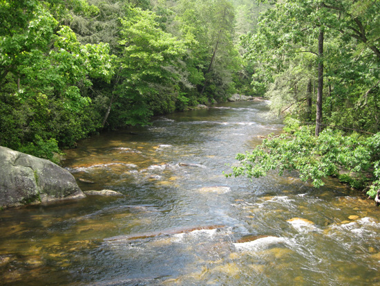
Day Hike: Chattooga River Trail to Ellicott Rock and Spoonauger Falls | |||||||
| The Basics: | |||||||
| Event Type: | Hike | ||||||
| Event Location: | Chattooga River Trail | ||||||
| Date(s) & Time: | Sun, Aug 30 2009 10:00 am >> N/A (Carpool Departure: 7:30 am *log in for location*) | ||||||
| Registration Opens: | Mon, Aug 10 2009 9:00 pm | ||||||
| Registration Cut Off: | Sat, Aug 29 2009 8:00 pm | ||||||
| Event Duration: | Full Day | ||||||
| Difficulty Rating: | D3: Moderate | ||||||
| Trip Leader(s): | Denise Van Huss gheetl  Email Trip Leader(s) Email Trip Leader(s)
You must be logged in to get the Trip Leader contact information. | ||||||
| Member Cost: | None | ||||||
| Participant Info: | |||||||
| Who's Invited: | Members Only, 21 And Older Only | ||||||
| Maximum Group Size: | 16 | ||||||
| Minimum Group Size: | 4 | ||||||
| Number Registered So Far: | 13 / 0 (To see who's signed up, log in to the Member Area) | ||||||
| Are Dogs Permitted: | No | ||||||
| Itinerary: | |||||||
Andrew Ellicott, a noted surveyor, was commissioned by North Carolina and Georgia to determine the boundary between the states. He completed his survey in 1811 by chiseling an inconspicuous mark on a rock on the east bank of the Chattooga River. This is Ellicott Rock. Two years later commissioners representing South Carolina and North Carolina marked a large rock along the Chattooga River bank with the inscription "Lat 35 AD 1813 NC + S.C." as the juncture where the South Carolina and North Carolina state lines joined. This is commonly accepted as the point where the boundary lines of South Carolina, North Carolina, and Georgia join. | |||||||
| |||||||
| How to Get There: | |||||||
| Event Directions: | (Burrell's Ford Parking Area) - From US 76/US 441 in Clayton, GA (at Wendy's), take a right onto Rickman Road for 0.5 miles to Warwoman Road. Turn right onto Warwoman Road and head 14 miles to State Route GA 28. Take a right onto GA 28 and follow it for 1.8 miles to U.S. Forest Service Road 646 (which is also known as Burrells Ford Road). Follow USFS 646 for about 7 miles to the Burrell Ford Parking Area. This road will turn to gravel for a majority of this drive. We will park on the GA side of the river. | ||||||
| Carpool to Event Distance (round trip): | 220Mile(s) | ||||||
| Carpool Departure Time: | 7:30 am | ||||||
| Carpool Location: | Log in for location | ||||||
| Carpool Directions: | Log in for directions | ||||||
| Carpool Cost: | Estimated cost per vehicle for this event is $88.00 using a reimbursement rate guideline of $0.400 per mile. The total amount should be divided by the number of people in the vehicle, including the driver. This is a guideline, not a rule, for drivers but the cost should not be higher unless there are extenuating circumstances. | ||||||
| Notes: | |||||||
|
We prefer for everyone to meet at the carpool and not at the trailhead. We will stop at McDonald's in Clayton to coordinate with anyone who chooses the "Meet at Event" option. * We encourage all members to follow our Etiquette Guidelines while participating in AOC events. | |||||||
Cancellation/Partial Attendance: Please review the AOC cancellation policy. | |||||||
 Calendar of Events
 Event Places