 Print-Friendly Version Print-Friendly Version
|
Last Minute Raging Water at Sweetwater Creek | |||||||
| The Basics: | |||||||
| Event Type: | Hike | ||||||
| Event Location: |
Sweetwater Creek State Park


| ||||||
| Date(s) & Time: | Sat, Feb 29 2020 11:00 am >> Sat, Feb 29 2020 2:00 pm | ||||||
| Registration Opens: | Fri, Feb 28 2020 12:00 pm | ||||||
| Registration Cut Off: | Sat, Feb 29 2020 9:00 am | ||||||
| Event Duration: | 3 Hours | ||||||
| Difficulty Rating: | D3: Moderate | ||||||
| Distance: | 5 Miles | ||||||
| Pace: | Moderate | ||||||
| Trip Leader(s): | Lisa Maldonado Email Trip Leader(s) Email Trip Leader(s)
You must be logged in to get the Trip Leader contact information. | ||||||
| Member Cost: | None | ||||||
| Participant Info: | |||||||
| Who's Invited: | Members Only, 21 And Older Only | ||||||
| Maximum Group Size: | 15 | ||||||
| Minimum Group Size: | 4 | ||||||
| Number Registered So Far: | 5 / 0 (To see who's signed up, log in to the Member Area) | ||||||
| Are Dogs Permitted: | Yes | ||||||
| Itinerary: | |||||||
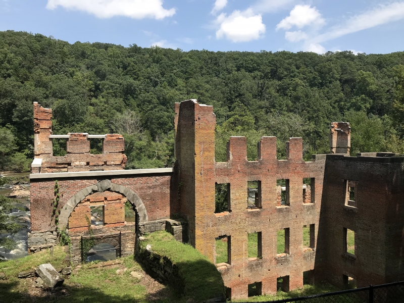
The creek is raging with all the rain.The rain has subsided and weather is looking perfect. We will start our hike from the visitor's center on The red trail. We will go past old mill ruins and hike along the creek. We will then hike on the white trail. Please bring a lunch or snack. The group will stop along the creek to have lunch. All of these trails have varied terrain with rocky areas and tree roots. Study hiking shoes are recommended. I am estimating about 5 miles but could be a little more. We will meet at the event, no carpool will be organized. Entrance fee is $5.00 unless you have a Georgia State Park Pass. | |||||||
| |||||||
| How to Get There: | |||||||
| Event Directions: | Park Address:
Sweetwater Creek State Park GPS Coordinates:N 33.753783 | W -084.639000 Take I-20 west from Atlanta, exit #44 at Thornton Road, turn left and go ¼ mile. Turn right on Blairs Bridge Road. After 2 miles, turn left on Mount Vernon Road and proceed to the park. | ||||||
| Notes: | |||||||
|
http://www.gastatepa rks.org/SweetwaterCreek * We encourage all members to follow our Etiquette Guidelines while participating in AOC events. | |||||||
Cancellation/Partial Attendance: Please review the AOC cancellation policy. | |||||||
 Calendar of Events
 Event Places