 Print-Friendly Version Print-Friendly Version
|
Wagon Train Trail (+Bell Knob warmup) | |||||||
| The Basics: | |||||||
| Event Type: | Hike | ||||||
| Event Location: | Young Harris, GA | ||||||
| Date(s) & Time: | Sun, Sep 13 2009 9:15 am >> N/A (Carpool Departure: 9:30 am *log in for location*) | ||||||
| Registration Opens: | Wed, Sep 9 2009 8:15 pm | ||||||
| Registration Cut Off: | Sat, Sep 12 2009 10:00 pm | ||||||
| Event Duration: | per itinerary | ||||||
| Difficulty Rating: | D5: Difficult | ||||||
| Trip Leader(s): | Tony C Email Trip Leader(s) Email Trip Leader(s)
You must be logged in to get the Trip Leader contact information. | ||||||
| Member Cost: | None | ||||||
| Participant Info: | |||||||
| Who's Invited: | Members Only, 21 And Older Only | ||||||
| Maximum Group Size: | 14 | ||||||
| Minimum Group Size: | 4 | ||||||
| Number Registered So Far: | 5 / 0 (To see who's signed up, log in to the Member Area) | ||||||
| Are Dogs Permitted: | No | ||||||
| Itinerary: | |||||||
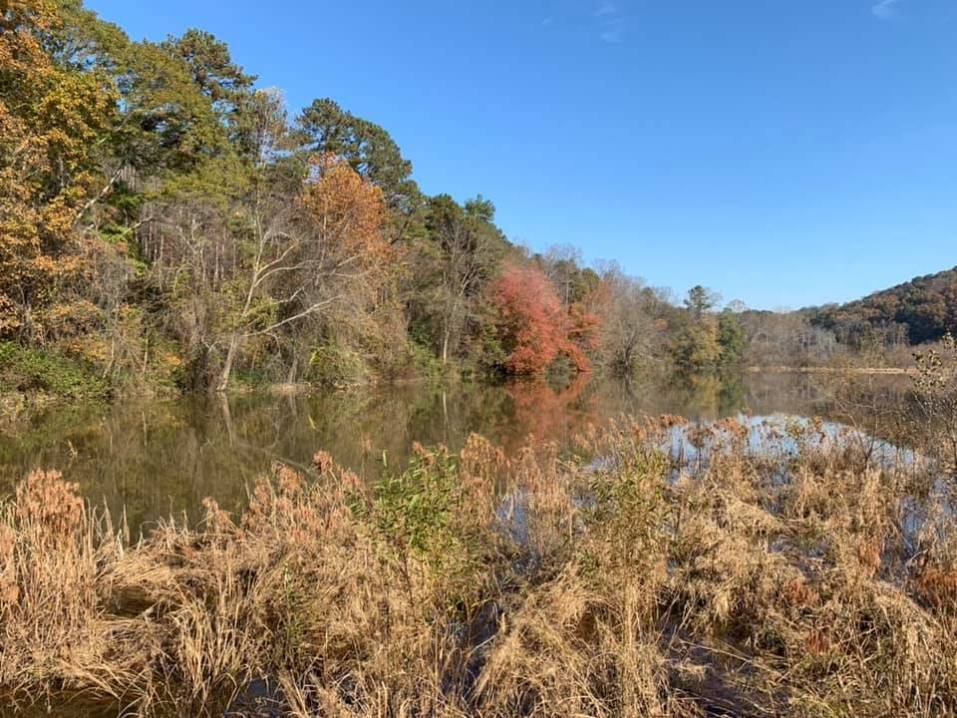
| This event begins with a little "warmup" hike up Bell Knob in Hiawassee. It is basically just a small detour on the drive to the Wagon Train trailhead, just a couple of miles out of the way. Bell Knob is a small but prominent mtn (elevation 3420') that you don't hear much about, but it's definitely worth a visit. Unfortunately the top of Bell is not very naturalistic....the top is scarred from quartzite mining....and if that wasn't bad enough, there is graffiti littering most all of the exposed rockface.....however.....keep your gaze directed outwards and you will enjoy the splendid views...you can see Brasstown Bald to the NW (where we will be soon), Eagle Mtn right next door to the E (will get to that one next month) and Lake Hiawassee below to the W. We will also hike up a little side trail that offers views of Tray Mtn and Double Springs knob, another two of the top 10 highest peaks in GA. After we take a break at the top of Bell to enjoy the views and do a little climbing and exploring, we will head to the Wagon Train trail....just about 10 miles away. The WTT is one of the "Big 3" that go up Brasstown Bald, the tallest mtn in GA,...the other two being the Arkaquah and Jacks Knob trails. The WTT is the longest of the three and offers nice winter views and a couple of good overlooks in the summer. Plus the views from the top of BB never disappoint. The WTT was actually built by convict labor many years ago. This old roadbed was the original path that Georgia highway 66 was to follow, but then the project was abandoned and it was never paved. So it is a fairly wide path but also not used that often so there will most likely be some high grass, etc that we hike through. Once we get to the northern end of the WTT, we will walk the paved trail to the BB summit and take a long lunch break. After we descend down the WTT, we can stop for dinner or just head back to the carpool....each vehicle can decide what they'd like to do. Summary- Bell Knob - 2 miles , 900' ascent/descent WTT out - 6.5 miles 2250' ascent, 150' descent BB trail out and back - .8 mi, 400' ascent/descent WTT back - 6.5 mi 150' ascent, 2250' descent Total distance: ~15.8 mi Elevation: ~3700' ascent/descent PLEASE NOTE:
| |||||||
| |||||||
| How to Get There: | |||||||
| Event Directions: | Directions Young Harris College (Wagon Train Trailhead) This google map actually shows you much farther down the road than you'd be able to drive (we'll be hiking on that portion of the old road) but the map should get you to the trailhead if you want to meet at event. View Larger Map | ||||||
| Carpool to Event Distance (round trip): | 195Mile(s) | ||||||
| Carpool Departure Time: | 9:30 am | ||||||
| Carpool Location: | Log in for location | ||||||
| Carpool Directions: | Log in for directions | ||||||
| Carpool Cost: | Estimated cost per vehicle for this event is $78.00 using a reimbursement rate guideline of $0.400 per mile. The total amount should be divided by the number of people in the vehicle, including the driver. This is a guideline, not a rule, for drivers but the cost should not be higher unless there are extenuating circumstances. | ||||||
| Notes: | |||||||
|
* We encourage all members to follow our Etiquette Guidelines while participating in AOC events. | |||||||
| Cost Includes: | Please share gas expenses with carpool drivers. | ||||||
Cancellation/Partial Attendance: Please review the AOC cancellation policy. | |||||||
 Calendar of Events
 Event Places