 Print-Friendly Version Print-Friendly Version
|
|
Hike the Wagon Train Trail to Brasstown Bald ( No Carpool) ! | |||||||
| The Basics: | |||||||
| Event Type: | Hike | ||||||
| Event Location: |
Young Harris, GA


| ||||||
| Date(s) & Time: | Sat, Jul 11 2020 8:45 am >> Sat, Jul 11 2020 3:45 pm | ||||||
| Registration Opens: | Tue, Jun 30 2020 8:00 pm | ||||||
| Registration Cut Off: | Sat, Jul 11 2020 7:00 am | ||||||
| Event Duration: | 7 Hours | ||||||
| Difficulty Rating: | D5: Difficult | ||||||
| Distance: | 13 Miles | ||||||
| Pace: | Moderate | ||||||
| Trip Leader(s): | Chuck R Email Trip Leader(s) Email Trip Leader(s)
You must be logged in to get the Trip Leader contact information. | ||||||
| Member Cost: | None | ||||||
| Participant Info: | |||||||
| Who's Invited: | Members Only, 21 And Older Only | ||||||
| Maximum Group Size: | 10 | ||||||
| Minimum Group Size: | 2 | ||||||
| Number Registered So Far: | 9 / 0 (To see who's signed up, log in to the Member Area) | ||||||
| Are Dogs Permitted: | Yes | ||||||
| Itinerary: | |||||||
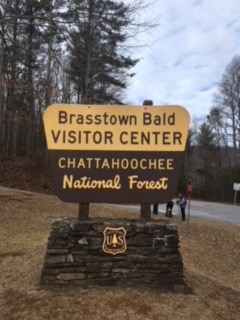
The wagon TrainTrail follows an old roadbed that was abandoned back some time ago. It is one of the least strenuous of the big 3 trails that leads to Brasstown Bald, which is the tallest mountain in Georgia - 4784 ft. Our hike will began at the trail head of the Wagon Train. We hike approximately 6 miles to the bottom of Brasstown Bald and will have access to bathrooms at that time. We will then take the paved walk way up for .6 miles to the summit. Once we reach the observation deck, we will take our lunch break and enjoy the 360 views of 4 states. After lunch we will re- trace our steps back to our cars. This hike has approximately around 3000 feet in mountain travel. I will like to see hikers who had recently done high D4 and D5s with the A.O.C. | |||||||
| |||||||
| How to Get There: | |||||||
| Event Directions: | Event Directions: : You will go north on Georgia 400 to Dahlonega. Continue on US Hwy 19 North past Voget State Park, then take a right on State Road 180 East. Stay on 180 for 2.4 miles, turn left at Town Creek School Rd and after 2 miles turn right on Trackrock Church Rd. Take another right onto Trackrock Gap Rd. You will meet up with State road 76 (Main Street of Young Harris).Turn right when you get to Bald Mountain road, it will be the parking lot of the Methodist Church and then park. The trail head is up the hill at the iron gates on the right, Wait at the parking lot!......... More direct is US Hwy 19 to Blairsville Georgia to Hwy 76 . | ||||||
| Notes: | |||||||
|
Will hike in rain,if conditions are favorable! * We encourage all members to follow our Etiquette Guidelines while participating in AOC events. | |||||||
| Cost Includes: |
| ||||||
Cancellation/Partial Attendance: Please review the AOC cancellation policy. | |||||||
 Calendar of Events
 Event Places