 Print-Friendly Version Print-Friendly Version
|
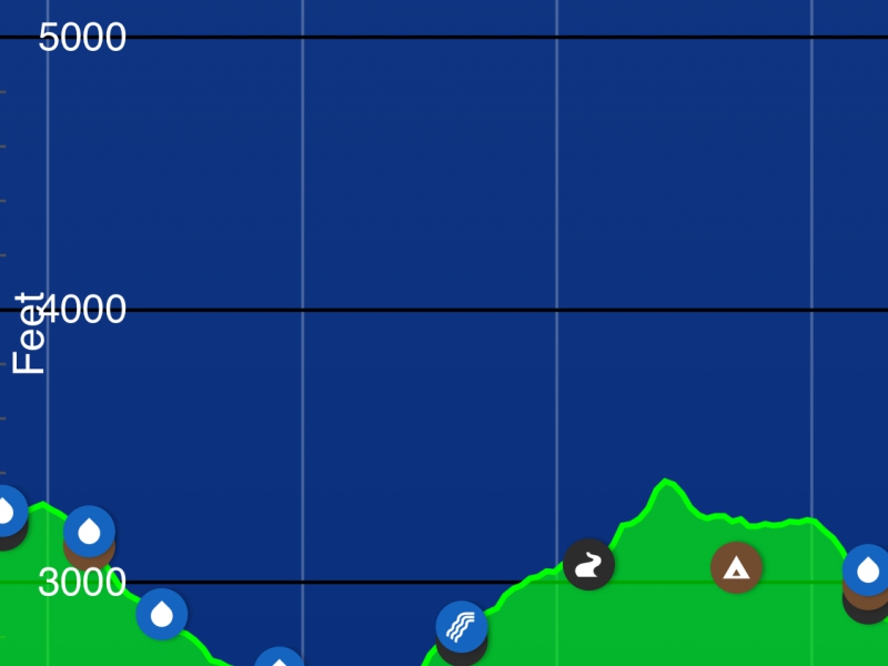
Long Creek Valley: AT 14-mile segment GA | |||||||
| The Basics: | |||||||
| Event Type: | Hike | ||||||
| Event Location: | Suches, GA | ||||||
| Date(s) & Time: | Thu, Aug 27 2020 8:30 am >> Thu, Aug 27 2020 2:30 pm | ||||||
| Registration Opens: | Sun, Aug 23 2020 6:25 pm | ||||||
| Registration Cut Off: | Wed, Aug 26 2020 6:25 pm | ||||||
| Event Duration: | 6 Hours | ||||||
| Difficulty Rating: | D6: Advanced | ||||||
| Distance: | 14.6 Miles | ||||||
| Pace: | Moderate | ||||||
| Trip Leader(s): | Gary 'L' Leigh B  Email Trip Leader(s) Email Trip Leader(s)
You must be logged in to get the Trip Leader contact information. | ||||||
| Member Cost: | None | ||||||
| Participant Info: | |||||||
| Who's Invited: | Members Only, 21 And Older Only | ||||||
| Maximum Group Size: | 10 | ||||||
| Minimum Group Size: | 4 | ||||||
| Number Registered So Far: | 4 / 0 (To see who's signed up, log in to the Member Area) | ||||||
| Are Dogs Permitted: | Yes | ||||||
| Itinerary: | |||||||
| |||||||
| |||||||
| How to Get There: | |||||||
| Event Directions: | please meet us at the trail access at 8:30am. There is no privy nor water at the trail access so we suggest a stop in Dahlonega at the McDonald's (or the convenience store across the street from the McDonald's may have larger restrooms and save you time) Following the GPS directions will lead you past parking and trail access at Cooper Gap and Horse Gap. We are going to the 3rd access which is Hightower Gap and will park there. Here is a link to Google Maps that will take you to Hightower Gap: | ||||||
| Notes: | |||||||
|
* We encourage all members to follow our Etiquette Guidelines while participating in AOC events. | |||||||
| Cost Includes: | There is no cost for parking at the trailhead. | ||||||
Cancellation/Partial Attendance: Please review the AOC cancellation policy. | |||||||
 Calendar of Events
 Event Places