 Print-Friendly Version Print-Friendly Version
|
|
Garland Mountain, Southwest Trails | |||||||
| The Basics: | |||||||
| Event Type: | Hike | ||||||
| Event Location: |
1411 Garland Mountain Way, Waleska, GA 30183


| ||||||
| Date(s) & Time: | Sun, Aug 30 2020 9:00 am >> Sun, Aug 30 2020 3:00 pm | ||||||
| Registration Opens: | Wed, Aug 26 2020 8:30 pm | ||||||
| Registration Cut Off: | Sun, Aug 30 2020 6:00 am | ||||||
| Event Duration: | 6 Hours | ||||||
| Difficulty Rating: | D4: Moderate to Difficult | ||||||
| Distance: | 10.7 Miles | ||||||
| Pace: | Moderate | ||||||
| Trip Leader(s): | Richard Joyce T.  Email Trip Leader(s) Email Trip Leader(s)
You must be logged in to get the Trip Leader contact information. | ||||||
| Member Cost: | None | ||||||
| Participant Info: | |||||||
| Who's Invited: | Members Only, 21 And Older Only | ||||||
| Maximum Group Size: | 10 | ||||||
| Minimum Group Size: | 4 | ||||||
| Number Registered So Far: | 10 / 0 (To see who's signed up, log in to the Member Area) | ||||||
| Are Dogs Permitted: | No | ||||||
| Itinerary: | |||||||
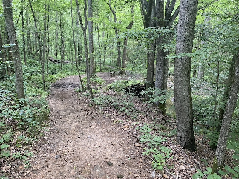
The Garland Mountain Equestrian/Hiking Trails are just a little north of the city in Waleska, GA - - not too far from Rinehardt College. The parking area and trails are maintained by the Cherokee County Saddle Club, where both riders and hikers are welcome. Because of the equestrian connection, all the trails are named for horse breeds: Palomino, Sorrel, Dun, Pinto, Chestnut, Dapple Grey, and Roan. Excellent blazes and maps allow for ease of following the trails, so there's no chance of getting lost. The trails are winding and rolling, but no long, steep climbs. We will walk a loop consisting of a short section of Palomino, all of Dun and Ellen's Way, the southern portion of Dapple and all of Bay. After reaching Greenway West we will stop for lunch at some tables located there. We will then walk on Greenway West and Greenway South until we reach the pipeline, and return to the parking lot through Canyon, a portion of Greenway South, Mountain View, portions of Roan, Chestnut and Greenway West, and Sorrel Pack a lunch or snack. We'll be taking a lunch break at picnic tables during our hike! | |||||||
| |||||||
| How to Get There: | |||||||
| Event Directions: | Follow I-75 N and I-575 N towards Canton. Take exit 16 from I-575 N and onto GA-140 W, GA-20 W, GA-5-BR W toward GA-5-BR N. After 1.2 miles turn right onto onto Marietta Hwy (GA-140, GA-5-BR). After 1.5 miles turn left onto Waleska Hwy (you will drive past Rinehardt College). After 10.6 miles turn right onto Garland Mountain Trl. After 1.1 miles turn left onto Garland Mountain Way and proceed 1.3 miles. The parking lot will be on your left.
| ||||||
| Notes: | |||||||
|
Garland Mountain Trail Map: https://www.playcherokee.org/ImageRepository/Document?documentID=285 Parking is free A single uni-sex bathroom is available at the parking lot * We encourage all members to follow our Etiquette Guidelines while participating in AOC events. | |||||||
Cancellation/Partial Attendance: Please review the AOC cancellation policy. | |||||||
 Calendar of Events
 Event Places