

 Print-Friendly Version Print-Friendly Version
|
Siler Bald NC Day-Hike | |||||||
| The Basics: | |||||||
| Event Type: | Hike | ||||||
| Event Location: |
Winding Stair Gap - 9 mi West of Franklin NC on US 64


| ||||||
| Date(s) & Time: | Sat, Jan 23 2021 10:30 am >> Sat, Jan 23 2021 5:00 pm | ||||||
| Registration Opens: | Mon, Jan 18 2021 9:00 pm | ||||||
| Registration Cut Off: | Fri, Jan 22 2021 5:00 pm | ||||||
| Event Duration: | 6 Hours 30 Minutes | ||||||
| Difficulty Rating: | D4: Moderate to Difficult | ||||||
| Distance: | 10 Miles | ||||||
| Pace: | Moderate | ||||||
| Trip Leader(s): | Kristi Email Trip Leader(s) Email Trip Leader(s)
You must be logged in to get the Trip Leader contact information. | ||||||
| Member Cost: | None | ||||||
| Participant Info: | |||||||
| Who's Invited: | Members Only, 21 And Older Only | ||||||
| Maximum Group Size: | 6 | ||||||
| Minimum Group Size: | 4 | ||||||
| Number Registered So Far: | 5 / 0 (To see who's signed up, log in to the Member Area) | ||||||
| Are Dogs Permitted: | Yes | ||||||
| Itinerary: | |||||||
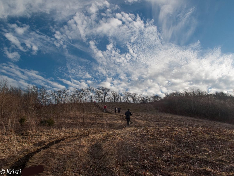
There are many scenic vistas on the Appalachian Trail within a couple hours driving time of Atlanta, but perhaps none more so than Siler Bald, North Carolina. With a summit of 5,216 feet it offers a sweeping 360 degree view of the surrounding valleys. There is almost 1500 feet in elevation gain over four miles. The final ascent to the summit is steeper. The total distance hiked will be around nine miles, we will circle around to the shelter on the way up to Snowbird Gap and onto the summit. High chance of snow in the shadows and on the trail if snow has occurred that week. So trekking poles, water proof boots and boot gaitors are highly recommended. Typical of the AT in this area, expect the terrain to be rocky and muddy. Remember that most of this is hike is at over 4000 ft elevation so bring appropriate clothing (layers, hat, gloves, jacket). Total hiking pace will average 2.5 mph with stops to enjoy the scenery and photograph it, though actual hiking pace may be faster. We will have a leisurely lunch at, or near the summit. Will probably remain at the summit basking in the sun and enjoying our efforts to climb this, for about an hour, so please sign up for this hike only if you really enjoy hanging out in the wilderness for a bit. If it's really windy, we can descend lower to the gap for lunch. Dress for a cold windy day and you'll be fine. The ending time of this event is an estimated time of being off the trail around 4:30pm or 5pm. If your AOC record shows limited hiking events and the trip leader is not familar with you, expect an e-mail asking about your recent hiking experience. Thanks to other members for this description, I copied from it from a former event that I led, so I'm not sure of the original sources. Due to Covid, physical distancing of 6-10 feet during the hike is mandatory. | |||||||
| |||||||
| How to Get There: | |||||||
| Event Directions: | https://goo.gl/maps/jfRaAvBzcgXr6U6N9 (These directions start from the Indian Trail Park-n-Ride; you can modify the starting location) North on I-85. Take I-985 near Mall of Georgia. Continue on I-985. After 26 miles this intersate will become US 23. Continue on US 23 through Clayton GA and into North Carolina. At Franklin NC take exit to US 64 West. Continue eight miles until Winding Stairs Gap parking lot. | ||||||
| Notes: | |||||||
|
If you have any questions e-mail the Event Coordinator and save phone calls for the day of the event. * We encourage all members to follow our Etiquette Guidelines while participating in AOC events. | |||||||
Cancellation/Partial Attendance: Please review the AOC cancellation policy. *Note: Late cancellations, particularly within 36 hours of the event make it difficult for those on the wait list to attend. Please be courteous to your fellow AOC members and cancel with as much notice as possible. | |||||||