 Print-Friendly Version Print-Friendly Version
|
East Palisades (longer 7 miles version) | |||||||
| The Basics: | |||||||
| Event Type: | Hike | ||||||
| Event Location: |
East Cobb


| ||||||
| Date(s) & Time: | Wed, Jan 13 2021 2:00 pm >> Wed, Jan 13 2021 5:00 pm | ||||||
| Registration Opens: | Tue, Jan 12 2021 8:32 am | ||||||
| Registration Cut Off: | Wed, Jan 13 2021 1:32 pm | ||||||
| Event Duration: | 3 Hours | ||||||
| Difficulty Rating: | D3: Moderate | ||||||
| Distance: | 7 Miles | ||||||
| Pace: | Fast | ||||||
| Trip Leader(s): | Gary 'L' Email Trip Leader(s) Email Trip Leader(s)
You must be logged in to get the Trip Leader contact information. | ||||||
| Member Cost: | None | ||||||
| Participant Info: | |||||||
| Who's Invited: | Members Only, 21 And Older Only | ||||||
| Maximum Group Size: | 10 | ||||||
| Minimum Group Size: | 4 | ||||||
| Number Registered So Far: | 3 / 0 (To see who's signed up, log in to the Member Area) | ||||||
| Are Dogs Permitted: | Yes | ||||||
| Itinerary: | |||||||
Moving Speed: up to 3.2 mph Avg. Speed: 2.7 mph Elevation Gain: 1000 feet Trail Condition: slippery and hazardous in places with the usual winter experiences of leaves over nuts, rocks, and roots, plus extra sticks and blowdowns Weather: 52 degrees, 5% rain chance, partly cloudy, 5 mph wind We will cover all the trails and work our way through the trail system from the lower level to try to have as much climbing as possible. If you think you are a slow hiker, then this hike would not be one you would want to choose. PLEASE NOTE THE PARKING LOT - - WHITEWATER CREEK (Not the Indian Trail lot) East Palisades is a unique hike in a densely forested park that rises to 400 feet above the Chattahoochee River. It offers some of the most scenic views of the river south of Lake Lanier.
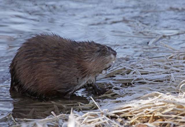
Along the way to the top, we will take all of the trails in order to maximize our elevation gain to have climbing be as much of a D3 experience as we can squeeze out of the trail system. Please make sure you meet at the WhiteWater Creek location. There are no restrooms Pass can be purchased at the Kiosk in the parking lot - they don't take cash any longer - you should be able to scan a QR code with your phone and pay electroncially. or prior to hike go to this website and purchase a daily or annual pass https://www.nps.gov/chat/planyourvisit/fees.htm Photo of East Palisades beaver by Chuck R. Thanks Chuck!
| |||||||
| |||||||
| How to Get There: | |||||||
| Event Directions: | Please note the physical address and the directions mentioned below are approximate; the best way to get to the parking lot is by GPS https://goo.gl/maps/YbKEx4xUjHaQZ6kS7 From I -285 East From I-285 West From I-75 North From U.S. 41 (Cobb Highway South) From U.S. 41 (Cobb Highway North)
| ||||||
| Notes: | |||||||
|
Electronic payment at kiosk for $5 parking unless you have an annual pass, which you can apply for HERE. Trail Maps - National Park Service http://www.nps.gov/chat/planyourvisit/upload/ TrailMapPalisadesEast.pdf Alltrails, of the standard loop (we will do more than twice as much) with section mileages if you zoom
Will hike in rain! * We encourage all members to follow our Etiquette Guidelines while participating in AOC events. | |||||||
Cancellation/Partial Attendance: Please review the AOC cancellation policy. | |||||||
 Calendar of Events
 Event Places