 Print-Friendly Version Print-Friendly Version
|
|
Foothills Trail 77 Thru-Hike | |||||||
| The Basics: | |||||||
| Event Type: | Backpacking | ||||||
| Event Location: |
Oconee State Park - FTC Terminus


| ||||||
| Date(s) & Time: | Fri, Jan 14 2022 4:00 am >> Mon, Jan 17 2022 4:00 pm (Carpool Departure: 4:00 am *log in for location*) | ||||||
| Registration Opens: | Mon, Jan 3 2022 11:11 am | ||||||
| Registration Cut Off: | Wed, Jan 12 2022 11:11 am | ||||||
| Event Duration: | 3 Days 12 Hours | ||||||
| Difficulty Rating: | D7: Extreme | ||||||
| Distance: | 77 Miles | ||||||
| Pace: | Fast | ||||||
| Trip Leader(s): | Horhay Email Trip Leader(s) Email Trip Leader(s)
You must be logged in to get the Trip Leader contact information. | ||||||
| Member Cost: | None | ||||||
| Participant Info: | |||||||
| Who's Invited: | Members Only, 21 And Older Only | ||||||
| Maximum Group Size: | 1 | ||||||
| Minimum Group Size: | 2 | ||||||
| Number Registered So Far: | 0 / 0 (To see who's signed up, log in to the Member Area) | ||||||
| Are Dogs Permitted: | No | ||||||
| Itinerary: | |||||||
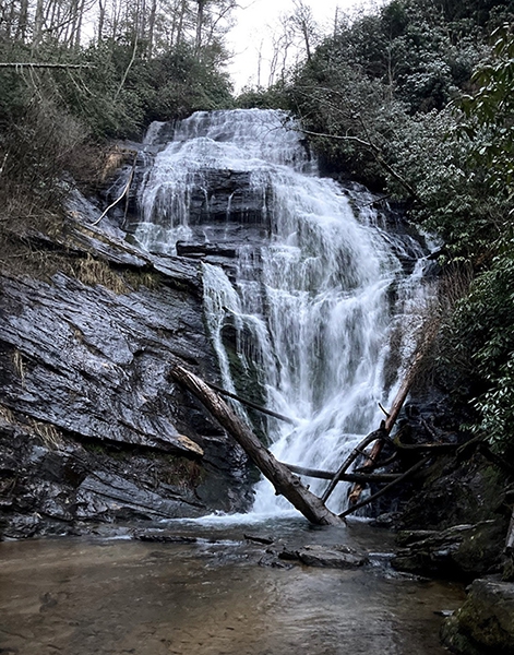
Take a day or two off and come join me for a FULL MOON (Wolf Moon), self-supported, winter backpacking thru-hike of the glorious FOOTHILLS TRAIL. We'll be kicking off early Friday to get a jump on local traffic and to get the cars set for the shuttle with Taz. Once set TAZ will take us down to Oconee State Park and that is where we'll kick off the weekend headed in a easterly direction to Table Rock State Park. Divided up into 4 uneven days to match the uneven approximate 17,500 feet of elevation and 77 miles we plan to test you to see if you got what it takes: DAY 1: Carpool Roll Out is 04:00!! Hauling arse from the carpool lot to TRSP and set up for the shuttle so we'll get on the trail as soon as humanly possible is critical. Pre-register your car for parking if you're not carpooling with me - THIS IS A MUST. We'll be at the gates at opening (07:00) the park is NOT going to open until 9, so you must pre-pay for parking (call TRSP for that at 864-878-9813, this is not an option). We have a rolling terrain today - but the plan is to be backpacking quckly so we reach our projected mileage goal b4 sunset (hopefully it's not that late). Gather water and gear up for a big day on Saturday! We'll get dinner rolling and get food in bearbags and stowed b4 hunkering down for the night. DAY 2: A LONG day awaits and another early alarm will be set to get the full kick of a projected 26 mile day with weight on its way. Not exactly sure what time that alarm will go off but rest assured it will be dark & cold when we roll out. Along the way there's absolutely amazing winter scenery and finding water along the way should not be a problem. A quick lunch stop may take place in a scenic locale, but most of the snacks will be consumed on the fly. What a day...once we're setting up for the night, it will be much of the same...water gathering, inhaling calories, hanging bearbags and catching Zzz'z. DAY 3: Well, today is another long day, an almost mirror image of the marathon effort from yesterday. The schedule will be planned according to how we're feeling as far as a wake up call, but planning another early start to be sure we get the necessary miles in. That way we we're set for a short day on Monday. A majority of the day has more elevation gain than loss, so we'll be testing our fitness for sure...and of course we'll have wiggle room today so we'll be shootin' from the hip on a lunch stop and breaks. Set up for the night will be depend on how far and how strong we're feeling, but I'd like to be sure it's less than 11 miles to get out on Monday...so as we set up for sleep on the last full day we can be sure to replace those calories and get ready to hit the rack for some much needed sleep. DAY 4: We're outta here gang! So hopefully we're set on schedule for less than a 11-miler (give or take) to Table Rock State Park and gather the other car(s) and head out. Plenty of snacks but no planned lunch stop on the trail today, just business as usual...but I will need an AB or two after kicking frozen dirt for 77 miles...so here's to the W-E thru hike of the FOOTHILLS TRAIL. Cheers! The elevation map below Magenta Bar - Day 1. Red Bar - Day 2. Blue Bar - Day 3. Green Bar - Day 4: Each day has "estimated" miles shown...not to scale, not in stone.
Lunch at Habanero's is a highly suggested option b4 heading home, hence the short day ;) but...we'll see how we're feeling! *denotes approximate distances, don't get feelings hurt if we extend mileage or cut things short. There has been a couple of bridges that have been destroyed from recent storms (written up originally in Spring of '19), so water crossings are possible - having an open mind is probably a great thing.
ALL MEMBERS INTERESTED WILL BE ADDED TO THE WAITLIST - PENDING AOC RESUME APPROVAL (MAX GROUP SIZE IS FOUR). | |||||||
| |||||||
| How to Get There: | |||||||
| Event Directions: | Final Terminus: TABLE ROCK STATE PARK Just #GTS :) | ||||||
| Carpool to Event Distance (round trip): | 300Mile(s) | ||||||
| Carpool Departure Time: | 4:00 am | ||||||
| Carpool Location: | Log in for location | ||||||
| Carpool Directions: | Log in for directions | ||||||
| Carpool Cost: | Estimated cost per vehicle for this event is $120.00 using a reimbursement rate guideline of $0.400 per mile. The total amount should be divided by the number of people in the vehicle, including the driver. This is a guideline, not a rule, for drivers but the cost should not be higher unless there are extenuating circumstances. | ||||||
| Notes: | |||||||
|
Spot tracker info can be followed here ::: Starting Friday (14Jan) around 08:00 the tracker will be active...wrapping up on Monday I am sharing my location at my MapShare website: https://share.garmin.com/HorhayFHT ABFE #LeaveNoTrace - actually leave it cleaner than you received it! #WinterBackpacking #NoTICKS #NoTourists
* We encourage all members to follow our Etiquette Guidelines while participating in AOC events. | |||||||
Cancellation/Partial Attendance: Please review the AOC cancellation policy. | |||||||
 Calendar of Events
 Event Places

