 Print-Friendly Version Print-Friendly Version
|
|
Sweetwater Creek State Park | |||||||
| The Basics: | |||||||
| Event Type: | Hike | ||||||
| Event Location: | Lithia Springs, GA | ||||||
| Date(s) & Time: | Sat, Nov 28 2009 11:00 am >> N/A (Carpool Departure: 10:45 am *log in for location*) | ||||||
| Registration Opens: | Sun, Nov 22 2009 9:00 pm | ||||||
| Registration Cut Off: | Wed, Nov 25 2009 11:55 pm | ||||||
| Event Duration: | 3 to 4 hours | ||||||
| Difficulty Rating: | D2: Easy to Moderate | ||||||
| Trip Leader(s): | gheetl Denise Van Huss  Email Trip Leader(s) Email Trip Leader(s)
You must be logged in to get the Trip Leader contact information. | ||||||
| Member Cost: | None | ||||||
| Participant Info: | |||||||
| Who's Invited: | Members Only, 21 And Older Only | ||||||
| Maximum Group Size: | 16 | ||||||
| Minimum Group Size: | 4 | ||||||
| Number Registered So Far: | 13 / 0 (To see who's signed up, log in to the Member Area) | ||||||
| Are Dogs Permitted: | No | ||||||
| Itinerary: | |||||||
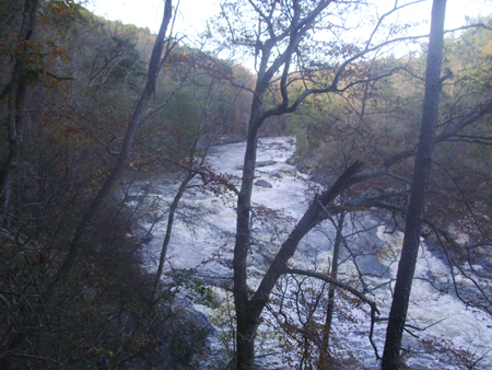
We will hike the blue trail to the red trail (about 3 miles) and then follow the red trail farther up to where a bridge used to cross over to the yellow trail. The bridge was washed out from the floods soo we will look to see if we can find where the bridge is now. | |||||||
| |||||||
| How to Get There: | |||||||
| Event Directions: | From the carpool, we travel back out to Thornton Road, turn left and over the I-20 bridge-it is 8/10ths of a mile to Blairs Bridge Road, on the Right (Big Car dearlership on the Right marks the corner). Turn right here and drive 2.1 miles, turn Left onto Factory Schoals Road, and follow this road until you start seeing the park and cross TWO lake bridges, before looking closely for the entrance to our park site, ON THE LEFT side of the road, Turn in here, and pay the park ranger if in the kiosk; if he or she is not there, drive in to leave payment in their envelopes at the park site, next to our trailhead. | ||||||
| Carpool to Event Distance (round trip): | 7Mile(s) | ||||||
| Carpool Departure Time: | 10:45 am | ||||||
| Carpool Location: | Log in for location | ||||||
| Carpool Directions: | Log in for directions | ||||||
| Carpool Cost: | Estimated cost per vehicle for this event is $2.80 using a reimbursement rate guideline of $0.400 per mile. The total amount should be divided by the number of people in the vehicle, including the driver. This is a guideline, not a rule, for drivers but the cost should not be higher unless there are extenuating circumstances. | ||||||
| Notes: | |||||||
|
* We encourage all members to follow our Etiquette Guidelines while participating in AOC events. | |||||||
Cancellation/Partial Attendance: Please review the AOC cancellation policy. | |||||||
 Calendar of Events
 Event Places