 Print-Friendly Version Print-Friendly Version
|
|
Linville Gorge Southern End | |||||||
| The Basics: | |||||||
| Event Type: | Adventure | ||||||
| Event Location: | Linville Gorge North Carolina | ||||||
| Date(s) & Time: | Fri, Jan 8 2010 11:00 am >> N/A (Carpool Departure: 6:00 am *log in for location*) | ||||||
| Registration Opens: | Mon, Nov 30 2009 9:00 pm | ||||||
| Registration Cut Off: | Thu, Jan 7 2010 11:00 pm | ||||||
| Event Duration: | 3 Days | ||||||
| Difficulty Rating: | D6: Advanced | ||||||
| Trip Leader(s): | Rob Garner Matt Tichenor  Email Trip Leader(s) Email Trip Leader(s)
You must be logged in to get the Trip Leader contact information. | ||||||
| Member Cost: | None | ||||||
| Participant Info: | |||||||
| Who's Invited: | Members Only, 21 And Older Only | ||||||
| Maximum Group Size: | 10 | ||||||
| Minimum Group Size: | 4 | ||||||
| Number Registered So Far: | 7 / 0 (To see who's signed up, log in to the Member Area) | ||||||
| Are Dogs Permitted: | No | ||||||
| Itinerary: | |||||||
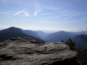
Linville Gorge, The Grand Canyon of North Carolina Friday morning, we'll travel from the carpool to the parking area at Pinch In Trail. Hopefully we'll be on the trail by 11:30am. We'll follow Pinch In to the Linville Gorge Trail (LGT) and turn north. The LGT follows the river and has many fantastic views of the river and gorge walls. We'll turn east and take the bridge across the river on the Spence Ridge trail. The bridge is very unique, an unusual design. Friday night will camp somewhere along the Spence, Mountain to Sea Trail (MST) connector. Saturday morning we'll head south on the MST following the east rim of the gorge. Along the way, we'll see Tablerock Mtn and The Chimneys. If we make it to Linville river before sundown, we'll ford it and setup camp. Otherwise, we'll camp on the east side of the river and cross it in the morning. It should be no more than knee deep and easy to cross. Sunday we'll continue on the MST until we reach state road 1238, a dirt road. We'll go north on the road for approximately 1 mile then head back into the gorge on the Rock Jock trial. Rock Jock takes us back to the Pinch In trail. We'll go west to the parking area, load up and head back to Atlanta. click here for more photos | |||||||
| |||||||
| How to Get There: | |||||||
| Carpool to Event Distance (round trip): | 460Mile(s) | ||||||
| Carpool Departure Time: | 6:00 am | ||||||
| Carpool Location: | Log in for location | ||||||
| Carpool Directions: | Log in for directions | ||||||
| Carpool Cost: | Estimated cost per vehicle for this event is $184.00 using a reimbursement rate guideline of $0.400 per mile. The total amount should be divided by the number of people in the vehicle, including the driver. This is a guideline, not a rule, for drivers but the cost should not be higher unless there are extenuating circumstances. | ||||||
| Notes: | |||||||
|
This is a D6 level event. If you haven't backpacked with me, I'll contact you to discuss your experience and fitness level. * We encourage all members to follow our Etiquette Guidelines while participating in AOC events. | |||||||
Cancellation/Partial Attendance: Please review the AOC cancellation policy. *Note: This a rain or snow or shine event. The only reason we will cancel is, the road conditions won't allow us to get to the trail head. | |||||||
 Calendar of Events
 Event Places