 Print-Friendly Version Print-Friendly Version
|
|
BMT Sections 6b-6d with Fall Branch Falls | |||||||
| The Basics: | |||||||
| Event Type: | Hike | ||||||
| Event Location: | Cherry Log, GA | ||||||
| Date(s) & Time: | Sat, Sep 25 2021 8:45 am >> Sat, Sep 25 2021 3:45 pm (Carpool Departure: 7:30 am *log in for location*) | ||||||
| Registration Opens: | Mon, Sep 20 2021 7:00 pm | ||||||
| Registration Cut Off: | Fri, Sep 24 2021 7:34 pm | ||||||
| Event Duration: | 7 Hours | ||||||
| Difficulty Rating: | D6: Advanced (Exploratory) | ||||||
| Distance: | 16 Miles | ||||||
| Pace: | Moderate | ||||||
| Trip Leader(s): | RonnyJ (Call me Ron) Email Trip Leader(s) Email Trip Leader(s)
You must be logged in to get the Trip Leader contact information. | ||||||
| Member Cost: | None | ||||||
| Participant Info: | |||||||
| Who's Invited: | Members Only, 21 And Older Only | ||||||
| Maximum Group Size: | 8 | ||||||
| Minimum Group Size: | 3 | ||||||
| Number Registered So Far: | 8 / 0 (To see who's signed up, log in to the Member Area) | ||||||
| Are Dogs Permitted: | Yes | ||||||
|
Note: This is an "EXPLORATORY" trip. This means that there are parts of this trip, or perhaps the whole trip, that is new to your Trip Leader(s). However, they are confident that this will not be an issue. This note is here so that you can make an informed decision. When a Trip Leader isn't personally familiar with a trip, there is an increased chance of things not going as planned and you need to be prepared. The Trip Leader may have additional details in the itinerary. | |||||||
| Itinerary: | |||||||
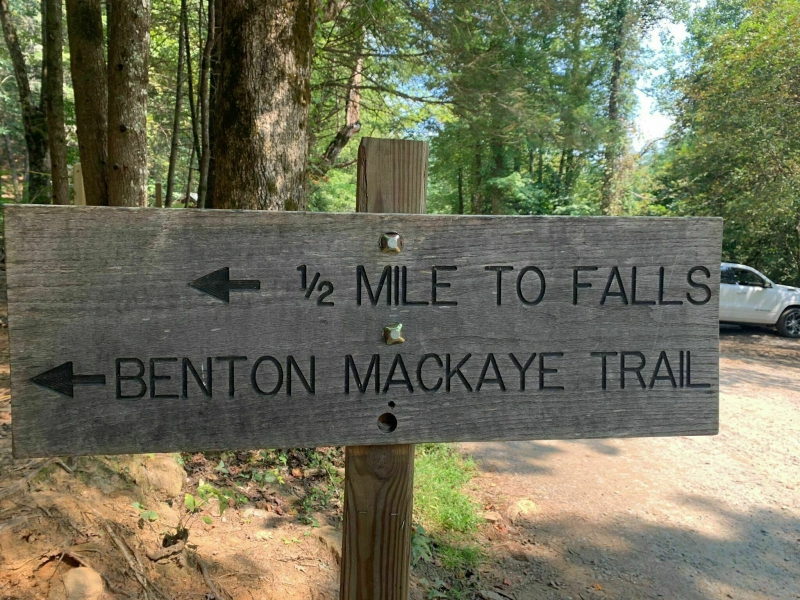
The Benton MacKaye Trail (BMT) is a footpath of nearly 300 miles through the Appalachian mountains of the southeastern United States. It is designed for foot travel in the tradition of the Appalachian Trail (AT). Running from Springer Mountain in Georgia to Big Creek Campground on the northern edge of the Great Smoky Mountains National Park the BMT passes through some of the most remote backcountry in Georgia, Tennessee and North Carolina, including eight federally designated Wilderness and Wilderness Study Areas. Join me as I explore sections 6b-6d including Fall Branch Falls. We will park at the Fall Branch Falls Trailhead parking area to start our initial ascent. We meet the falls after about a half mile where we will snap a few pictures before rejoining our ascent. The ascent will take us near the peak of Rocky Mountain (not the Rocky Mountain that is a hated part of the AT) and on to Scroggin Knob. After the knob we will descend to Laurel Creek and eventually to Laurel Creek Lake. We will continue along the creek until we reach our turn around point where the trail meets Laurel Ridge Drive and the trail becomes a road walk. We will retrace our steps to complete our out and back adventure. Somewhere along the way we will stop for our lunch and share some laughs.
This is a difficult D5 hike, only seasoned adventurers will be allowed to join. | |||||||
| |||||||
| How to Get There: | |||||||
| Event Directions: | |||||||
| Carpool to Event Distance (round trip): | 100Mile(s) | ||||||
| Carpool Departure Time: | 7:30 am | ||||||
| Carpool Location: | Log in for location | ||||||
| Carpool Directions: | Log in for directions | ||||||
| Carpool Cost: | Estimated cost per vehicle for this event is $40.00 using a reimbursement rate guideline of $0.400 per mile. The total amount should be divided by the number of people in the vehicle, including the driver. This is a guideline, not a rule, for drivers but the cost should not be higher unless there are extenuating circumstances. | ||||||
| Notes: | |||||||
|
* We encourage all members to follow our Etiquette Guidelines while participating in AOC events. | |||||||
Cancellation/Partial Attendance: Please review the AOC cancellation policy. | |||||||
 Calendar of Events
 Event Places