 Print-Friendly Version Print-Friendly Version
|
AT Section - 3500 footers: Wildcat Mt, Poor Mt, and Sheep Rock Top | |||||||
| The Basics: | |||||||
| Event Type: | Hike | ||||||
| Event Location: | North GA- Tesnatee Gap - 15 miles northwest of Cleveland, GA | ||||||
| Date(s) & Time: | Tue, Jan 11 2022 9:30 am >> Tue, Jan 11 2022 3:30 pm (Carpool Departure: 7:45 am *log in for location*) | ||||||
| Registration Opens: | Sun, Jan 9 2022 11:00 am | ||||||
| Registration Cut Off: | Tue, Jan 11 2022 9:30 am | ||||||
| Event Duration: | 6 Hours | ||||||
| Difficulty Rating: | D5: Difficult | ||||||
| Distance: | 15 Miles | ||||||
| Pace: | Moderate | ||||||
| Trip Leader(s): | Gary 'L' Leigh B  Email Trip Leader(s) Email Trip Leader(s)
You must be logged in to get the Trip Leader contact information. | ||||||
| Member Cost: | None | ||||||
| Participant Info: | |||||||
| Who's Invited: | Members Only, 21 And Older Only | ||||||
| Maximum Group Size: | 10 | ||||||
| Minimum Group Size: | 4 | ||||||
| Number Registered So Far: | 5 / 0 (To see who's signed up, log in to the Member Area) | ||||||
| Are Dogs Permitted: | Yes | ||||||
| Itinerary: | |||||||
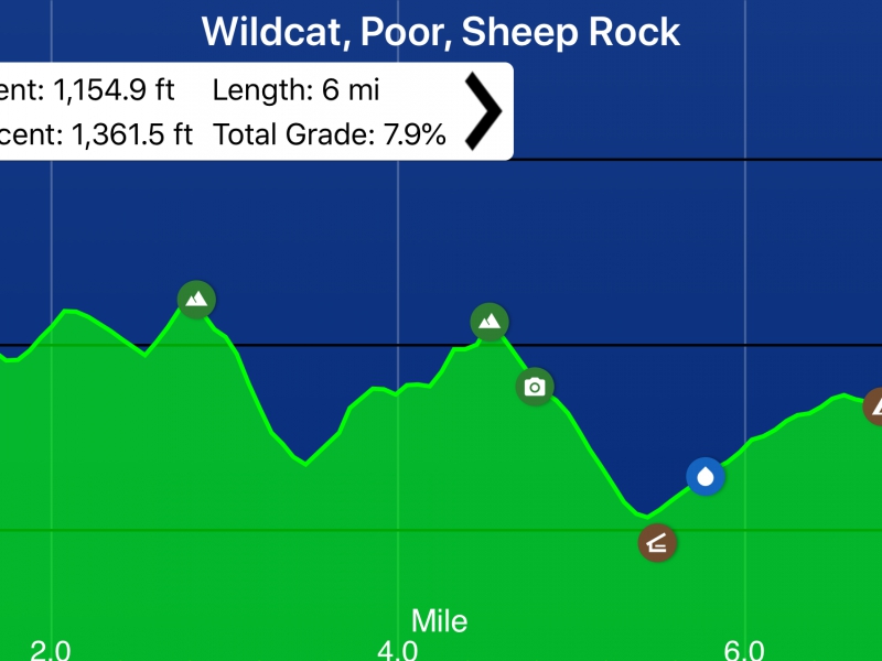
This hike has an elevation gain of 3442 feet and we did the hike at an average of 2.7mph last time. There are 3 climbs of 400-500 feet and another 5 climbs of 200-300 feet. D5 experience is required along with the ability to maintain a Pace in the Fast End of Moderate. If these qualifiations are not evident in your profile, we will contact you to request additional background on your qualification. We do this to be sure we have a group hike meeting the group's expectations.
Most of this hike is situated in the 16,400 acre Mark Trail Wilderness of the Chattahoochee National Forest and includes photo spots at the mile 0.5 rock cliff, and the mile 1.1 blue blaze trail ridgetop. Itinerary: 0.0 mile Tesnatee Gap parking on GA 348 (elevation 3138 feet) no privy 0.5 mile rock cliff with views of Cowrock Mt. and 1200 foot deep Town Creek gorge 0.7 mile Wildcat Mt. crest (elevation 3600 feet) and follow blue blaze trail on ridgetop with wonderful views from grassy spots between stands of laurel and rhododendron and many wildflowers 2.1 mile Hogpen Gap (elevation 3450 feet) and enter Mark Trail Wilderness 3.0 mile White Oak stamp on ridgecrest 3.2 mile Strawberry Top 4.1 mile Poor Mountain (elevation 3650 feet) 4.7 mile Wide Gap (elevation 3159 feet) and narrow ridge 5.9 mile Sheep Rock Top (elevation 3575 feet) rocky summit 6.7 mile Low Gap Shelter elevation 3060 feet) with Stink Creek and Smell Creek a safe distance beyond to the west 8.1 mile Poplar Stamp Gap campsite (elevation 3350 feet) and turnaround 6.9 mile reverse hike, skipping the blue blaze trail, brings our total hike to 15.0 miles | |||||||
| |||||||
| How to Get There: | |||||||
| Event Directions: | Use google maps directions with the destination being Tesnatee Gap: https://goo.gl/maps/AMizGZ9B8Q4DtDi1A
| ||||||
| Carpool to Event Distance (round trip): | 140Mile(s) | ||||||
| Carpool Departure Time: | 7:45 am | ||||||
| Carpool Location: | Log in for location | ||||||
| Carpool Directions: | Log in for directions | ||||||
| Carpool Cost: | Estimated cost per vehicle for this event is $56.00 using a reimbursement rate guideline of $0.400 per mile. The total amount should be divided by the number of people in the vehicle, including the driver. This is a guideline, not a rule, for drivers but the cost should not be higher unless there are extenuating circumstances. | ||||||
| Notes: | |||||||
|
* We encourage all members to follow our Etiquette Guidelines while participating in AOC events. | |||||||
| Cost Includes: | NA | ||||||
Cancellation/Partial Attendance: Please review the AOC cancellation policy. *Note: NA | |||||||
 Calendar of Events
 Event Places