
 Print-Friendly Version Print-Friendly Version
|
|
NC Mountains: Standing Indian | |||||||
| The Basics: | |||||||
| Event Type: | Hike | ||||||
| Event Location: | Tallulah and Nantahala Wilderness Areas | ||||||
| Date(s) & Time: | Sat, Mar 13 2010 10:00 am >> N/A (Carpool Departure: 7:30 am *log in for location*) | ||||||
| Registration Opens: | Sun, Feb 7 2010 7:45 pm | ||||||
| Registration Cut Off: | Thu, Mar 11 2010 12:00 pm | ||||||
| Event Duration: | 12 hours total, including drive time and dinner | ||||||
| Difficulty Rating: | D5: Difficult | ||||||
| Trip Leader(s): | Stefan Kathy Malone  Email Trip Leader(s) Email Trip Leader(s)
You must be logged in to get the Trip Leader contact information. | ||||||
| Member Cost: | None | ||||||
| Participant Info: | |||||||
| Who's Invited: | Members Only, 21 And Older Only | ||||||
| Maximum Group Size: | 12 | ||||||
| Minimum Group Size: | 4 | ||||||
| Number Registered So Far: | 16 / 0 (To see who's signed up, log in to the Member Area) | ||||||
| Are Dogs Permitted: | Yes | ||||||
| Itinerary: | |||||||
Why Standing Indian? Well, it is the highest peak within dayhiking distance of Atlanta. 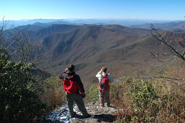
We start out just north of Tate City, at about 2,900 feet. We take the Beech Creek trail up to Case Knife Gap. From there, we do a very steep bushwack straight up the side of the mountain to the AT, which will take us to Standing Indian at 5,500 feet. Then it's down the AT to Deep Gap. There we pick up the Deep Gap trail, which goes along a stream back to where we started. As usual, the faster hikers can go ahead. However, we will gather as a group in three spots; Case Knife Gap, Standing Indian and Deep Gap. That way, we won't get too strung out for the whole hike. IMPORTANT: This is a strenuous 10 mile loop hike. If you have not yet been on a D-5 hike, do not sign up unless you first contact one of the trip leaders. After the hike, we will stop for dinner in Clayton. | |||||||
| |||||||
| How to Get There: | |||||||
| Event Directions: | 85 N to 985 N to 23/365 N to 23/441 N this will take us into Clayton GA. We will make a pit stop, which will be at the Clayton Burger King, which will be on your right. In Clayton turn left onto 76 W, travel about 15 minutes. Right onto Persimmon, left onto Tallulah road , travel about 20 minutes, or until the road ends. | ||||||
| Carpool to Event Distance (round trip): | 240Mile(s) | ||||||
| Carpool Departure Time: | 7:30 am | ||||||
| Carpool Location: | Log in for location | ||||||
| Carpool Directions: | Log in for directions | ||||||
| Carpool Cost: | Estimated cost per vehicle for this event is $96.00 using a reimbursement rate guideline of $0.400 per mile. The total amount should be divided by the number of people in the vehicle, including the driver. This is a guideline, not a rule, for drivers but the cost should not be higher unless there are extenuating circumstances. | ||||||
| Notes: | |||||||
|
We want to extend all due credit to Dean, who leads this hike a lot, and taught it to everyone. * We encourage all members to follow our Etiquette Guidelines while participating in AOC events. | |||||||
Cancellation/Partial Attendance: Please review the AOC cancellation policy. | |||||||
 Calendar of Events
 Event Places