AtlantaOutdoorClub
sponsor
Print-Friendly Version
Add this event to your calendar (Outlook, iCalendar)
Add REGISTRATION REMINDER to your calendar


REGISTRATION REQUIRED: Once you've reviewed the event details, and decided you'd like to join us, you MUST sign up at the bottom of this page.


Chatt NRA North to South: Part 11 - Powers Island


The Basics:
Event Type:Hike
Event Location: Atlanta, GA
Date(s) & Time:Sun, Jan 31 2010  11:30 am >> N/A
Registration Opens: Thu, Jan 28 2010 9:00 pm
Registration Cut Off: Sun, Jan 31 2010 2:00 am
Event Duration:approx 1 hr
Difficulty Rating:D2: Easy to Moderate
Trip Leader(s):
Tony C
Jack Litten
Email Trip Leader(s)
You must be logged in to get the Trip Leader contact information.
Member Cost:None

Participant Info:
Who's Invited: Members Only, 21 And Older Only
Maximum Group Size:10
Minimum Group Size:4
Number Registered So Far: 9 / 0 (To see who's signed up, log in to the Member Area)
Are Dogs Permitted: No

Itinerary:

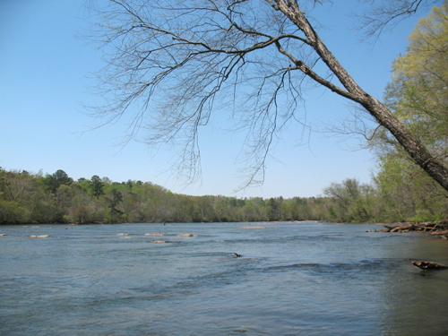
This series of hikes is designed to celebrate the beautiful collection of parks that we have in "our own backyard”, the Chattahoochee National Recreation Area. Administered by the National Park Service, the Chatt NRA offers miles of scenic trails, picturesque river views, and sightings of aquatic wildlife.

While the AOC frequently offers hikes at many of these parks, I thought it would be fun to hike all the branches, starting from the most northern (Bowmans Island) to the most southern (West Palisades).

For details on the other hikes in the series, visit the AOC forums...

Chatt NRA North to South thread

Part 11: Powers Island

Ok time to finish up this series and we are doing it with the last three hikes in one day.  East and West Palsades are later in the day after this hike...so sign up for more than one if you'd like to get some extra miles in.

This isn't one of the more sensational units of the Chatt NRA but it does have a particular charm to it.  Especially if you have ever looked at Powers Island from Cochran Shoals....it's fun to actually get over there and explore a bit.

We will begin by making a full clockwise loop around the outside of the actual island...part of this involves hiking under I-285, which is not especially scenic but we will do it anyway.  But soon enough we will be back by the river.  We will complete the loop and then head back through the parking lot and to the northern areas of trail. 

There are not a whole lot of trails up there, but some nice areas and a good little hill to get our heart rates up, at least for a bit.   After we finish this portion of the trails, we will head back and do one more counterclockwise half loop of Powers Island.

Total hiking time should be about 1 hr...total distance about 4 mi.  We won't be rushing, but just taking our time and enjoying the views, stopping to take photos etc.  This is certainly more of a leisurely social hike than anything remotely resembling a workout hike.  Still, we will cover some ground and get a little exercise in.


Required Items to Bring:
  • hiking boots or trail shoes
  • Recommended Items to Bring:
    Use our Event Checklists to make sure you have everything you need.

    camera


    How to Get There:
    Event Directions:

    http://www.nps.gov/chat/planyourvisit/powersisland.htm

    Directions

    From I-285 East

    • Take exit 22, Northside Drive, New Northside Drive, Powers Ferry Road.
    • Go to second traffic light and turn left onto New Northside Drive
    • Use the through lane to pick up Interstate North Parkway.
    • Unit will be .6 miles on the right before the river.

    From I-285 West

    • Take exit 22, Northside Drive, New Northside Drive, Powers Ferry Road.
    • Right on to New Northside Drive.
    • Use the through lane to pick up Interstate North Parkway
    • Unit will be .6 miles on the right before the river.

    From U.S. 41 South (Cobb Parkway)

    • Travel to Akers Mill Road
    • Left for bout 1.5 miles to the junction of Akers Mill and Powers Ferry Road.
    • Left going under I-285 than an immediate right onto Interstate North Parkway.
    • It will be .4 miles on the left after crossing the river.

    From U.S. 41 North (Cobb Parkway)

    • Travel to Akers Mill Road
    • Right for bout 1.5 miles to the junction of Akers Mill and Powers Ferry Road.
    • Left going under I-285 than an immediate right onto Interstate North Parkway.
    • It will be .4 miles on the left after crossing the river.

    Notes:
    * We encourage all members to follow our Etiquette Guidelines while participating in AOC events.


    Cancellation/Partial Attendance:   Please review the AOC cancellation policy.