 Print-Friendly Version Print-Friendly Version
|
Springer, BMT and AT Loop | |||||||
| The Basics: | |||||||
| Event Type: | Hike | ||||||
| Event Location: | Springer Mountain | ||||||
| Date(s) & Time: | Fri, Feb 24 2023 9:45 am >> Fri, Feb 24 2023 3:30 pm | ||||||
| Registration Opens: | Mon, Feb 20 2023 8:30 pm | ||||||
| Registration Cut Off: | Thu, Feb 23 2023 8:00 pm | ||||||
| Event Duration: | 5 Hours 45 Minutes | ||||||
| Difficulty Rating: | D4: Moderate to Difficult | ||||||
| Distance: | 10.5 Miles | ||||||
| Pace: | Moderate | ||||||
| Trip Leader(s): | Ann Ralph Howard  Email Trip Leader(s) Email Trip Leader(s)
You must be logged in to get the Trip Leader contact information. | ||||||
| Member Cost: | None | ||||||
| Participant Info: | |||||||
| Who's Invited: | Members Only, 21 And Older Only | ||||||
| Maximum Group Size: | 8 | ||||||
| Minimum Group Size: | 3 | ||||||
| Number Registered So Far: | 6 / 0 (To see who's signed up, log in to the Member Area) | ||||||
| Are Dogs Permitted: | No | ||||||
| Itinerary: | |||||||
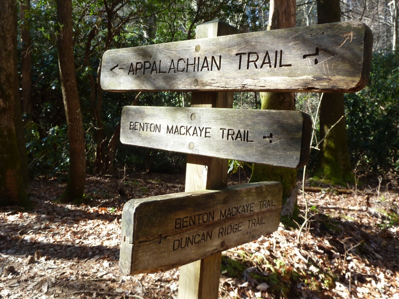
This hike will be a combination of AT and BMT trails, 4 miles on the AT (white rectangular blaze) and 6 miles on the BMT (white diamond blaze). The hike will have approximately 3 miles of uphill climb mostly on the AT. AT Trail BMT Trail AT Trail 2000' elevation gain overall. | |||||||
| |||||||
| How to Get There: | |||||||
| Event Directions: | Google map Springer Mountain Trailhead. Drive up 52 towards Ellijay and take the directions to Springer Mountain Trailhead - this west side provides a smoother ride on forest service road 42 (although it takes a little longer). Detailed directions will be sent to attendees. | ||||||
| Notes: | |||||||
|
* We encourage all members to follow our Etiquette Guidelines while participating in AOC events. | |||||||
| Cost Includes: | Free. | ||||||
Cancellation/Partial Attendance: Please review the AOC cancellation policy. | |||||||
 Calendar of Events
 Event Places