 Print-Friendly Version Print-Friendly Version
|
|
Vineyard Mountain - Red, Yellow and Blue | |||||||
| The Basics: | |||||||
| Event Type: | Hike | ||||||
| Event Location: |
Vineyard Mountain Trailhead, Emerson, GA


| ||||||
| Date(s) & Time: | Tue, Mar 28 2023 9:00 am >> Tue, Mar 28 2023 12:00 pm | ||||||
| Registration Opens: | Wed, Mar 22 2023 6:00 pm | ||||||
| Registration Cut Off: | Tue, Mar 28 2023 7:00 am | ||||||
| Event Duration: | 3 Hours | ||||||
| Difficulty Rating: | D4: Moderate to Difficult | ||||||
| Distance: | 6.5 Miles | ||||||
| Pace: | Moderate | ||||||
| Trip Leader(s): | Kip Email Trip Leader(s) Email Trip Leader(s)
You must be logged in to get the Trip Leader contact information. | ||||||
| Member Cost: | None | ||||||
| Participant Info: | |||||||
| Who's Invited: | Members Only, 21 And Older Only | ||||||
| Maximum Group Size: | 10 | ||||||
| Minimum Group Size: | 4 | ||||||
| Number Registered So Far: | 11 / 0 (To see who's signed up, log in to the Member Area) | ||||||
| Are Dogs Permitted: | No | ||||||
| Itinerary: | |||||||
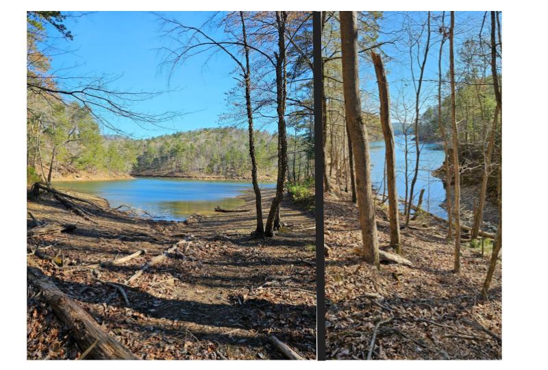
The views of the lake, dam and surrounding mountains from the Vineyard Trail are beautiful this time of year while the leaves are off of the trees. This will probably be one of the last hikes of the early Spring before the trees bloom and obscure the views. We will hike all 3 trails on the mountain. We will begin our hike at the trailhead on the Yellow Trail. We will follow the Yellow Trail to a point on the mountain that overlooks the Alatoona Dam and then proceed on the Red Trail to the top of the mountain. After a short break at the top of the mountain, we will descend the Red Trail to the intersection of the Red, Blue and Yellow Trails and then follow the Yellow Trail to the base of the mountain. We will ascend the mountain again on the Blue trail back to the intersection of the 3 trails, break again, and then backtrack on the Yellow Trail to the trailhead. This is a rugged trail with steep elevation gains, switchbacks and many obstacles on the hiking paths. We will hike at approximately 2.5 mph on the Red and Blue trails, and a little faster on the gentler sections of the Yellow Trail. Previous D4 experience is necessary to attend this hike. Although the total distance is relatively short this is not a "first D4" hike. | |||||||
| |||||||
| How to Get There: | |||||||
| Event Directions: | Access to the trailhead is off of I-75, exit 285 Red Top Mountain Road. zhead east on Red Top Mountain Rd to the trailhead parking area on the left side of the road. If you cross the bridge you have gone too far. | ||||||
| Notes: | |||||||
|
There is limited parking at the trailhead. The parking area is a paved cut-out on the side of the road at the trailhead. The parking area accommodates about 10-12 cars. It's recommended that you arrive a little early to ensure that you have a parking space. Traveling with another hiker is also a good idea. * We encourage all members to follow our Etiquette Guidelines while participating in AOC events. | |||||||
Cancellation/Partial Attendance: Please review the AOC cancellation policy. | |||||||
 Calendar of Events
 Event Places