 Print-Friendly Version Print-Friendly Version
|
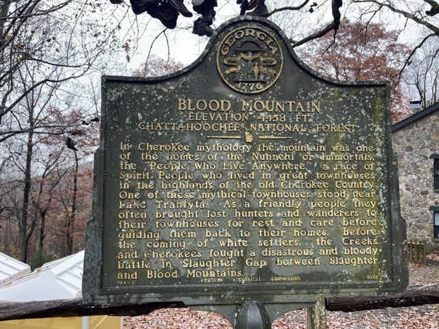
Lake Winfield Scott to Blood Mountain and Neels Gap | |||||||||
| The Basics: | |||||||||
| Event Type: | Hike | ||||||||
| Event Location: |
Chattahoochee National Forest


| ||||||||
| Date(s) & Time: | Tue, Dec 12 2023 9:00 am >> Tue, Dec 12 2023 4:30 pm (Carpool Departure: 7:00 am *log in for location*) | ||||||||
| Registration Opens: | Tue, Dec 5 2023 6:00 pm | ||||||||
| Registration Cut Off: | Mon, Dec 11 2023 4:00 pm | ||||||||
| Event Duration: | 7 Hours 30 Minutes | ||||||||
| Difficulty Rating: | D5: Difficult (Exploratory) | ||||||||
| Distance: | 12 Miles | ||||||||
| Pace: | Moderate | ||||||||
| Trip Leader(s): | Chuck M Email Trip Leader(s) Email Trip Leader(s)
You must be logged in to get the Trip Leader contact information. | ||||||||
| Member Cost: | None | ||||||||
| Participant Info: | |||||||||
| Who's Invited: | Members Only, 21 And Older Only | ||||||||
| Maximum Group Size: | 10 | ||||||||
| Minimum Group Size: | 3 | ||||||||
| Number Registered So Far: | 3 / 0 (To see who's signed up, log in to the Member Area) | ||||||||
| Are Dogs Permitted: | Yes | ||||||||
|
Note: This is an "EXPLORATORY" trip. This means that there are parts of this trip, or perhaps the whole trip, that is new to your Trip Leader(s). However, they are confident that this will not be an issue. This note is here so that you can make an informed decision. When a Trip Leader isn't personally familiar with a trip, there is an increased chance of things not going as planned and you need to be prepared. The Trip Leader may have additional details in the itinerary. | |||||||||
| Itinerary: | |||||||||
| |||||||||
| |||||||||
| How to Get There: | |||||||||
| Event Directions: | Lake Winfield Scott Rercreation Area, near Suches, Georgia. We will meet at the small parking lot on the lake. Enter Lake Winfield Scott Recreation Area, proceed to the check-in area and pay fee, and then proceed down the main road to the lake. The parking area is on the left side of the road when you reach the lake. Additional parking, if needed, is available 200 yards down the road. This should link to the parking area: Google Maps: https://www.google.com/maps/place/%2034%C2%B04 4'14.6%22N+83%C2%B058'25.0%22W
| ||||||||
| Carpool to Event Distance (round trip): | 152Mile(s) | ||||||||
| Carpool Departure Time: | 7:00 am | ||||||||
| Carpool Location: | Log in for location | ||||||||
| Carpool Directions: | Log in for directions | ||||||||
| Carpool Cost: | Estimated cost per vehicle for this event is $60.80 using a reimbursement rate guideline of $0.400 per mile. The total amount should be divided by the number of people in the vehicle, including the driver. This is a guideline, not a rule, for drivers but the cost should not be higher unless there are extenuating circumstances. | ||||||||
| Notes: | |||||||||
|
Will cancel if heavy or continuous rain is forecast. * We encourage all members to follow our Etiquette Guidelines while participating in AOC events. | |||||||||
Cancellation/Partial Attendance: Please review the AOC cancellation policy. | |||||||||
 Calendar of Events
 Event Places