 Print-Friendly Version Print-Friendly Version
|
|
Tapoco Lodge to Big Fat Gap on the BMT | |||||||
| The Basics: | |||||||
| Event Type: | Hike | ||||||
| Event Location: | Robbinsville,NC | ||||||
| Date(s) & Time: | Wed, Jan 3 2024 9:20 am >> Wed, Jan 3 2024 3:00 pm (Carpool Departure: 7:00 am *log in for location*) | ||||||
| Registration Opens: | Mon, Jan 1 2024 7:00 pm | ||||||
| Registration Cut Off: | Wed, Jan 3 2024 6:00 am | ||||||
| Event Duration: | 5 Hours 40 Minutes | ||||||
| Difficulty Rating: | D5: Difficult (Exploratory) | ||||||
| Distance: | 11 Miles | ||||||
| Pace: | Moderate | ||||||
| Trip Leader(s): | RonnyJ (Call me Ron) Email Trip Leader(s) Email Trip Leader(s)
You must be logged in to get the Trip Leader contact information. | ||||||
| Member Cost: | None | ||||||
| Participant Info: | |||||||
| Who's Invited: | Members Only, 21 And Older Only | ||||||
| Maximum Group Size: | 10 | ||||||
| Minimum Group Size: | 2 | ||||||
| Number Registered So Far: | 6 / 0 (To see who's signed up, log in to the Member Area) | ||||||
| Are Dogs Permitted: | Yes | ||||||
|
Note: This is an "EXPLORATORY" trip. This means that there are parts of this trip, or perhaps the whole trip, that is new to your Trip Leader(s). However, they are confident that this will not be an issue. This note is here so that you can make an informed decision. When a Trip Leader isn't personally familiar with a trip, there is an increased chance of things not going as planned and you need to be prepared. The Trip Leader may have additional details in the itinerary. | |||||||
| Itinerary: | |||||||
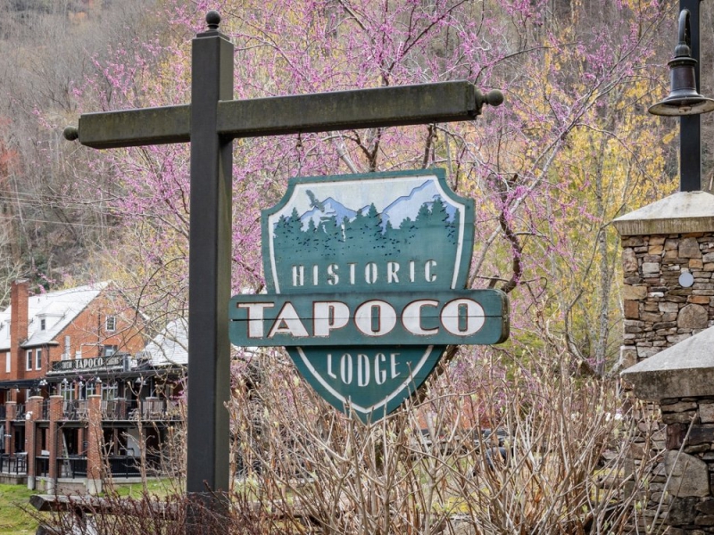
The Benton MacKaye Trail is a nearly 300 mile long trail starting at Springer Mountain, weaving through Georgia, Tennessee and North Carolina before ending in the GSMNP just past Big Creek. Often considered more difficult than the adjacent sections of the AT, this trail presents plenty of challenge and adventure. Join me as I dayhike the BMT, one section at a time. Todays hike will have us starting at the back parking lot of the Tapoco Lodge. The lodge is beautiful and would make a great location for an after hike beer. We will start on the Tapoco Trail, after about 1.1 miles we will reach Yellowhammer Gap and a left turn onto the Yellow Hammer Gap Trail. After about 2 miles of rolling hills we will have a relatively steep climb for about 3/4 of a mile. After the climb, things flatten out as we make our way to Big Fat Gap. If you were on the Robbinsville Trip last fall you will recognize this gap as the place we parked before our assault on "The Hangover". At this point, we retrace our steps back to our cars, and if conditions are just right, a cold beer at the lodge. Somewhere along the way we will stop for a nutritious lunch. We will have several creek crossings but, all the crossings appear to be rock-hoppable. This is a difficult D5 event, the second half of our hike will be fast with speeds around 3 mph. Only hikers with recent D5 experience should sign up.
| |||||||
| |||||||
| How to Get There: | |||||||
| Event Directions: | We will meet at the back of the parking lot of the Tapoco Lodge. | ||||||
| Carpool to Event Distance (round trip): | 260Mile(s) | ||||||
| Carpool Departure Time: | 7:00 am | ||||||
| Carpool Location: | Log in for location | ||||||
| Carpool Directions: | Log in for directions | ||||||
| Carpool Cost: | Estimated cost per vehicle for this event is $104.00 using a reimbursement rate guideline of $0.400 per mile. The total amount should be divided by the number of people in the vehicle, including the driver. This is a guideline, not a rule, for drivers but the cost should not be higher unless there are extenuating circumstances. | ||||||
| Notes: | |||||||
|
* We encourage all members to follow our Etiquette Guidelines while participating in AOC events. | |||||||
Cancellation/Partial Attendance: Please review the AOC cancellation policy. | |||||||
 Calendar of Events
 Event Places