 Print-Friendly Version Print-Friendly Version
|
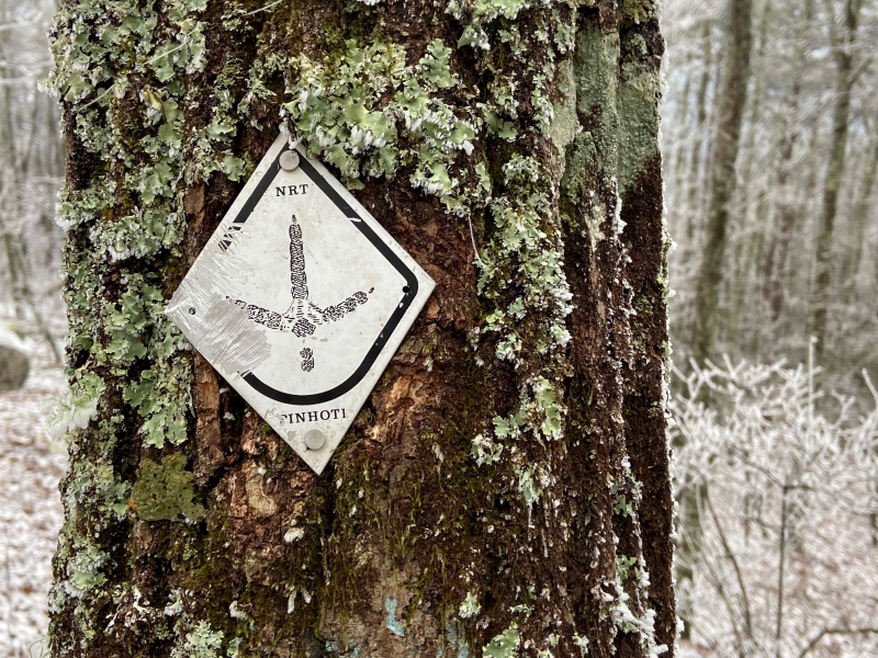
Pinhoti Trail - Snake Creek Gap to Middle Mountain (rescheduled) | |||||||
| The Basics: | |||||||
| Event Type: | Hike | ||||||
| Event Location: |
Snake Creek Gap


| ||||||
| Date(s) & Time: | Fri, Mar 8 2024 9:00 am >> Fri, Mar 8 2024 3:30 pm (Carpool Departure: 8:00 am *log in for location*) | ||||||
| Registration Opens: | Sat, Feb 24 2024 10:00 am | ||||||
| Registration Cut Off: | Thu, Mar 7 2024 8:00 pm | ||||||
| Event Duration: | 6 Hours 30 Minutes | ||||||
| Difficulty Rating: | D5: Difficult (Exploratory) | ||||||
| Distance: | 16 Miles | ||||||
| Pace: | Moderate | ||||||
| Trip Leader(s): | Tim W Email Trip Leader(s) Email Trip Leader(s)
You must be logged in to get the Trip Leader contact information. | ||||||
| Member Cost: | None | ||||||
| Participant Info: | |||||||
| Who's Invited: | Members Only, 21 And Older Only | ||||||
| Maximum Group Size: | 10 | ||||||
| Minimum Group Size: | 2 | ||||||
| Number Registered So Far: | 6 / 0 (To see who's signed up, log in to the Member Area) | ||||||
| Are Dogs Permitted: | Yes | ||||||
|
Note: This is an "EXPLORATORY" trip. This means that there are parts of this trip, or perhaps the whole trip, that is new to your Trip Leader(s). However, they are confident that this will not be an issue. This note is here so that you can make an informed decision. When a Trip Leader isn't personally familiar with a trip, there is an increased chance of things not going as planned and you need to be prepared. The Trip Leader may have additional details in the itinerary. | |||||||
| Itinerary: | |||||||
This hike is part of the Pinhoti Trail series. It follows the trail north of Snake Creek Gap up to Middle Mountain. Starting at the Snake Creep Gap trailhead off rte 136 we climb up from the parking area to the ridge line. After following the ridge for about 3 miles the trail turns south down to Swamp Creek. We'll hike along the creek for a mile or two before climbing up Middle Mountain. Turning around near the summit we'll head back and find a good spot for lunch before making our way back to the cars. I've not hiked this section of trail before so it's marked as exploratory but it's been done on other AOC events so I've borrowed a map and the trail should be easy to follow. This is a longer D5 hike of about 16 miles but the total elevation gain is somewhat moderate. You'll need prior D5 or high end D4 experience and should be comfortable hiking at an average pace of 2.8+ mph for up to 6 hours with minimum stops. If there are no previous D5 hikes in your profile or I have not hiked with you then please expect an email to assess your compatibility for the hike. Kudos to Ron for the AllTrails map, picture and previous writeup. I'm also borrowing Gary's Friday time slot while he's away. | |||||||
| |||||||
| How to Get There: | |||||||
| Event Directions: | |||||||
| Carpool to Event Distance (round trip): | 110Mile(s) | ||||||
| Carpool Departure Time: | 8:00 am | ||||||
| Carpool Location: | Log in for location | ||||||
| Carpool Directions: | Log in for directions | ||||||
| Carpool Cost: | Estimated cost per vehicle for this event is $44.00 using a reimbursement rate guideline of $0.400 per mile. The total amount should be divided by the number of people in the vehicle, including the driver. This is a guideline, not a rule, for drivers but the cost should not be higher unless there are extenuating circumstances. | ||||||
| Notes: | |||||||
|
* We encourage all members to follow our Etiquette Guidelines while participating in AOC events. | |||||||
Cancellation/Partial Attendance: Please review the AOC cancellation policy. | |||||||
 Calendar of Events
 Event Places