 Print-Friendly Version Print-Friendly Version
|
|
Benton MacKaye and Appalacian Trail Hike | |||||||
| The Basics: | |||||||
| Event Type: | Hike | ||||||
| Event Location: | Benton MacKaye and Appalachian Trail | ||||||
| Date(s) & Time: | Sat, Jan 22 2005 9:00 am >> N/A | ||||||
| Registration Opens: | Mon, Jan 1 2007 12:00 am | ||||||
| Registration Cut Off: | Thu, Jan 20 2005 11:59 pm | ||||||
| Event Duration: | per itinerary | ||||||
| Difficulty Rating: | D5: Difficult | ||||||
| Trip Leader(s): | Don Norton (Chicken Feathers) Email Trip Leader(s) Email Trip Leader(s)
You must be logged in to get the Trip Leader contact information. | ||||||
| Member Cost: | None | ||||||
| Participant Info: | |||||||
| Who's Invited: | Members Only, 21 And Older Only | ||||||
| Maximum Group Size: | 10 | ||||||
| Minimum Group Size: | 2 | ||||||
| Number Registered So Far: | 11 / 0 (To see who's signed up, log in to the Member Area) | ||||||
| Are Dogs Permitted: | No | ||||||
| Itinerary: | |||||||
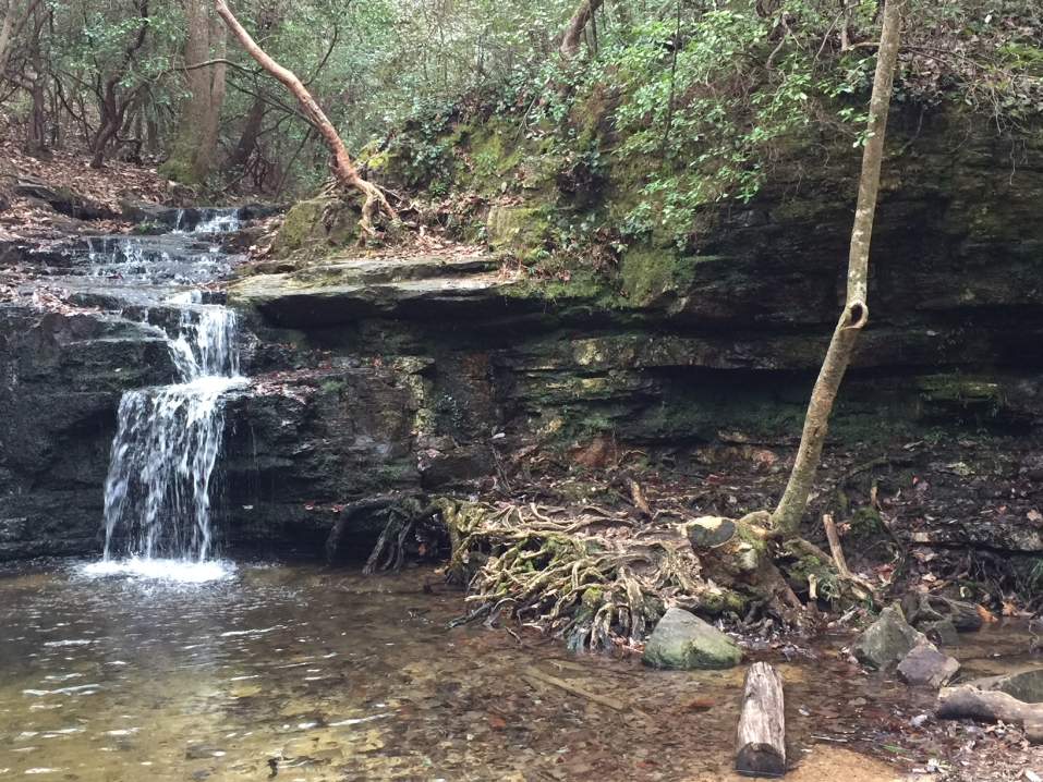
| moderate to strenuous (10 miles) We will hike up toward Springer Mtn. to BMT and follow White Diamond Shaped blazed trail. This hike is very different from hiking in the Spring or Summer. When I firsted hiked the trail there was a dusting of snow and it was a sight to see. You will see things on the trail that you did not know where there. Since all the leaves on the trees are gone. We will hike about 4.5 miles to Three Forks where it meets the Appalacation Trail and turn Left and go to Stover Creek Shelter for our lunch break. After lunch we will follow the A T White Rectangular Blazes for approximately 3 miles to the parking lot. | |||||||
| |||||||
| How to Get There: | |||||||
| Event Directions: | Benton MacKaye Trail 10:00 sharp at Springer Mtn parking lot From Chastain Park & Ride, turn left on Busbee Dr. At the traffic light Chastain Road-turn right at fourth traffic light, turn left to get on I-575 North. Drive approximately 50 miles for our restroom break at the Burger King on the right. Return to I-515 (I 575) turn right 1 mile to Hwy 52 take a right. At stop sign turn left HWY 52 East. Drive approxamately 6 miles; turn left (Roy Road between Cartecay Methodist Church and Chevron Service Station.Drive approximately 9 miles, turn rightonto another paved road at the second stop sign. Sorry do not remember name of road. Drive approximately 2 miles turn right onto gravel road FS 42 opposite Mount Pleasant Baptist Church. (Sign at FS 42 reads Springer Mtn. 6.5 miles) drive to Hiker Trail sign park in the clearing to the left. | ||||||
| Notes: | |||||||
|
If you have to cancel for any reason please contact the leader at donnorton@comcast.net Are Dogs Permitted? No Will this event occur rain or shine? if heavy rain trip will be called off leader will email those that signup (be sure to check your email before you leave the house!) If extreme cold trip will be canceled and the leader will email those that signup. If event is full contact donnorton@comcast.net to be put on a waiting list. * We encourage all members to follow our Etiquette Guidelines while participating in AOC events. | |||||||
| Cost Includes: | bring some cash to assist with your carpool drivers expenses | ||||||
Cancellation/Partial Attendance: Please review the AOC cancellation policy. | |||||||
 Calendar of Events
 Event Places