 Print-Friendly Version Print-Friendly Version
|
Shining Rock Wilderness backpacking | |||||||
| The Basics: | |||||||
| Event Type: | Backpacking | ||||||
| Event Location: | Shining Rock Wilderness Area | ||||||
| Date(s) & Time: | Sat, Jun 19 2010 6:30 am >> N/A (Carpool Departure: 6:45 am *log in for location*) | ||||||
| Registration Opens: | Sun, Jun 6 2010 10:00 am | ||||||
| Registration Cut Off: | Fri, Jun 18 2010 5:00 pm | ||||||
| Event Duration: | 2 days/1 night | ||||||
| Difficulty Rating: | D5: Difficult | ||||||
| Trip Leader(s): | Michael J Bob Bunner  Email Trip Leader(s) Email Trip Leader(s)
You must be logged in to get the Trip Leader contact information. | ||||||
| Member Cost: | None | ||||||
| Participant Info: | |||||||
| Who's Invited: | Members Only, 21 And Older Only | ||||||
| Maximum Group Size: | 10 | ||||||
| Minimum Group Size: | 2 | ||||||
| Number Registered So Far: | 8 / 0 (To see who's signed up, log in to the Member Area) | ||||||
| Are Dogs Permitted: | No | ||||||
| Itinerary: | |||||||
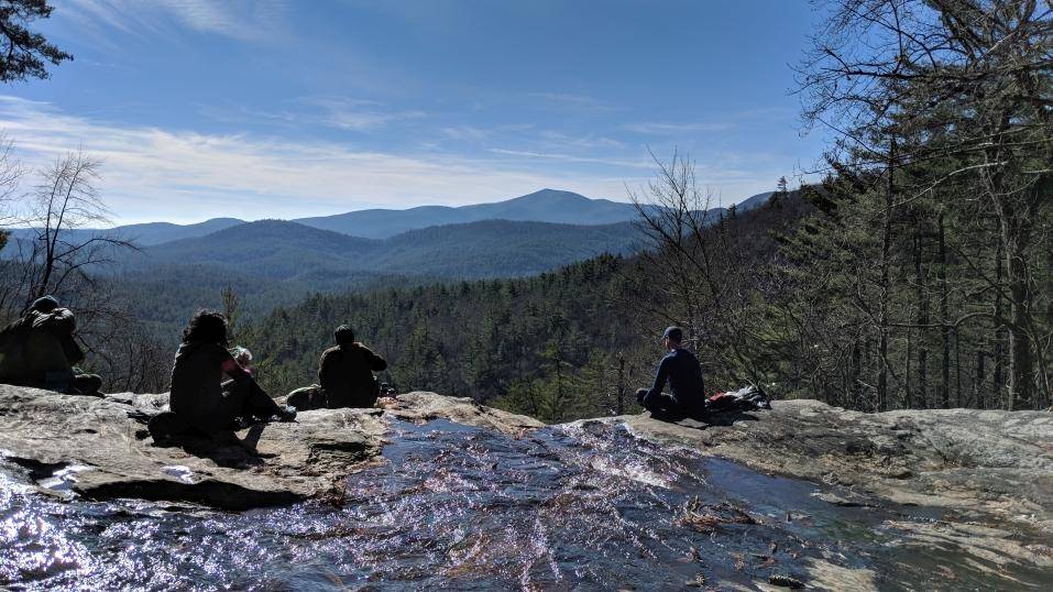
 Hi everyone, it's time to escape the heat and head up into the higher mountains of Shining Rock Wilderness Area, where we'll camp at almost 6k' elevation with fantastic views from the top of Shining Rock Gap at sunset and if you're an early bird, sunrise too. This loop hike takes you from the Big East Fork trailhead to Grassy Cove and Shining Rock. Day 1: Start the loop on the Big East Fork trail and follow this creek side trail past waterfalls to the Grassy Cove trail. Take the Grassy cove trail for a strenuous climb to Grassy Cove Top. There the views will finally start opening up and you will be able to enjoy views of ridge after ridge. Take the Art Leob Trail North towards Shining Rock. You will shortly arrive at Flower Gap where you can find limited campsites. Day 2: Continue North on the Art Leob Trail towards Shining Rock Gap and Shining Rock. After passing Shining Rock take the Old Butt Knob Trail back to the trailhead. Type: Backpacking Hike - Loop | |||||||
| |||||||
| How to Get There: | |||||||
| Event Directions: | From I-85/Indian trail going north.
Slight left at I-985 N/Lanier Pkwy (signs for Gainesville) | ||||||
| Carpool to Event Distance (round trip): | 300Mile(s) | ||||||
| Carpool Departure Time: | 6:45 am | ||||||
| Carpool Location: | Log in for location | ||||||
| Carpool Directions: | Log in for directions | ||||||
| Carpool Cost: | Estimated cost per vehicle for this event is $120.00 using a reimbursement rate guideline of $0.400 per mile. The total amount should be divided by the number of people in the vehicle, including the driver. This is a guideline, not a rule, for drivers but the cost should not be higher unless there are extenuating circumstances. | ||||||
| Notes: | |||||||
|
* We encourage all members to follow our Etiquette Guidelines while participating in AOC events. | |||||||
Cancellation/Partial Attendance: Please review the AOC cancellation policy. | |||||||
 Calendar of Events
 Event Places